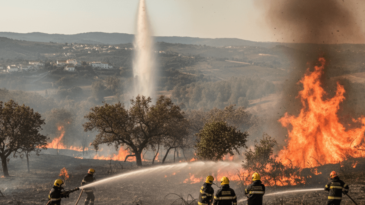
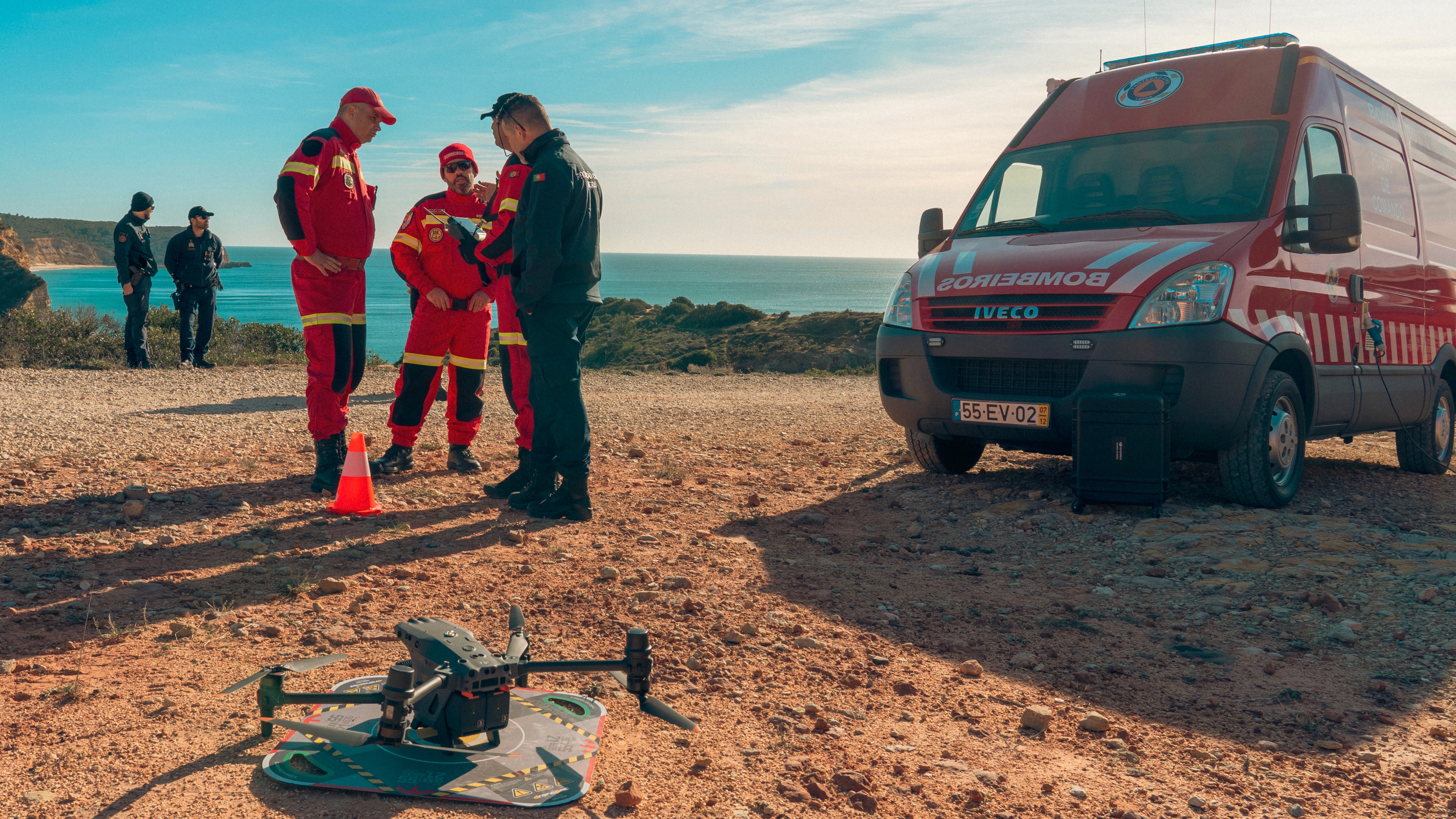
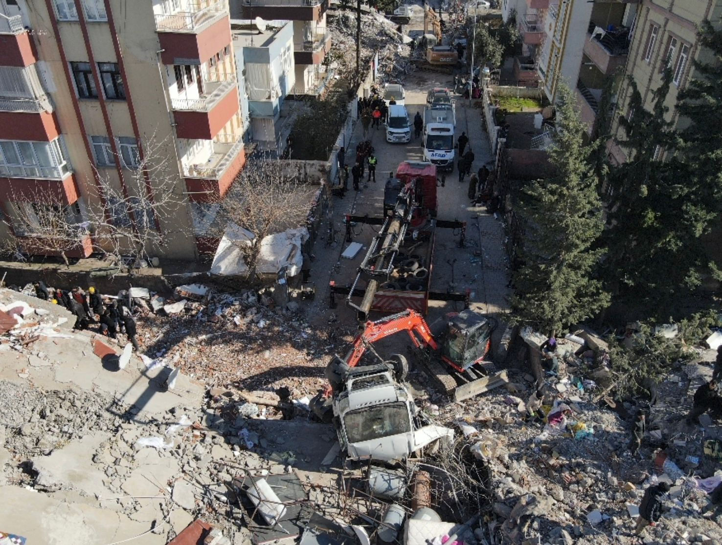
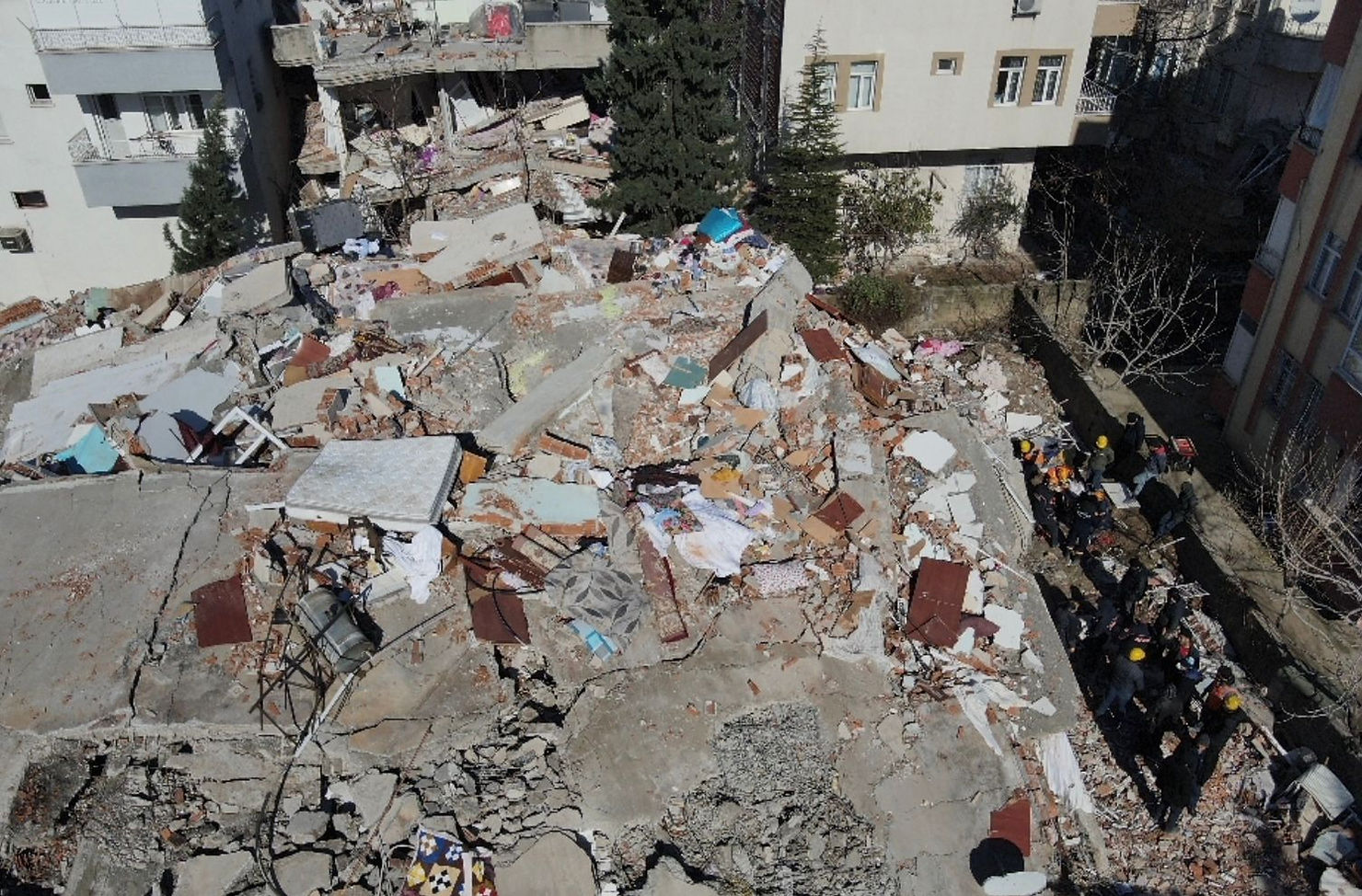
News

Discover drone news, tips, and updates on UAV rules, tech, and best practices for pros and fleet managers.

Scaling Drone Operations in Public Safety with AirHub
Scaling Public Safety Drone Operations: From Pilot Project to Operational Division

Insights from the World Police Summit 2025

At the 2025 edition of the World Police Summit in Dubai, we presented a clear message: public safety drone operations are no longer small-scale experiments. Increasingly, they are becoming embedded in the day-to-day functioning of police, fire, border control, and emergency services.

But as drone operations scale, so too does their complexity. What begins as a tactical tool piloted by a handful of officers can quickly evolve into a mission-critical capability, requiring fleet management, airspace coordination, training oversight, and operational governance.

At AirHub, we support this transition in two ways: through our Drone Operations Platform, which provides the digital infrastructure for managing complex operations, and through our consultancy services, which help organisations build compliant, scalable, and sustainable programs.

Here’s how we’re helping agencies move from isolated drone teams to integrated operational divisions.


Structuring Drone Programs Like an Airline

Our approach is rooted in aviation. We don’t treat drones as gadgets or ad hoc tools. We treat them as aircraft—flown by certified crews, governed by procedures, and subject to airspace constraints.

This mindset leads to a shift in structure. As drone programs grow, agencies must think and operate more like airlines. That means establishing:

  • A clear governance model

  • Defined training and competence frameworks

  • Documented SOPs, checklists, and emergency protocols

  • Technical oversight of airframes, batteries, payloads, and software

  • Risk-based flight planning aligned with national and international regulations

These aren’t aspirational ideas—they are practical necessities for safe, compliant, and repeatable drone operations.


The Four Areas Every Public Safety Drone Program Must Master

From our consultancy work with public safety agencies across Europe and the Middle East, we’ve identified four core areas that determine whether a drone program succeeds or stagnates:

1. Organisational Governance and Compliance

Too often, drone operations start without a clear operating structure. We help agencies define roles, responsibilities, escalation paths, and internal controls. This includes drafting or reviewing their Operations Manual, defining their Emergency Response Plan, and setting up incident reporting workflows.

Our software ensures that these procedures aren’t just written, but actually used. Digital checklists, pilot sign-offs, SOP version control, and real-time reporting bring compliance to life.

2. Fleet and Equipment Oversight

Drones, batteries, and payloads must be treated as airworthy assets. We help teams implement maintenance programs, configure flight hour and cycle-based alerts, and create digital maintenance logs that are audit-ready.

The AirHub platform automates much of this. It tracks usage across your fleet, alerts you to required inspections or firmware updates, and logs every change made—ensuring full traceability.

3. Crew Management and Training

Whether you're operating VLOS patrols or BVLOS first-responder missions, personnel must be trained, qualified, and current. We support agencies in building structured training programs—including initial, type-specific, and recurrent training—and in aligning these with national certification schemes or SORA OSO requirements.

In the platform, each pilot has a personal profile linked to certifications, expiries, and aircraft types. You always know who’s qualified to fly what—and when retraining is due.

4. Mission Planning and Airspace Coordination

Planning drone operations in urban or controlled airspace requires a clear understanding of flight geography, contingency volumes, ground risk buffers, and airspace constraints. We help teams implement planning procedures that are compliant with SORA, national requirements, and future U-space integration.

Our Drone Operations Center (DOC) allows planners to visualise missions in real-world context—overlaying CTRs, NOTAMs, No-Fly Zones, and even population density maps. You can draw your flight volume, input risk buffers, and export visual materials for internal review or regulatory submission.


Moving from Reactive to Proactive

As agencies scale their use of drones, many begin to experience internal friction. Data silos emerge. SOPs are inconsistently followed. Equipment is underutilised or overworked. Training gaps appear. Regulatory renewals become stressful.

The transition to proactive, structured drone operations requires both the right tools and the right guidance.

That’s why we offer end-to-end support:

  • Strategic consultancy to design the operational, legal, and technical foundation

  • SORA support for authorisations and cross-border operations

  • Platform deployment—on-premise, cloud, or hybrid—tailored to security and sovereignty needs

  • Ongoing onboarding, training, and operational refinement

Ready to Scale?

At AirHub, we’re not just building software. We’re building systems that enable safe, scalable drone operations in public safety, security, and critical infrastructure. Whether you’re just getting started or managing a nationwide network, we can help you take the next step—with the structure, tools, and expertise to match.

If you're interested in a platform demo or want to explore how our consultancy can support your program, get in touch. We’d be happy to help.

AirHub x Frequentis Partnership Annoucement
Press Release: FREQUENTIS and AirHub sign strategic partnership to enhance UTM accessibility

​​Press Release | Lisbon, 15 May 2025

  • Partnership will make UTM more accessible and user-friendly

  • Cooperation will open the door for advanced drone applications in emergency response, infrastructure inspection, environmental monitoring, and more

  • Partnership combines AirHub’s advanced mission management platform with Frequentis’ UTM technology, for seamless data exchange and real-time situational Awareness


Frequentis and Dutch drone enterprise solutions innovator AirHub have announced a strategic partnership aimed at making Uncrewed Traffic Management (UTM) more accessible and user-friendly for drone operators across Europe and beyond. This collaboration focuses on simplifying UTM services, ensuring seamless and easy-to-use solutions for public safety, critical infrastructure, and commercial applications, including police and fire departments, many of which are already AirHub clients.

The partnership combines AirHub’s advanced mission management platform with Frequentis’ UTM technology, designed for seamless data exchange and real-time situational awareness. This integration empowers drone operators to efficiently plan, execute, and manage missions in compliance with regulatory requirements while benefiting from real-time geospatial data, digital flight approvals, and live telemetry monitoring—all from a single intuitive interface.


Driving European airspace modernisation

The collaboration aims to modernise airspace management by making UTM services more accessible to all drone operators. By utilising Frequentis' UTM capabilities, the platform enables secure, efficient information exchange between drone operators, air navigation service providers (ANSPs), and government agencies. This ensures seamless synchronisation of crewed and uncrewed air traffic, enhancing safety and reducing complexity in both urban and rural environments.

With Frequentis’ market-leading UTM solution, AirHub users will experience streamlined approval processes and real-time airspace authorisation, supporting complex drone missions with high reliability. This opens the door for advanced drone applications in emergency response, infrastructure inspection, environmental monitoring, and more.


Unlocking new UTM capabilities

“By partnering with AirHub we will expand our UTM capabilities across Europe. This strategic collaboration aligns perfectly with our mission to enable safe and efficient drone operations through secure, real-time communication channels. Integrating AirHub’s intuitive platform with our robust UTM infrastructure will set new standards for airspace safety, compliance, and scalability,” states Thomas Pilsl, Frequentis Vice President New Market Solutions.

The partnership also unlocks new UTM capabilities, including the ability for operators to seamlessly share flight reports and live telemetry with Frequentis' secure UTM network. Through this integration, mission-critical data is synchronised instantly, providing stakeholders with a complete overview of airspace activities. This supports coordinated drone flights in controlled and uncontrolled airspace, paving the way for scalable drone deployments.

“Our partnership with Frequentis marks a major milestone for AirHub. By integrating with Frequentis' world-class UTM platform, we are expanding our ability to offer real-time, compliant, and secure airspace management to our platform’s users. This collaboration not only enhances safety but also accelerates the adoption of drone technology across Europe and beyond,” says Thomas Brinkman, CEO of AirHub.


Leading the way to a digitally connected European sky

This strategic partnership underscores a shared vision of digitally connected skies, where crewed and uncrewed aircraft seamlessly operate in a harmonised airspace. Both Frequentis and AirHub are committed to supporting the Digital European Sky initiative, contributing to the safe and efficient integration of drones into Europe's airspace.


————————————————————————

About AirHub

AirHub is a Dutch-based drone software & consultancy company that knows unmanned aviation is as serious as manned aviation. It’s our goal to safely and efficiently integrate drones into our society by bringing the best drone solutions to companies through innovative software and services. By connecting drones to the enterprise through our software and consulting services we want to deliver on the full potential of drones.

Thomas Brinkman, Co-founder & CEO, AirHub, thomas@airhub.nl

——————

About FREQUENTIS

Frequentis stands for a safer world. Our solutions are used in our customers’ command and control centres to help them make the world safer.

Frequentis is a world leader in high-tech solutions for Air Traffic Management, supporting both civil and military air traffic control organisations, as well as Public Safety and Transport, where police, emergency rescue services, fire brigades, railways, coastguards, and port authorities rely on our extensive portfolio.

The listed family business based in Vienna, Austria, drives innovative and sustainable solutions for safety and security in everyday life and in the safety-critical sector. Its air traffic optimisation solutions for air traffic control centres are contributing to reducing emissions.

As a global player with more than 2,400 employees (full-time equivalents/FTE), Frequentis has a worldwide network of companies in over 50 countries. Its products, services, and solutions are used in around 150 countries. Shares in

Frequentis are traded on the Vienna and Frankfurt stock exchanges; ISIN: ATFREQUENT09, WKN: A2PHG5. In 2024, revenues were EUR 480.3 million and EBIT was EUR 32.1 million.

For more information, please visit www.frequentis.com.

Jennifer McLellan, Global Media Relations Manager, Frequentis AG,

jennifer.mclellan@frequentis.com, +44 2030 050 188

Barbara Fuerchtegott, Head of Communications/Company Spokesperson, Frequentis AG

barbara.fuerchtegott@frequentis.com, +43 1 81150-4631

AirHub x Advanced Media Partnership Annoucnement
Press Release: AirHub and Advanced Media Announce Strategic Partnership to Deliver Enterprise Drone Soutions for Public Safety and Critical Infrastructure
PRESS RELEASE

Dubai, UAE – May 14, 2025 — At the World Police Summit 2025, AirHub, a leading provider of mission-critical drone software, and Advanced Media Trading, the Middle East’s leading provider of professional audiovisual and drone technologies, announced a strategic partnership to deliver enterprise drone solutions tailored to the needs of public safety agencies, security providers, and critical infrastructure managers across the region and beyond.

Through this collaboration, AirHub’s Drone Operations Platform will be made available to organizations seeking to streamline their drone operations, improve situational awareness, and maintain full control over their data. The platform is already trusted by major police forces, including Dubai Police, and offers a comprehensive suite of capabilities:

  • Fleet Management – covering aircraft, batteries, maintenance schedules, and equipment lifecycle tracking.

  • Live Operations – enabling real-time video streaming, multi-drone coordination, and seamless communication for enhanced operational awareness.

  • Secure Data Mode – ensuring that sensitive flight data remains within the organization, fully aligned with the most stringent data protection requirements.

  • Flexible Deployment Options – including secure on-premise installations and private cloud environments, such as the recent deployment at Dubai Police.

Advanced Media, with its extensive distribution network and regional market expertise, will support the integration and delivery of these solutions to law enforcement agencies, first responders, and infrastructure operators in the UAE and across the wider MENA region.

“With drone operations becoming a core capability for police forces and security organizations, it’s critical to have the right tools in place to manage complexity, ensure compliance, and act fast when it matters most. Together with Advanced Media, we’re proud to bring our technology to more teams on the frontline,” said Stephan van Vuren, CEO of AirHub.

“We’re excited to collaborate with AirHub to provide our clients with a truly enterprise-grade drone management solution,” added Pejman Ghorbani, Head of Creative Solutions at Advanced Media. “Our joint efforts will help accelerate the adoption of safe, scalable, and secure drone operations in the public safety sector.”

The partnership aims to scale deployments across the region in the coming year, offering turnkey solutions that combine AirHub’s advanced software platform with Advanced Media’s hardware integration, training, and support services.

——

About AirHub
AirHub provides software solutions for mission-critical drone operations. Its Drone Operations Platform enables full oversight and coordination of enterprise drone programs, supporting public safety, critical infrastructure, and government users across Europe, the Middle East, and beyond.

Learn more at www.airhub.app.

About Advanced Media
Advanced Media Trading LLC is the Middle East's largest supplier of professional video, photo, and broadcast equipment. As a trusted technology provider, Advanced Media supports government entities, production houses, and enterprise clients with cutting-edge drone, imaging, and audiovisual solutions.

Visit www.amt.tv for more information.

UK SORA introduced by the CAA
UK SORA: A New Chapter for Drone Operations in the United Kingdom

What It Means for Operators—and How to Navigate the Change

After years of divergence, a long-awaited development has arrived in the UK drone regulatory landscape: the introduction of the UK SORA. As of April 23rd, 2025, operators can now apply for Operational Authorisation under the UK SORA framework via the UK Civil Aviation Authority (CAA). This shift brings the UK more in line with European risk-based regulation—and makes things significantly easier for organisations operating across borders.

But what exactly is UK SORA? How does it differ from its European counterpart? And what should operators—particularly those with cross-border ambitions—expect?

Let’s unpack what’s changed, what’s improved, and what still requires attention.


From CAP 722A to UK SORA: A Structural Leap Forward

When the UK left the European Union on January 1st, 2021, it retained much of the EU’s aviation regulatory framework, including Regulation 2019/947. However, instead of adopting the JARUS SORA approach—as the EU did—the UK CAA relied on CAP 722A, a qualitative risk-based methodology for obtaining operational authorisation in the Specific Category.

While CAP 722A worked for domestic operators, it created friction for organisations accustomed to the more quantitative, structured JARUS SORA used across the EU. Applying for separate approvals in the UK often meant reworking an entire safety case from scratch.

That’s now changed.

The UK has officially implemented a UK-specific version of SORA, based on JARUS SORA v2.5, but tailored to the UK airspace and regulatory environment. It marks a significant improvement in structure, clarity, and harmonisation.


What Is UK SORA?

At its core, the UK SORA is a risk assessment methodology for drone operations in the Specific Category, designed to align regulatory oversight with actual operational risks. Just like the JARUS version, UK SORA guides operators through a structured process to determine:

  • The Specific Assurance and Integrity Level (SAIL)

  • Appropriate Operational Safety Objectives (OSOs)

  • The need for strategic or tactical mitigations

  • Requirements for containment, flight planning, and system reliability

But there are important differences to be aware of.


Key Differences from JARUS SORA

While UK SORA shares the same DNA as JARUS SORA 2.5, it introduces several UK-specific adaptations:

1. A UK Air Risk Model

The UK has built its own air risk classification system that better reflects the structure and usage of UK airspace. Notably, operations in uncontrolled airspace are now assigned ARC-c by default, increasing the SAIL and robustness level of tactical mitigations for operations in uncontrolled airspace.

2. Updated Annexes and Requirements

The requirements listed in Annex B - Strategic Mitigations for Ground Risk and Annex E - Integrity and assurance levels for the Operational Safety Objectives have been clarified making them less open for interpretation.

3. Terminology

Some key terminology has been changed, for example:

  • In the semantic model “Flight Geography” is now referred to as “Flight Volume”

  • The qualitative descriptors for population density were changed, e.g. the reference for “Sparsely” and “Lightly” populated areas are swapped

4. OSO assurance criteria

The assurance criteria of the OSOs were adapted to account for the UK CAA’s specific role as competent authority.


New Concepts Introduced by the UK CAA

Recognised Assessment Entities – Flightworthiness (RAE(F))

The UK has introduced RAE(F) organisations that can evaluate the flightworthiness of UAS platforms. Manufacturers and operators can apply for a SAIL Mark Certificate, showing that their system meets predefined design assurance criteria.

This enables the UAS designer to directly support the operator in demonstrating compliance with the requirements for a certain SAIL.

Remote Pilot Certification Tiers

UK SORA introduces five levels of Remote Pilot Certificates:

  • GVC (General Visual Line of Sight Certificate)

  • RPC-L1 to RPC-L4

This framework provides clearer progression and differentiation of pilot responsibilities and competence levels based on the complexity of operations.


A Two-Step Application Process

Operators applying under UK SORA will follow a two-phase process:

  1. Assessment Phase 1: Determine SAIL and containment strategy

  2. Assessment Phase 2: Demonstrate compliance and provide evidence for applicable OSOs

Systematic compliance checks will be conducted by the CAA for selected OSOs, based on the assessed risk level and operation type. The bar for evidence is higher, especially for higher SAIL levels—operators will need to move beyond simple self-declarations and always provide verifiable documentation, test results, or third-party validation.


Cross-Border Operations: Still a Separate Process

Despite the regulatory alignment, the UK continues to require separate operational authorisations for non-UK operators. Article 13 of EU Regulation 2019/947, which enables cross-border operations within the EU, remains repealed in the UK version.

This means that EU-based operators will still need to apply separately for a UK Operational Authorisation—even if their SORA is accepted in their home country.


How AirHub Supports UK SORA Compliance

At AirHub, we’ve helped dozens of organisations navigate SORA across Europe, and we’re ready to support UK SORA applications too. Whether you’re:

  • A manufacturer seeking a SAIL Mark through RAE(F)

  • An operator preparing your ConOps, SORA assessment, and safety portfolio

  • A government agency building internal governance and compliance structures

We can help. Our consultancy team offers end-to-end SORA support—from ConOps development to OSO evidence preparation.

Meanwhile, the AirHub Drone Operations Platform helps digitise and embed compliance into your day-to-day operations:

  • Create and manage digital checklists, SOPs, and mission logs

  • Track pilot certifications (GVC, RPC-Lx) and training requirements

  • Plan and visualise Flight Volumes, GRBs, and airspace integration

  • Maintain a digital audit trail for inspections or revalidation

Conclusion: A Welcome Step Toward Harmonisation

The launch of UK SORA is a major improvement for professional drone operators. It replaces the ambiguity of CAP 722A with a structured, risk-based framework and brings the UK much closer to European standards.

It won’t eliminate all the challenges—particularly around cross-border operations—but it creates a clearer, more consistent path forward for organisations that take safety and compliance seriously.

If you're preparing to operate in the UK or need help adapting your current SORA documentation for UK requirements, get in touch. Our team is ready to guide you through the transition.

How AirHub’s ISO 27001 and ISO 9001 Certifications Drive Quality and Security in Software Development


In today’s fast-evolving technological landscape, organizations are increasingly scrutinizing the software platforms they use for operational efficiency, data security, and compliance with global standards. At AirHub, our commitment to excellence is backed by two industry-leading certifications: ISO 27001 for information security management and ISO 9001 for quality management. These certifications ensure that our platform not only meets the highest standards of data protection but also delivers a consistently high-quality user experience.


This blog explores how these certifications shape our approach to software development, support compliance with regulations like the GDPR, and position us as a forward-thinking organization prepared for upcoming frameworks like the EU AI Act.


ISO 27001: Ensuring the Highest Standards of Information Security


ISO 27001 is the international standard for managing information security, outlining best practices to protect sensitive data from breaches, loss, and unauthorized access. For AirHub, this certification reflects our commitment to safeguarding the data of our customers and partners.


How ISO 27001 Benefits Our Customers


  1. Comprehensive Risk Management:

    • We systematically identify, assess, and mitigate risks to ensure that our platform remains secure against evolving threats.


    • All customer data is encrypted during transfer and storage, ensuring that sensitive information remains protected.


  2. Secure Development Practices:

    • Our software development lifecycle incorporates strict security controls, from code reviews to vulnerability testing.


    • Regular audits ensure that our platform adheres to the highest security standards.


  3. Incident Management and Recovery:

    • A robust incident response process allows us to address security issues swiftly and effectively.


    • Our disaster recovery plan ensures minimal downtime and data loss in case of unforeseen events.


By choosing AirHub, customers can trust that their operational and personal data are managed with the utmost care, meeting not only ISO 27001 standards but also regulatory requirements like the General Data Protection Regulation (GDPR).


ISO 9001: Delivering High-Quality Software


ISO 9001 focuses on quality management systems, ensuring that organizations deliver products and services that consistently meet customer expectations. At AirHub, this certification reinforces our commitment to building software that is reliable, user-friendly, and adaptable to the needs of diverse industries.


How ISO 9001 Improves Software Quality


  1. Customer-Centric Development:

    • Our development process includes direct feedback loops with customers to ensure our platform evolves in line with their operational needs.


    • Regular updates and feature enhancements are driven by a deep understanding of industry challenges.


  2. Consistency in Delivery:

    • ISO 9001 requires rigorous documentation and standardization of processes, ensuring that every feature, update, or integration meets the same high standards.


    • Our platform undergoes continuous testing to ensure seamless functionality across all devices and use cases.


  3. Commitment to Continuous Improvement:

    • A culture of continuous improvement ensures that we adapt to emerging technologies, regulatory changes, and customer requirements.


    • ISO 9001 frameworks help us identify and resolve potential issues before they affect end users.


With this certification, AirHub ensures that our platform remains a trusted, high-quality solution for managing drone operations, no matter the scale or complexity.


GDPR Compliance: Protecting Customer Privacy


The General Data Protection Regulation (GDPR) sets a global benchmark for data protection and privacy. AirHub’s compliance with GDPR demonstrates our dedication to transparent and ethical data handling practices.


Key Aspects of Our GDPR Compliance:


  • Data Minimization: We collect only the data necessary for operational purposes, reducing the risk of misuse or exposure.


  • User Rights: Customers can access, modify, or delete their data at any time, in full compliance with GDPR mandates.


  • Third-Party Data Protection: Our platform integrates securely with third-party systems, ensuring that all external data exchanges adhere to GDPR standards.


Preparing for the EU AI Act: Responsible AI Development


The upcoming EU AI Act aims to establish a regulatory framework for the safe and ethical use of artificial intelligence. While this regulation is still under development, AirHub is proactively aligning our practices with its anticipated requirements.


Our Preparedness for the EU AI Act:


  1. Transparency and Explainability:

    • Any AI-driven features in our platform, such as real-time risk assessments or data analytics, are developed with transparency in mind, ensuring users understand how decisions are made.


  2. Bias Mitigation:

    • We actively work to eliminate biases in AI algorithms, ensuring fairness and accuracy across diverse operational scenarios.


  3. Risk Management:

    • Consistent with ISO 27001, we apply rigorous risk management processes to AI development, ensuring that all features comply with ethical standards and legal requirements.


By preparing for the EU AI Act, AirHub ensures that our platform remains compliant with the highest regulatory standards, giving customers confidence in the responsible use of advanced technologies.


A Unified Approach to Quality, Security, and Compliance


At AirHub, our certifications and compliance efforts are part of a broader commitment to delivering software that empowers our customers to operate drones safely, efficiently, and in full alignment with global standards. Here’s how these elements work together:


  • ISO 27001: Protects sensitive data and ensures information security.


  • ISO 9001: Guarantees consistent quality and customer satisfaction.


  • GDPR Compliance: Safeguards privacy and data rights for all users.


  • EU AI Act Preparedness: Positions us as a leader in responsible AI development.


Conclusion: Trust AirHub for Quality and Security


In an industry where safety, efficiency, and compliance are paramount, AirHub stands out as a partner that delivers on all fronts. Our ISO 27001 and ISO 9001 certifications ensure that our platform meets the highest standards of quality and security, while our alignment with GDPR and preparation for the EU AI Act demonstrate our forward-thinking approach.


By choosing AirHub, you’re not only investing in cutting-edge drone software but also in a solution you can trust to protect your data, meet regulatory requirements, and adapt to future challenges.


For more information about our certifications and how they benefit you, visit www.airhub.app.


How AirHub’s Platform Supports Compliance with FAA Regulations for UAS Operations


Operating drones in the United States requires adherence to the Federal Aviation Administration’s (FAA) regulatory framework, including Part 107 for small UAS operations and the upcoming Part 108, which will address Beyond Visual Line of Sight (BVLOS) operations. These regulations establish safety, operational, and technological requirements to ensure the seamless integration of drones into the National Airspace System (NAS).


AirHub’s software platform provides UAS operators with the tools to ensure compliance with current FAA regulations and prepare for advanced BVLOS operations under Part 108. With features like airspace awareness, flight planning, asset management, and maintenance tracking, AirHub simplifies operational workflows and enhances regulatory compliance.


Compliance with FAA Part 107: Small UAS Operations


Part 107 governs most commercial drone operations in the United States, outlining requirements for airspace access, pilot certification, and operational protocols. AirHub’s platform helps operators meet these requirements efficiently:


1. Airspace Awareness and Access


  • Dynamic Airspace Data: AirHub integrates real-time airspace data, including controlled airspaces, restricted areas, and temporary flight restrictions (TFRs). This helps operators remain compliant with Part 107 by avoiding unauthorized areas.


  • LAANC Provider Integration: While AirHub does not offer LAANC directly, we can integrate with LAANC providers, enabling operators to request airspace authorizations for controlled airspaces seamlessly within our platform.


2. Pilot Certification and Skills Management


  • Training and Certification Tracking: AirHub tracks pilot certifications, including Part 107 remote pilot certificates and recurrent training requirements, ensuring that all pilots are qualified to operate within regulatory guidelines.


  • Skills Validation: Operators can document and validate practical skills, such as proficiency in night operations or specific equipment use, ensuring that teams remain compliant with operational standards.


3. Flight Planning and Logging


  • Flight Planning Tools: AirHub enables comprehensive flight planning, allowing operators to set operational parameters that align with Part 107 regulations. These include altitude limits (e.g., 400 feet AGL), avoiding manned air traffic, and ensuring visual line of sight (VLOS) compliance.


  • Automated Logbook: Our platform automatically logs flight details, capturing required data such as location, duration, and operational conditions. These records ensure operators are audit-ready and can demonstrate compliance with FAA requirements.


4. Operational Standards


  • Operational Protocols: AirHub allows organizations to develop, store, and standardize operational standards and protocols. This ensures consistency across teams, reduces human error, and meets FAA requirements for safe and efficient operations.


  • Emergency Response Planning: Operators can create and store emergency response protocols, ensuring readiness to address incidents such as lost communication or unexpected flight termination.


AirHub also supports the integration of Unmanned Traffic Management (UTM) tools into its workflows, providing operators with real-time airspace updates and situational awareness to ensure compliance with FAA airspace safety requirements.


Preparing for FAA Part 108: BVLOS Operations


Part 108, currently in development, will establish guidelines for routine BVLOS operations, enabling applications like long-distance infrastructure inspections, delivery services, and autonomous drone operations. AirHub’s platform provides the tools operators need to meet anticipated requirements under this new framework.


1. Pilot Certification for BVLOS


The FAA is expected to introduce a new Remote Pilot certification rating specific to BVLOS operations, building on the existing Part 107 certification. AirHub’s platform helps operators manage:


  • Pilot Certification Tracking: Ensures all pilots have the necessary certifications and additional BVLOS-specific training.


  • Training Modules for BVLOS Operations: Organizations can log and track BVLOS-focused training, ensuring pilots are prepared for certification and operational requirements.


2. BVLOS Operational Standards


Part 108 will likely require specific operational standards to ensure the safety and efficiency of BVLOS flights. AirHub supports these needs through:


  • Flight Planning and Monitoring: Operators can plan long-distance missions using AirHub’s flight planning tools and monitor flights in real time, ensuring adherence to operational standards and safety protocols.


  • Emergency Protocols for BVLOS: AirHub allows for the development and implementation of emergency protocols tailored to BVLOS scenarios, such as detect-and-avoid maneuvers and loss-of-link procedures.


3. Technological Requirements


Advanced technologies, such as detect-and-avoid (DAA) systems, will be critical for BVLOS compliance under Part 108. AirHub integrates with various airspace awareness and detection systems, enabling operators to:


  • Detect Manned Aircraft: Our platform integrates with ADS-B systems and other traffic monitoring tools to enhance situational awareness and reduce airspace conflict risks.


  • Execute Tactical Mitigations: Operators can use integrated airspace data and detection feeds to implement avoidance protocols, ensuring safe interactions with other airspace users.


Ensuring Airworthiness and Maintenance Compliance


Maintaining the airworthiness of UAS and associated equipment is essential for both Part 107 and Part 108 operations. AirHub simplifies compliance with FAA maintenance requirements through robust asset management and maintenance tracking features:


1. Asset Management


  • Drones, Batteries, and Payloads: Track the status of all assets, including firmware updates, flight hours, and maintenance history, ensuring equipment remains operationally ready.


  • Documentation Storage: Store maintenance records, manufacturer declarations, and other critical documents directly in the platform for easy access during audits.


2. Maintenance Scheduling


  • Automated Workflows: Schedule maintenance based on flight hours, number of flights, or time intervals, ensuring compliance with FAA airworthiness standards and minimizing operational downtime.


Conclusion: Supporting FAA Compliance with AirHub


The FAA’s regulatory framework for UAS operations, including Part 107 and the upcoming Part 108, requires organizations to prioritize safety, risk management, and operational efficiency. AirHub’s platform integrates essential features like airspace management, real-time monitoring, and automated workflows to help operators comply with these regulations and prepare for the future of advanced BVLOS operations.


Whether conducting VLOS operations today or planning for BVLOS missions in the future, AirHub provides the tools needed to operate safely, efficiently, and in full compliance with FAA standards.


For more information or to schedule a demo, visit www.airhub.app.


AirHub Knowledge Series: SORA Step 5 — Application of Strategic Mitigations


Following our previous discussion on Step 4 of SORA: Initial Air Risk Class (ARC) Determination, we now focus on Step 5, which involves the application of strategic mitigations to reduce the risk of mid-air collisions.


This step is essential for reducing the initial Air Risk Class (ARC), making drone operations safer and ensuring regulatory compliance. Strategic mitigations are applied before the flight to proactively limit the exposure to risk, either by operational restrictions or by utilizing airspace structures and rules.


What Are Strategic Mitigations?


Strategic mitigations are pre-flight risk reduction measures aimed at lowering the probability of a UAS encountering a manned aircraft in the operational airspace. These mitigations modify the Initial ARC and result in a Residual ARC, which determines the necessary level of tactical mitigations in subsequent steps.


Strategic mitigations can be classified into two main categories:


  1. Operational Restrictions – Measures that the UAS operator directly controls.


  2. Common Airspace Structures and Rules – Measures that are controlled by the Competent Authority or ANSP (Air Navigation Service Provider) and must be followed by all airspace users.


Strategic Mitigation by Operational Restrictions


Operational restrictions are mitigation strategies that limit the operational exposure of the UAS, thereby reducing the likelihood of encounters with manned aircraft. These mitigations include:


1. Geographical boundaries


  • Limiting the operational volume to specific areas where manned aircraft operations are rare.


  • Operating away from high-density airspace, such as airport control zones or busy flight corridors.


  • Flying in segregated or restricted airspace to reduce collision risk.


Example: A UAS operation within Class C airspace near an airport may be limited to a defined sector where no regular manned aircraft traffic is expected.


2. Time-based restrictions


  • Restricting operations to specific time periods when manned air traffic density is lower.


  • Conducting night-time operations in airspaces where manned aircraft predominantly operate during the day.


Example: A drone operator intending to fly over a port area may restrict operations to late-night hours when helicopter traffic is minimal.


3. Limiting time of exposure


  • Reducing the total operational duration within airspace where manned aircraft operate.


  • Minimizing transition time in high-risk areas, such as flying a shorter route through controlled airspace.


Example: A drone performing a powerline inspection near a busy flight corridor might be required to quickly transit through risk areas, rather than operating there for extended periods.


Strategic Mitigation by Common Airspace Structures and Rules


Unlike operational restrictions, common structures and rules apply to all aircraft within a given airspace and are enforced by authorities like ANSPs or U-Space providers.


1. Common Flight Rules


  • Right-of-way rules that establish priority between manned and unmanned aircraft.


  • Requirements for electronic conspicuity, such as ADS-B transponders.


  • Mandatory flight planning and submission to a central ANSP system.


Example: Some controlled airspaces require all manned aircraft to use electronic conspicuity to improve detectability.


2. Common Airspace Structures


  • Designated UAS corridors to separate drone traffic from manned aircraft.


  • Predefined airways or procedural routes for safer integration.


  • Mandatory participation in UTM/U-Space services, ensuring dynamic air traffic awareness.


Example: A country might implement dedicated drone transit corridors near urban areas to safely integrate drone operations without affecting general aviation.


Lowering the Initial ARC Using Strategic Mitigations


The Initial ARC is assigned based on Airspace Encounter Categories (AECs), which define operational environments and their respective air traffic densities. The ARC can be lowered through strategic mitigations by demonstrating that the local air traffic density is lower than the generalized risk assumptions.


Understanding the AEC and Density Rating


  • The AEC classification assigns a density rating to airspace based on the probability of encountering manned aircraft.


  • Density ratings range from 1 (low) to 5 (very high).


  • The Initial ARC is based on these ratings and can be found in standardized tables.


Steps to Lower the Initial ARC


  1. Identify the AEC applicable to the operation (e.g., operating near an airport, in uncontrolled rural airspace, in segregated airspace, etc.).


  2. Determine the initial ARC based on the AEC and generalized air traffic density rating.


  3. Apply strategic mitigations to justify a lower local air density rating, such as:

    • Operating in a restricted time window when fewer manned aircraft are present.


    • Using airspace segregation or pre-coordination with ATC/ANSP.


    • Providing traffic studies, radar data, or operational assessments to validate reduced encounter rates.


  4. Submit evidence to the Competent Authority for approval of the adjusted ARC level.


What If Strategic Mitigations Are Not Sufficient?


If strategic mitigations alone do not sufficiently reduce the ARC, operators will need to apply tactical mitigations (Step 6), such as:


  • Detect and Avoid (DAA) systems.


  • UTM-based conflict resolution tools.


  • Real-time pilot intervention measures.


Conclusion


Step 5 of the SORA process helps operators implement strategic mitigations to proactively manage air risks before flight. By applying operational restrictions and common airspace structures, operators can potentially lower the required safety measures in subsequent steps.


At AirHub Consultancy, we specialize in risk assessments, airspace integration, and strategic planning for enterprise drone operations. Our AirHub Drone Operations Platform provides tools to analyze operational airspaces, manage air risk, and ensure compliance with SORA.


Stay tuned for our next blog, where we explore Step 6 of SORA: Tactical Mitigations and Detect & Avoid Requirements!


Need help with your SORA application? Contact AirHub Consultancy for expert guidance on navigating the SORA process and ensuring compliance with UAS regulations.


How AirHub’s Platform Supports Compliance with EASA Regulations for UAS Operations


The European Union Aviation Safety Agency (EASA) has established a robust regulatory framework for unmanned aircraft system (UAS) operations, setting the global standard for safety, efficiency, and integration into the airspace. Compliance with EASA regulations—including 2019/947 (UAS operations), 2019/945 (technical and maintenance requirements), and the U-space regulations 2021/664-666—is essential for organizations operating drones in the Specific Category or seeking advanced permissions like BVLOS (Beyond Visual Line of Sight) operations.


AirHub’s software platform provides UAS operators with the tools needed to ensure full compliance with EASA’s regulations, integrating risk assessment, operational planning, maintenance, and U-space airspace management into a single, streamlined solution. Below, we outline how our platform supports compliance across key regulatory areas.


Compliance with Regulation 2019/947: UAS Operations


EASA Regulation 2019/947 governs all UAS operations, focusing on risk management and operational safety. AirHub’s platform helps organizations meet these requirements by integrating key features designed to simplify compliance:


1. SORA (Specific Operations Risk Assessment) Compliance


  • Ground Risk Class (GRC) compliance: Our platform allows operators to assess and mitigate ground risks using base maps integrated with people density tools. These tools provide real-time insights into the number of people in an operational area, helping to ensure compliance with the approved GRC and future quantitative approaches under SORA 2.5.


  • Emergency Response Plans (ERP): Operators can develop and implement emergency response plans and workflows, including emergency checklists, ensuring compliance with SORA's emergency preparedness requirements (e.g., M3 mitigation).


  • Strategic mitigations: Operators can analyze airspace structures, including IFR and VFR routes, to select safe operational areas away from high-density manned air traffic. This strategic planning helps reduce air risk classifications (ARC).


2. Operational Documentation


  • Operations Manual (OM): Our platform enables users to develop, save, and update their Operations Manuals to meet EASA requirements, ensuring consistency across operational teams. These documents can include SOPs, emergency protocols, and compliance matrices.


  • Checklists and workflows: Users can create and enforce standardized checklists and workflows for normal, abnormal, and emergency operations, minimizing human error and ensuring operational consistency.


3. Training and Competence Management


  • Training and Skills module: Our training module tracks pilot certifications, including A1/A3, A2, and STS-01/02 certifications, and logs recurrent and specialized training. This ensures compliance with EASA’s requirements for remote pilot qualifications.


  • Skill validation: The platform records practical skill validations, helping organizations demonstrate the competence of their personnel during audits or applications for operational authorization.


4. Flight Planning and Logging


  • Flight planning tools: AirHub simplifies flight planning by integrating airspace data, risk assessments, and operational parameters. Operators can ensure compliance with SORA and EASA requirements by planning operations within approved airspace and maintaining real-time situational awareness.


  • Logbook: The logbook feature automatically records flights, capturing essential data for compliance reporting and audit readiness.


Compliance with Regulation 2019/945: Maintenance and Technical Standards


EASA Regulation 2019/945 sets out requirements for the maintenance of UAS and associated systems. AirHub’s platform streamlines compliance with maintenance standards, ensuring the continued airworthiness of drones and safety-critical components:


1. Asset Management


  • Drones, batteries, and payloads: Operators can track the status of all assets, including firmware versions, maintenance schedules, and total flight hours, ensuring compliance with maintenance intervals and reducing downtime.


  • Parachute systems: For operations requiring impact mitigation (e.g., parachutes), our system records documentation and maintenance logs, ensuring compliance with technical requirements under SORA (e.g., Light-UAS.2512).


2. Maintenance management


  • Scheduled maintenance: Users can create detailed maintenance workflows, assign tasks to technicians, and track progress in real time. Maintenance schedules can be based on time, flight hours, or the number of operations, ensuring that all equipment remains airworthy.


  • Documentation storage: Operators can store manufacturer declarations, robustness reports, and other maintenance-related documents directly in the platform, ensuring easy access during audits.


Compliance with U-space Regulations (2021/664-666)


The U-space framework introduces new requirements for managing UAS in controlled and integrated airspaces. AirHub supports operators in meeting these requirements through integration with leading UTM platforms like Altitude Angel, providing seamless access to U-space services:


1. Airspace Access and Approvals


  • Dynamic airspace data: Our platform integrates real-time airspace data, allowing operators to determine the appropriate airspace class and submit airspace access requests directly through UTM platforms. This ensures compliance with U-space requirements for airspace authorization.


  • Integration with ATC: Through UTM platforms, AirHub supports operators in obtaining automatic approval from Air Traffic Control (ATC) or other airspace managers, streamlining operational workflows.


2. Tactical Airspace Awareness


  • Integration with radar systems: AirHub integrates with ADS-B feeds and unmanned traffic systems like DJI Aeroscope and Senhive, providing operators with real-time situational awareness. This enables compliance with tactical mitigation performance requirements (TMPR) for detecting and avoiding other airspace users.


Comprehensive Compliance Support Across Regulations


AirHub’s platform goes beyond supporting individual regulations by offering a holistic solution for managing compliance across the board. Features like document management, incident reporting, and safety performance monitoring ensure that operators can meet ongoing regulatory requirements and prepare for audits:


  • Audit readiness: Our platform stores all operational documentation, risk assessments, and compliance records, simplifying audits with the National Civil Aviation Authority (NCAA).


  • Regulatory updates: AirHub Consultancy’s support and compliance packages ensure that operators stay up to date with changes in EASA regulations or national guidelines, minimizing the risk of non-compliance.


Conclusion: Simplifying EASA Compliance with AirHub


Navigating EASA’s regulatory framework can be challenging, but AirHub’s platform provides the tools and expertise needed to ensure seamless compliance with regulations 2019/947, 2019/945, and U-space (2021/664-666). By integrating features like SORA compliance, airspace integration, and asset management, AirHub empowers operators to streamline workflows, reduce risks, and maintain regulatory approval.


Whether you’re conducting on-site VLOS operations or advanced BVLOS missions with platforms like the DJI Dock, AirHub provides the support you need to achieve and sustain compliance with EASA’s rigorous standards.


For more information or to schedule a demo, visit www.airhub.app.


AirHub Knowledge Series: SORA Step 4 — Determination of the Initial Air Risk Class (ARC)


Following our previous discussions on the Concept of Operations (ConOps), Ground Risk Classification (iGRC and Final GRC), and Mitigation Strategies, we now move to the next step of the Specific Operations Risk Assessment (SORA): Determination of the Initial Air Risk Class (ARC).


This step is crucial for evaluating the risk of a mid-air collision between an unmanned aircraft (UA) and manned aircraft within the operational volume. It provides the foundation for determining strategic and tactical mitigations in subsequent steps to minimize air risk.


Understanding the Initial Air Risk Class (ARC)


The Initial Air Risk Class (ARC) is a qualitative classification of the rate at which a UAS would typically encounter a manned aircraft within its operational airspace. It serves as a baseline assessment of airspace collision risks before any mitigations are applied.


The ARC is influenced by several factors, including:


  • Altitude of operations


  • Controlled vs. uncontrolled airspace


  • Proximity to airports, heliports, or urban areas


  • Use of segregated or typical airspace


The higher the ARC classification, the greater the unmitigated risk of mid-air collision. ARC-a airspace has the lowest risk, while ARC-d represents the highest risk.


Step 4 Task Description


1. Defining the Operational Volume


The first step in determining the initial ARC involves identifying the vertical limits of the operational volume:


  • Define the upper boundary of the flight geography.


  • Determine the contingency volume (maximum height the UA may reach if it exits the planned flight geography before returning to it).


  • Establish contingency procedures in case of deviations beyond the planned altitude.


2. Airspace Collision Risk Mapping


The Competent Authority, Air Navigation Service Provider (ANSP), or UTM/U-Space Service Provider may publish airspace collision risk maps based on airspace characterization studies. These maps provide a direct assignment of the initial ARC and should be used where available.


If an official air collision risk map exists for the operational area, operators can refer directly to it to determine the ARC and proceed to Step 5 (Application of Strategic Mitigations).


3. Identifying the Initial ARC Using the SORA Decision Tree


If no air collision risk maps are available, the SORA decision tree is used to classify the ARC based on:


  • The type of airspace (controlled vs. uncontrolled)


  • Whether operations occur near airports or heliports


  • Whether the operational volume is in an urban vs. rural area


  • Whether the operation takes place in typical vs. atypical airspace


Classification of Airspace and ARC Levels


The ARC categories define the baseline air risk level of a UAS operation before any mitigations are applied:


1. ARC-a (Lowest Air Risk Environment)


  • Defined as airspace where the risk of collision between a UAS and manned aircraft is inherently low.


  • Typically found in reserved, restricted, or segregated airspace.


  • May also apply to very low-altitude operations in areas where manned aircraft activity is rare (e.g., industrial sites, close to obstacles).


2. ARC-b (Moderate Air Risk Environment)


  • Airspace where manned aircraft operations occur but at low density.


  • Examples include rural uncontrolled airspace with limited general aviation activity.


  • Tactical mitigations (such as electronic conspicuity) may be required in later steps.


3. ARC-c (High Air Risk Environment)


  • Airspace with moderate to high levels of manned aircraft traffic.


  • Includes uncontrolled airspace in suburban or semi-urban environments.


  • Typically requires both strategic and tactical mitigations to lower air risk.


4. ARC-d (Highest Air Risk Environment)


  • Airspace with frequent manned aircraft operations.


  • Includes controlled airspace near major airports, heliports, or dense urban environments.


  • Requires Mandatory coordination with ANSP and robust detect-and-avoid capabilities.


  • May require alternative solutions such as certification under manned aviation regulations.


Challenges in Assigning the Initial ARC


  • Multiple airspace environments: The operational volume may extend across different airspace classifications, requiring a risk assessment for each environment.


  • Conservative ARC assignment: The default ARC assignment is intentionally conservative. However, authorities may adjust the classification upwards if the assumptions in the decision tree are invalidated.


  • ANSP consultation: Operators should engage with the ANSP or Competent Authority to verify ARC assumptions and airspace characteristics.


Final Outcome of Step 4


By the end of Step 4, the operator should have:


  • Identified the airspace collision risk within the operational volume.


  • Documented references and methodologies used to determine the initial ARC.


  • Prepared to apply strategic mitigations in Step 5 to reduce the ARC if necessary.


Conclusion


Step 4 of the SORA process provides a structured method for assessing the intrinsic air risk of UAS operations. By understanding the different ARC classifications, operators can take appropriate measures to mitigate mid-air collision risks in subsequent steps.


At AirHub Consultancy, we support enterprises in navigating airspace risk assessments, compliance with U-space regulations, and air traffic coordination. Our AirHub Drone Operations Platform offers tools for assessing operational volumes and strategic mitigations.


Stay tuned for our next blog, where we explore Step 5 of SORA: Application of Strategic Mitigations to Reduce Air Risk!


The Advantages and Challenges of Flying Drones Over 4G


As drone technology evolves, 4G connectivity is becoming a game-changer for many industries, including public safety, security, and critical infrastructure management. By enabling drones to communicate and operate over cellular networks, 4G provides a reliable and scalable solution for remote operations and extended-range missions. AirHub’s software fully supports drones flying over 4G, integrating seamlessly with devices like the DJI Dongle and enabling advanced capabilities through our Ground Control Applications and Drone Operations Center.


In this blog, we’ll explore the advantages of flying drones over 4G, examine challenges to consider, and provide examples of its applications in our three main industries.


Advantages of Flying Drones Over 4G


1. Unlimited Range


One of the most significant benefits of 4G connectivity is its ability to remove range limitations traditionally imposed by radio-based communication systems. As long as a drone remains within cellular coverage, its operational range is limited only by its battery endurance. This is particularly beneficial for BVLOS (Beyond Visual Line of Sight) operations, where range constraints can hinder mission effectiveness.


  • Example for Public Safety: A search and rescue (SAR) team in a remote area can deploy drones over 4G to scan large terrains for missing persons without being constrained by line-of-sight limitations.


  • Example for Security: Security teams managing expansive industrial sites, such as ports or border areas, can conduct perimeter surveillance without worrying about losing communication with their drones.


  • Example for Critical Infrastructure: During inspections of pipelines or railways, drones flying over 4G can cover vast stretches of infrastructure in a single mission, reducing downtime and improving efficiency.


2. Low-Latency Video Streaming


4G enables real-time video streaming with minimal latency, ensuring that operators can make timely decisions based on live data. This is especially critical for industries that rely on immediate situational awareness.


  • Example for Public Safety: Firefighters can receive live aerial footage of a burning building, enabling commanders to adjust tactics dynamically and prioritize resources where they’re most needed.


  • Example for Security: Security personnel monitoring suspicious activities can stream live feeds to a command center, allowing for coordinated responses without delay.


  • Example for Critical Infrastructure: Engineers inspecting high-voltage power lines can view live video to identify potential faults or damages, making decisions on maintenance in real-time.


3. Future-Ready for Fast Data Transfer


While 4G already supports high-quality video streaming, the future integration of 5G will unlock even faster data transfers, enabling rapid uploads of photos, videos, and sensor data. For now, 4G provides a reliable backbone for transmitting large amounts of data efficiently.


  • Example for Public Safety: Law enforcement can use drones to capture high-resolution images of a crime scene and quickly transfer them to investigators for analysis.


  • Example for Security: Drones patrolling sensitive facilities can upload thermal imagery or video footage directly to secure cloud storage for archiving and review.


  • Example for Critical Infrastructure: During inspections of wind turbines, drones can upload 3D models or thermal imaging data to engineers at remote locations, accelerating maintenance workflows.


Challenges and Considerations of Flying Over 4G


1. Cellular Network Coverage


The reliability of 4G operations depends on the availability of cellular network coverage in the operational area. Remote or rural locations may have limited or no connectivity, potentially affecting mission feasibility.


  • Solution: Before deploying drones, operators should assess cellular coverage using tools available in AirHub’s flight planning module, ensuring that operations remain within reliable network areas.


2. Latency and Bandwidth Constraints


Although 4G offers low-latency communication, network congestion or poor signal strength can introduce delays or degrade video quality. This is especially critical in urban environments where cellular networks are heavily utilized.


  • Solution: Operators can mitigate these issues by prioritizing network-optimized drones and conducting pre-flight assessments to evaluate latency and bandwidth availability.


3. Data Security


Flying over 4G involves transmitting sensitive data over public networks, which raises concerns about potential interception or breaches.


  • Solution: AirHub addresses this challenge by offering Secure Data Mode and on-premise deployment options, ensuring that all data remains encrypted and secure during transmission and storage.


4. Battery Endurance


While 4G removes range limitations, it doesn’t solve the constraint of battery life, which remains a critical factor in mission duration.


  • Solution: Efficient flight planning through AirHub’s Drone Operations Center ensures optimal route selection and battery usage, maximizing mission duration.


Applications Across Industries


Public Safety


4G-enabled drones are transforming emergency response by providing real-time aerial insights and extending operational reach:


  • Law enforcement can use 4G drones for pursuit operations, tracking suspects across urban or rural areas.


  • Firefighters can deploy drones to map wildfire progress over large terrains, coordinating evacuation efforts and resource deployment.


  • SAR teams can conduct wide-area searches, reducing the time needed to locate missing persons in remote or hazardous environments.


Security


For the security industry, 4G drones enhance surveillance and rapid response capabilities:


  • Companies like G4S or Securitas can deploy drones for patrol missions, monitoring large industrial sites or residential complexes without the need for on-site pilots.


  • Border patrol agents can use drones to monitor vast areas, providing live video feeds of unauthorized crossings or suspicious activities.


  • Drones equipped with thermal cameras can patrol sensitive areas during night operations, providing enhanced situational awareness.


Critical Infrastructure Management


4G drones are revolutionizing how organizations inspect and maintain vital infrastructure:


  • Utilities can use drones to inspect power lines, pipelines, and wind turbines without requiring teams to be physically present in the field.


  • Transportation agencies can deploy drones for bridge inspections or railway assessments, capturing high-resolution imagery and live video to identify potential issues.


  • Water management authorities can monitor canals, dams, or flood-prone areas, leveraging 4G drones to assess conditions and make proactive decisions.


Conclusion: A Transformative Technology for Drone Operations


Flying drones over 4G is reshaping the way organizations approach drone operations, offering unlimited range, real-time data streaming, and the potential for rapid data transfers in the near future. While challenges like cellular coverage and data security must be considered, AirHub’s platform provides the tools needed to mitigate these risks and maximize the benefits of 4G connectivity.


By integrating 4G capabilities into our Ground Control Applications and Drone Operations Center, AirHub empowers operators across public safety, security, and critical infrastructure management to conduct missions more efficiently, safely, and effectively. With 4G connectivity, the possibilities for drone operations are truly limitless.


For more information or to schedule a demo, visit www.airhub.app.


AirHub Knowledge Series: SORA Step 3 — Determination of the Final Ground Risk Class (GRC)


In our previous blog, we explored Step 2 of SORA, where we determined the Intrinsic Ground Risk Class (iGRC) by evaluating the aircraft's physical characteristics, operational footprint, and population density. Now, in Step 3, we examine how strategic and tactical mitigation measures can reduce the iGRC to determine the Final Ground Risk Class (GRC). This step is essential for ensuring that drone operations adhere to safety regulations while minimizing risks to people and property on the ground.


Understanding the Final Ground Risk Class (GRC)


The Final Ground Risk Class (GRC) represents the adjusted level of ground risk after implementing mitigation measures. The goal of this step is to reduce the likelihood and consequences of an unmanned aircraft (UA) impacting the ground by applying strategic and tactical mitigations.


Key Principles of Step 3


  • The intrinsic risk of a UAS operation can be mitigated before and during flight.


  • Risk reduction is achieved through strategic mitigations (e.g., operational restrictions, controlled ground areas) and tactical mitigations (e.g., onboard safety systems, parachutes).


  • The Final GRC is determined by subtracting the mitigation credits from the iGRC.


  • If the Final GRC is greater than 7, the operation falls outside the scope of SORA and may require certification.


Mitigation Strategies for Final GRC Determination


1. Strategic Mitigations (M1)


These mitigations reduce ground risk before the flight takes place and typically involve operational and procedural restrictions.


M1(A) Sheltering


  • Assumes people spend most of their time indoors and that structures provide a level of protection against drone impacts.


  • Sheltering mitigations cannot be used for operations over open-air assemblies or large open spaces without cover.


  • Integrity levels:

    • Low: Operator declares the presence of sheltering structures.


    • Medium: Uses time-based restrictions to maximize sheltering effectiveness.


    • High: Requires substantiated structural integrity analysis.


M1(B) Operational Restrictions


  • Limits operations to areas where fewer uninvolved people are present.


  • Methods include scheduling flights during low population density periods and avoiding highly populated regions.


  • Integrity levels:

    • Medium: Justifies lower population density based on data analysis.


    • High: Requires third-party validation of population density reductions.


M1(C) Ground Observation


  • Requires the use of ground observers or onboard sensors to monitor the operational area in real time.


  • Allows the remote pilot to dynamically adjust flight paths to avoid uninvolved persons.


  • Integrity levels:

    • Low: Ground observation conducted by remote crew members.


    • Medium: Incorporates sensor-based detection and automated alerts.


    • High: Uses AI-based tracking with real-time avoidance capabilities.


2. Tactical Mitigations (M2)


These mitigations reduce the effects of a ground impact and apply during flight.


M2(A) Impact Dynamics Reduction


  • Involves design features or safety equipment to reduce the impact energy of a falling drone.


  • Examples include parachute deployment systems, autorotation capabilities, and frangible materials to lessen impact severity.


  • Integrity levels:

    • Medium: Reduces impact risk by 90% (one order of magnitude).


    • High: Reduces impact risk by 99% (two orders of magnitude).


  • Assurance levels:

    • Medium: Requires simulation-based validation and operational experience.


    • High: Requires third-party validation, testing, and flight demonstrations.


Critical Areas and Maximum Characteristic Dimensions


The critical area is the projected ground impact zone of an unmitigated UAS crash. It is directly related to the maximum characteristic dimension of the UA. The larger the aircraft, the larger the critical area, and thus the higher the ground risk.


Operators can apply M2 mitigations to reduce the critical area by demonstrating the effectiveness of parachutes, energy absorption designs, and impact reduction techniques.


Applying the Mitigation Measures


Mitigation measures must be applied in numerical order to determine their cumulative effect on reducing ground risk. The table below summarizes the credit values assigned to each mitigation type:


Determining the Final GRC


  1. Identify the iGRC based on Step 2 calculations.


  2. Apply applicable mitigation measures sequentially.


  3. Subtract the cumulative credit from the iGRC to obtain the Final GRC.


  4. Assess whether further mitigations are required or if the operation should be reassessed under a different risk category.


Conclusion


Step 3 of the SORA process allows drone operators to implement effective mitigations to reduce the ground risk of their operations. Understanding which mitigations apply to your operation is critical for ensuring regulatory compliance and operational safety.


At AirHub Consultancy, we support enterprises and public agencies in conducting risk assessments and integrating appropriate mitigations. Our AirHub Drone Operations Platform provides tools for analyzing operational environments, identifying population densities, and simulating risk mitigation strategies.


Stay tuned for our next blog, where we will explore Step 4 of SORA: Determination of the Initial Air Risk Class (ARC)!


Need help with your SORA application? Contact AirHub Consultancy for expert guidance on navigating the SORA process and ensuring compliance with UAS regulations.


The Importance of a Proper Training Structure for Large Drone Teams


As drone operations scale, especially within industries like public safety, security, and critical infrastructure management, having a robust training structure becomes essential. When managing large drone teams, safety, efficiency, and compliance hinge on consistent training tied directly to standard operating procedures (SOPs) and regulatory requirements. At AirHub, we work with hundreds of operators globally to establish comprehensive training structures that ensure their teams are well-prepared for the challenges of operating in diverse environments.


A proper training structure isn’t just about ticking regulatory boxes—it’s about embedding best practices into every operation, reducing human error, and creating a culture of professionalism and safety.


Building the Foundation: The Operations Manual (OM)


Every successful training program begins with a well-developed Operations Manual (OM). This document serves as the backbone of an organization’s drone operations, outlining procedures for normal, abnormal, and emergency situations. It ensures that all pilots, observers, and support personnel operate according to standardized workflows.


Our consultancy team at AirHub has helped hundreds of operators craft Operations Manuals tailored to their specific needs, ensuring compliance with local regulations while supporting operational efficiency. A robust OM typically includes:


  • SOPs for flight preparation, execution, and debriefing.


  • Emergency protocols to address unexpected situations like communication loss or equipment failure.


  • Training syllabi for various types of drones and missions, ensuring pilots receive relevant, scenario-specific instruction.


When paired with Quick Reference Handbooks (QRH) and checklists, the OM becomes a practical guide for day-to-day operations, enabling teams to execute missions confidently and safely.


Translating the OM into Training


A proper training structure takes the policies and procedures outlined in the OM and translates them into actionable, skill-building programs. These programs are typically divided into two components:


1. Theoretical Training


This component provides drone operators with the foundational knowledge they need to understand aviation principles, regulatory frameworks, and the technical specifications of their equipment. Topics include:


  • Airspace rules and regulations.


  • Weather assessment and its impact on drone operations.


  • Equipment capabilities and limitations.


  • Risk assessment and mitigation.


2. Practical Training


Practical training allows operators to apply their theoretical knowledge in real-world scenarios. This includes hands-on instruction in:


  • Executing pre-flight, in-flight, and post-flight checklists.


  • Responding to abnormal or emergency conditions.


  • Operating different types of drones safely, from multirotors to fixed-wing and VTOL platforms.


Our global partner network delivers both theoretical and practical training to operators worldwide, ensuring localized expertise and high-quality instruction. With their support, organizations can develop drone pilots who are not only skilled but also confident in adhering to SOPs and safety protocols.


Reinforcing Skills with AirHub’s Platform


In practice, drone pilots apply their training by consistently following the workflows and procedures outlined in the OM. AirHub’s platform reinforces these workflows by enabling teams to:


  • Create and manage checklists for pre-flight, in-flight, and post-flight operations. This ensures that every mission adheres to SOPs, minimizing the risk of oversight or human error.


  • Develop and store workflows for normal, abnormal, and emergency situations, ensuring operators have access to the right protocols at the right time.


  • Log training progress and track certifications through our Training and Skills Module, helping organizations monitor team readiness and compliance with regulatory requirements.


By embedding these features into daily operations, AirHub helps organizations create a seamless connection between training and execution, ensuring that pilots operate safely and efficiently.


The Benefits of a Proper Training Structure


1. Enhancing Safety


With a solid training structure, drone teams are better equipped to handle unexpected challenges, reducing the likelihood of accidents or incidents. Following standardized procedures and using tools like checklists minimizes the risk of human error, which is the leading cause of aviation accidents.


2. Ensuring Compliance


Regulatory authorities often require documentation of training programs, pilot certifications, and operational protocols. A structured training approach ensures that organizations meet these requirements, simplifying audits and demonstrating professionalism.


3. Increasing Operational Efficiency


Well-trained pilots execute missions more effectively, saving time and resources. Consistent training also reduces the need for repetitive instruction, enabling organizations to scale their operations without sacrificing quality.


4. Building Team Confidence


When operators understand their roles and responsibilities, they approach missions with confidence. This not only improves performance but also fosters a culture of accountability and pride within the team.


Conclusion: Invest in Training for Scalable Success


As drone operations become more complex, organizations with large teams cannot afford to overlook the importance of a proper training structure. Starting with a comprehensive Operations Manual and supported by robust theoretical and practical training programs, organizations can ensure their teams are well-prepared to handle the demands of modern drone operations.


AirHub’s platform enhances these efforts by providing tools that reinforce workflows, ensure adherence to SOPs, and track training progress. By combining structured training with cutting-edge technology, organizations can scale their drone operations safely, efficiently, and confidently.


To learn more about how AirHub can support your training and operational needs, visit www.airhub.app.


AirHub Knowledge Series: SORA Step 2 — Determination of the Intrinsic Ground Risk Class (iGRC)


Building on our previous blog about Step 1 of SORA, where we explored the Concept of Operations (ConOps) and how it forms the foundation of UAS operational planning, we now move forward to the next critical step. The Specific Operations Risk Assessment (SORA) methodology provides a structured approach to evaluating risks in Unmanned Aircraft Systems (UAS) operations. Step 2 of the SORA process, determining the Intrinsic Ground Risk Class (iGRC), is essential for assessing the potential risk a UAS operation poses to people and property on the ground. This step lays the groundwork for identifying necessary mitigations and shaping safe, compliant operations.


What is the Intrinsic Ground Risk Class (iGRC)?


The Intrinsic Ground Risk Class (iGRC) is a numerical value (ranging from 1 to 10) that reflects the baseline risk level posed by a UAS operation to people and infrastructure on the ground before any mitigations are applied. The iGRC is determined based on:


  • UAS Physical Characteristics:

    • Maximum characteristic dimension (e.g., wingspan for fixed-wing aircraft, blade diameter for rotorcraft, or maximum distance between blade tips for multi-copters).


    • Maximum speed at impact (the highest possible commanded airspeed as defined by the manufacturer).


  • Operational Environment:

    • Population density within the operational volume and the surrounding ground risk buffer.


    • Whether the flight occurs over sparsely populated, populated, or densely populated areas.


Understanding the iGRC is crucial, as it establishes the baseline risk before applying any mitigations. This classification is a key input in subsequent SORA steps.


Visualizing Ground Risk


The iGRC is also represented graphically to help visualize the risk footprint of a UAS operation.


This figure highlights how different operational environments influence risk classification and the potential impact zones of an uncontrolled UAS.


Determining the iGRC


The iGRC is determined through a structured process that assesses both the operational footprint and environmental factors:


1. Identifying the iGRC Footprint


  • Flight geography: Define the area where the UAS is expected to operate under normal conditions.


  • Contingency volume: Calculate the additional volume of airspace that accounts for potential deviations from planned flight paths.


  • Initial ground risk buffer: Establish an initial safety buffer (the final ground risk buffer will be determined in Step #8 of SORA).


  • Population density analysis: Identify the highest population density within the iGRC footprint. If multiple segments of the flight pass through areas with varying population densities, the segment with the highest density should be used.


2. Evaluating UAS Physical Characteristics


  • Maximum Characteristic Dimension:

    • Fixed-Wing UAS: Measure wingspan.


    • Rotorcraft: Measure blade diameter.


    • Multi-Copters: Measure the maximum distance between blade tips.


  • Maximum Speed Considerations:

    • Defined as the highest possible commanded airspeed of the UA, as specified by the manufacturer.


    • Not limited to mission-specific maximum airspeed since operational reductions may not necessarily reduce the impact area.


    • Speed-reduction mitigations, which limit impact velocity, can be accounted for in Step #3 of the SORA process (SORA Annex B).


3. Population Density and Risk Assessment


  • Official mapping tools: Population density should be determined using officially designated maps with an appropriate grid size for the operation.


  • Alternative methods: If no suitable population density maps exist, qualitative descriptors (see the table below) may be used to estimate the population density in the operational volume and ground risk buffer.


  • Submission of custom maps: In certain cases, authorities may allow applicants to submit their own population density maps if official sources are inadequate.


4. Adjustments to Population Density Estimates


  • If an applicant identifies inaccuracies in a static population density map, they may provide alternative data sources such as:

    • Other mapping products.


    • Satellite imagery.


    • On-site inspections.


    • Local expertise and historical data.


  • If approved by the competent authority, these alternative sources may be used to refine iGRC calculations.


  • Time-based adjustments: Considerations such as time-based restrictions (e.g., flying at night to reduce ground risk) are addressed in Step #3 of the SORA process.


5. Alternative Methods for iGRC Calculation


  • Operators may find that the default iGRC values are too conservative for their specific UAS operation.


  • In such cases, an applicant may apply a mathematical model, as defined in Annex F of SORA, to determine a more precise iGRC.


  • Operations beyond the scope of SORA: If an operation does not correspond to an existing iGRC category (i.e., grey cells on the reference table), it falls outside the scope of SORA and should be considered under the certified category.


Since exact population density data is not always available, qualitative descriptors can help estimate the density of people in the operational area. These estimations are crucial in assigning the correct iGRC.


For example:


  • Sparse areas include remote locations, forests, and industrial zones with minimal human presence.


  • Populated areas include suburban neighborhoods and parks with occasional crowds.


  • Densely populated areas cover city centers, stadiums, and mass gatherings.


By overlaying UAS operational volumes onto population density maps, operators can make informed decisions about risk levels and necessary mitigations.


Conclusion


Step 2 of the SORA process, determining the Intrinsic Ground Risk Class (iGRC), provides the foundation for evaluating the potential impact of a UAS operation on people and property. Understanding iGRC classification allows operators to:


  • Identify the baseline risk level of their operation.


  • Establish necessary mitigation measures.


  • After determining the iGRC, strategic mitigations are applied to reduce the ground risk, ultimately leading to the final ground risk class (GRC).


At AirHub Consultancy, we help professional drone operators navigate the complexities of risk assessment and regulatory compliance. The AirHub Drone Operations Platform provides tools for determining the density of people on the ground and identifying other potential hazards, such as critical infrastructure and No-Fly Zones, to enhance situational awareness and safety planning.


Stay tuned for the next blog in our SORA series, where we explore how to apply mitigations to reduce ground risk effectively.


The Future of Drone Operations: Integrating Multirotors, Fixed-Wing, and VTOL Drones in Public Safety, Security, and Critical Infrastructure Management


By Stephan van Vuren, CEO of AirHub


The drone industry is evolving rapidly, with advancements in drone technology, regulation, and operational models paving the way for increasingly complex and integrated missions. While today’s drone operations primarily rely on multirotors for visual line of sight (VLOS) operations, the future will likely see a blend of multirotors, fixed-wing, and vertical take-off and landing (VTOL) drones conducting beyond visual line of sight (BVLOS) missions. This evolution will enable large-scale, multi-drone operations that offer unprecedented coverage, efficiency, and adaptability.


In this blog, we’ll explore how each type of drone can play a unique role in public safety, security, and critical infrastructure management, and how AirHub’s Drone Operations Center (DOC) provides the control and integration capabilities necessary to manage these complex operations.


1. Multirotors: The versatile tool for close-range, on-site operations


Multirotor drones are widely used today in public safety, security, and infrastructure inspections. They excel at hovering in place, maneuvering in tight spaces, and capturing detailed data at close range, making them ideal for on-site operations where agility and stability are essential. Currently, more than 90% of drone operations are conducted as VLOS with multirotors, as they are straightforward to deploy and control for both routine and emergency scenarios.


In public safety, multirotors can provide a quick aerial perspective for police or fire departments responding to an incident. For example, they can capture live footage of a crime scene, help firefighters locate hotspots, or provide situational awareness during search and rescue (SAR) missions. Security teams also use multirotors for surveillance and patrolling restricted areas or sensitive facilities, as they can be easily deployed from on-site stations.


Benefits of multirotors in VLOS operations:


  • Ideal for short-range flights and hovering tasks.


  • Capable of detailed imaging and thermal scanning.


  • Simple to deploy and control, especially in confined areas.


While multirotors are highly versatile, their shorter flight times and limited range make them less suited to extensive BVLOS missions. As technology advances, however, organizations are expected to complement multirotor operations with other drone types to create more effective, large-scale solutions.


2. Fixed-wing drones: Covering large areas in BVLOS operations


Fixed-wing drones are designed for long-distance, high-endurance flights, making them highly efficient for BVLOS operations. Unlike multirotors, which rely on multiple rotors to hover, fixed-wing drones fly like traditional airplanes, using lift from their wings to conserve energy and cover larger areas. This makes them especially valuable in critical infrastructure management and border security, where large regions need to be surveyed regularly.


For infrastructure inspections, fixed-wing drones can be used to monitor pipelines, power lines, railways, and waterways over long distances, capturing valuable data with minimal downtime. In security applications, they can assist with border patrol and coastal surveillance, tracking suspicious activities or responding to alerts along extended perimeters.


As regulations for BVLOS flights become more standardized, we anticipate an increase in the use of fixed-wing drones for regional coverage, making it easier to conduct efficient, large-scale monitoring with fewer personnel on the ground.


Benefits of fixed-wing drones in BVLOS operations:


  • Greater endurance and range for long-distance missions.


  • High speed for rapid area coverage.


  • Ideal for monitoring large, open areas, such as coastal borders or infrastructure corridors.


By integrating fixed-wing drones into a centralized operations platform like AirHub’s DOC, organizations can conduct real-time monitoring and data analysis across multiple sites, enhancing their situational awareness and operational response.


3. VTOL drones: Combining range with versatility


Vertical take-off and landing (VTOL) drones offer a hybrid solution, combining the range and efficiency of fixed-wing drones with the vertical take-off capabilities of multirotors. This makes VTOL drones ideal for remote or rural locations where launch and landing areas may be limited. In the future, VTOLs are expected to play a major role in both public safety and critical infrastructure management, where their unique capabilities will enable BVLOS operations in challenging environments.


For example, in oil and gas facility monitoring, VTOL drones can cover large facilities autonomously, landing at docking stations for recharging and maintenance. Emergency responders may also use VTOLs in rural or mountainous areas where landing options are scarce, enabling them to reach victims faster and with more flexibility than ground vehicles or traditional aircraft.


Benefits of VTOL drones:


  • Longer range combined with precision hovering.


  • Can operate in restricted environments with minimal take-off and landing space.


  • Suitable for multi-phase missions, such as detailed inspection after wide-area surveying.


AirHub’s Drone Operations Center supports the management of mixed fleets, enabling organizations to integrate VTOL drones into their operations alongside multirotors and fixed-wing drones. This provides comprehensive control and real-time monitoring across multiple drone types, allowing operators to switch between broad area coverage and precise inspections.


4. The shift toward BVLOS and remote operations


As technology and regulations advance, BVLOS operations are becoming the next frontier in drone usage. While most current operations remain VLOS, BVLOS flights will allow organizations to expand their reach without having personnel on-site, reducing both response times and operational costs. Integrating BVLOS drones into a remote operations center aligns with industry trends of using centralized command structures, especially as organizations with teams across multiple regions look to standardize and streamline their operations.


With AirHub’s Drone Operations Center, organizations gain the capability to coordinate and monitor both VLOS and BVLOS operations from a centralized location. This allows operational managers to:


  • Monitor ongoing missions in real time, whether conducted on-site or remotely.


  • Access data from multiple teams and locations, providing comprehensive situational awareness.


  • Maintain control over a large fleet spread across a region or even internationally, ensuring that every operation adheres to organizational standards and regulatory requirements.


For public safety agencies, this setup means faster response times and enhanced coordination during emergencies. Infrastructure managers can also maintain uninterrupted monitoring of critical assets, while security organizations can conduct widespread surveillance with fewer personnel on the ground.


Conclusion: Preparing for the future of multi-drone, BVLOS operations


The future of drone operations in public safety, security, and critical infrastructure management lies in multi-drone missions that leverage the strengths of multirotors, fixed-wing drones, and VTOLs. With AirHub’s Drone Operations Center, organizations are equipped to embrace this future, combining the insights and control necessary for effective, large-scale operations.


As BVLOS operations become more common, AirHub’s platform will empower organizations to manage these complex missions, ensuring that teams remain connected, data is secure, and operations are both efficient and safe. The future is here, and with a strategic approach to drone integration, organizations can lead the way in developing scalable, resilient solutions for critical tasks.


AirHub Knowledge Series: SORA Step 1 — Defining Your Concept of Operations (ConOps)


In the context of professional and enterprise drone operations, where safety and compliance are non-negotiable, developing a robust framework for safe and compliant operations is essential. One of the most critical steps in achieving this is developing a robust and detailed Concept of Operations (ConOps). ConOps is not just a regulatory requirement under the Specific Operations Risk Assessment (SORA) framework; it serves as the cornerstone for assessing and mitigating risks in drone operations. This blog will guide you through Step 1 of the SORA process: defining your ConOps.


What is a ConOps?


A Concept of Operations (ConOps) provides a comprehensive description of the intended UAS operation. It includes the technical, operational, and system details necessary to assess risks and ensure safe execution. According to EASA, the ConOps forms the foundation for all subsequent SORA steps and reflects the operator’s safety culture.


The ConOps is not a static document. As risk assessments progress and additional mitigations or limitations are identified, the ConOps may need to be updated to remain accurate and comprehensive.


Key Elements of a ConOps


A ConOps is essentially a description of the mental picture of the intended operation. At AirHub Consultancy, we identify four key points that form the foundation of any ConOps. These points are expanded below while integrating additional details to fully describe what constitutes a robust ConOps:


1. Man


  • This refers to the crew involved in the operation, including the remote pilot, observer(s), and any other roles such as payload operators.


  • Responsibilities, training, and qualifications of each crew member must be clearly defined to ensure competence and readiness.


2. Machine


  • Includes the UAS itself along with any external systems and services used during the operation, such as navigation systems, communication links, geo-awareness tools, and payload equipment.


  • Details should cover the technical specifications, maintenance procedures, and operational capabilities of the equipment to ensure reliability and compliance.


3. Organisation


  • The organization responsible for the operation must establish a robust governance structure and operational framework.


  • This includes Standard Operating Procedures (SOPs) for normal, abnormal, and emergency scenarios, as well as an Emergency Response Plan (ERP).


  • The organization must also ensure personnel meet training requirements, maintain operational safety culture, and comply with all technical and procedural standards.


4. Environment


  • Refers to the operational volume, encompassing the flight geography, contingency volume, and ground risk buffer.


  • External stakeholders, such as Air Traffic Control (ATC) or U-space service providers, should be considered, along with population density, airspace type, and environmental factors like weather conditions.


  • Relevant charts, diagrams, and data visualizations should be included to provide a clear picture of the environment in which the operation will take place.


Each of these components contributes to a comprehensive understanding of the operation, ensuring that all technical, procedural, environmental, and organizational aspects are considered. This integrated approach provides a solid foundation for risk assessment and compliance with regulatory standards.


Iterative Nature of the ConOps


Developing the ConOps is an iterative process. During the SORA process, additional risk mitigations and operational limitations may emerge, requiring the ConOps to be revised. For example:


  • If additional technical specifications are needed to address risks identified in Step 2 or beyond, these must be incorporated.


  • Any procedural updates resulting from operational safety objectives (OSOs) should be reflected in the ConOps.


Key Definitions to Understand the ConOps


The following definitions provide essential context for creating a comprehensive ConOps:


  • Flight Geography: The volume of airspace where the UAS is planned to operate under normal conditions.


  • Contingency Volume: The volume of airspace outside the flight geography where contingency procedures are applied.


  • Operational Volume: The combination of the flight geography and contingency volume.


  • Ground Risk Buffer: An area on the surface surrounding the operational volume to minimize risk to third parties.


  • Emergency Response Plan (ERP): Procedures for addressing loss of control, crashes, or containment breaches.


  • Occurrence Reporting: The process of reporting damage, collisions, or injuries to the relevant authorities.


Conclusion


Defining a detailed ConOps is the first and most crucial step in the SORA process. It lays the groundwork for identifying risks, implementing mitigations, and ensuring safe and compliant drone operations. Whether you are an experienced operator or new to professional UAS operations, investing the time to develop a thorough ConOps will pay dividends in operational safety and regulatory compliance.


At AirHub Consultancy, we specialize in helping operators navigate the complexities of the SORA process, including defining a robust ConOps. Contact us to learn more about how we can support your drone operations.


Press Release: AirHub and Public Safety UAS Join Forces to Revolutionize the Drone Operations Education


PDF Version


Groningen, 28 November 2024 – AirHub, an all-in-one Drone Operations Center, and Public Safety UAS (PSU), a provider of drone training and education for public safety organizations, are proud to announce a strategic partnership.


This collaboration combines AirHub’s comprehensive drone operations software, which ensures workflow uniformity, data security, and fleet management, with PSU’s decades of public safety experience and drone training expertise. The two companies aim to strengthen drone education and operational efficiency for public safety organizations worldwide.


“Our Drone Operations Center is internationally recognized as the go-to solution for supporting public safety agencies and enabling Drone as a First Responder (DFR) services,” explained Stephan van Vuren, AirHub’s CEO and Co-Founder.


David Young, the owner of Public Safety UAS, emphasized their shared vision: “Our mission is clear: to equip the next generation of public safety leaders and first responders with the skills and technology they need to navigate the challenges of today and tomorrow. From reducing risks for those on the front lines to fostering a culture of continuous learning and innovation, we are committed to pushing boundaries and creating solutions that transform the way we protect our communities.”


The partnership focuses on integrating AirHub’s software into PSU’s training programs and incorporating PSU’s expertise into AirHub’s global initiatives. “We are excited to collaborate with Public Safety UAS to better serve the public safety community by leveraging drone technology to enhance safety, security, and efficiency in their operations,” added van Vuren.


Public Safety UAS echoed this enthusiasm. “We are thrilled to embrace innovative partnerships and cutting-edge platforms that empower both students and professionals to make meaningful contributions to the field,” said Young. “These collaborations provide invaluable tools and resources designed to enhance safety, improve efficiency, and ultimately save lives. By leveraging the latest advancements in technology, we’re revolutionizing how public safety operates—making it safer, smarter, and more responsive than ever before.”


Through this partnership, AirHub will offer its platform to PSU training participants, while PSU will deliver tailored training for AirHub’s clients. “Together, we are shaping a future where technology and human expertise converge to safeguard lives and create resilient, thriving communities,” Young concluded.


About Public Safety UAS Public Safety UAS are active First Responders with decades of public safety and aviation experience, dedicated to training federal, state, and local public safety organizations in Drone Operations. For further information: David Young Owner www.publicsafetyuas.net About AirHub AirHub is a comprehensive drone operations platform for first responders, security personnel, and critical infrastructure companies. Our all-in-one software helps you to securely plan, execute, log, and manage your drone missions. With AirHub, drone pilots have everything they need in one place: workflow uniformity, data security, and regulation compliance. For further information: Stephan van Vuren CEO and Co-Founder www.airhub.app


AirHub Knowledge Series: Categories of Drone Operations


As the professional and enterprise drone industry continues to evolve, understanding the framework of regulations becomes critical. The European Union Aviation Safety Agency (EASA) has established detailed rules for Unmanned Aircraft Systems (UAS) operations under Regulation 2019/947, ensuring safety and harmonization across Member States. Building on the foundational terminology introduced in our previous blog, this article delves deeper into the categories of drone operations. These classifications are essential for both seasoned operators and newcomers seeking to navigate regulatory requirements effectively. This blog explores the three distinct categories of UAS operations: Open, Specific, and Certified, as outlined in Articles 3 to 10 of the regulation, while continuing our efforts to develop a comprehensive knowledge hub for professional drone users.


Overview of UAS Operation Categories


EASA regulations classify UAS operations into three categories based on the associated risk level:


  1. Open Category: Low-risk operations.


  2. Specific Category: Medium-risk operations requiring risk assessment and authorization.


  3. Certified Category: High-risk operations akin to manned aviation.


Each category includes specific rules, procedures, and limitations to ensure safety.


The Open Category


The Open Category covers operations presenting minimal risks. These operations are subject to simple rules and do not require prior authorization or declarations to the competent authority.


Key features:


  • Operations are divided into three subcategories:

    • A1: Flying over people but not over crowds.


    • A2: Flying close to people, requiring additional remote pilot competency.


    • A3: Flying far from people and buildings.


  • The maximum take-off mass (MTOM) is limited to 25 kg.


  • Operations must be conducted within the Visual Line of Sight (VLOS).


  • Flights are restricted to a maximum altitude of 120 meters above ground level.


Remote pilot requirements:


  • Complete online training and pass an examination for certain subcategories (e.g., A2).


  • Comply with the manufacturer’s instructions and operational limitations.


Key exclusions:


  • No operations over assemblies of people.


  • No transport of dangerous goods or dropping of materials that could pose risks.


The Specific Category


The Specific Category includes operations presenting a higher level of risk than the Open Category. Operators must conduct a risk assessment and obtain operational authorization from the competent authority.


Key features:


  • Requires a Standard Scenario (STS) or compliance with a Pre-Defined Risk Assessment (PDRA) when applicable. An STS provides predefined mitigation measures for common operations, while a PDRA offers a structured risk assessment for less common, but still specific, operations.


  • The SORA (Specific Operations Risk Assessment) framework provides an alternative to using a Standard Scenario (STS) or Pre-Defined Risk Assessment (PDRA). It allows operators to develop tailored risk mitigations that align with the unique characteristics of their operations, ensuring safety and compliance.


  • Allows for Beyond Visual Line of Sight (BVLOS) operations with appropriate mitigations. This category also permits operations above 120 meters AGL, use of drones with an MTOM exceeding 25 kg, and operations involving heavier drones over populated areas, provided the necessary safety measures are in place.


Authorization process:


  1. Define your Concept of Operations (ConOps) or check if your ConOps can be covered by a Standard Scenario (STS) or Pre-Defined Risk Assessment (PDRA).


  2. Apply the Specific Operations Risk Assessment (SORA) if your ConOps is not covered by an STS or PDRA. Each SORA results in a Specific Assurance and Integrity Level (SAIL).


  3. Ensure compliance with the Operational Safety Objectives (OSOs) of your STS/PDRA/SORA and other requirements, including procedures in the Operations Manual, remote pilot training requirements, and technical specifications for the UAS, external systems, and external services.


The Certified Category


The Certified Category applies to high-risk operations, comparable to manned aviation. These operations require:


  • Certification of the UAS.


  • Licensing of the remote pilot.


  • Certification of the operator.


Key features:


  • Applicable to operations involving large drones, passenger transport, or hazardous materials.


  • UAS must meet stringent airworthiness standards under Delegated Regulation (EU) 2019/945.


  • Operations require coordination with air traffic management and compliance with manned aviation rules.


Examples:


  • Transporting people or goods in urban environments.


  • Conducting operations in controlled airspace alongside manned aircraft.


Rules and Procedures for UAS Operations


Across all categories, certain foundational rules apply:


  • Competency of remote pilots: Remote pilots must demonstrate knowledge and skills commensurate with the category of operation. For Specific and Certified categories, this often includes advanced training and certification.


  • Minimum age for remote pilots: Remote pilots must meet the minimum age requirements set by Member States, typically 16 years for the Open Category and higher for Specific and Certified Categories.


  • Airworthiness requirements: Certified operations must meet comprehensive airworthiness criteria, ensuring the UAS can safely perform its intended function.


  • UAS operator requirements: UAS operators must ensure the right governance and organization of their drone operations to guarantee safety and compliance. This includes maintaining an Operations Manual (OM) that outlines procedures and protocols for safe operation. For operators holding a Light UAS Operator Certificate (LUC), additional responsibilities include implementing a Safety Management System (SMS) to manage operational risks effectively. Operators are also required to ensure that personnel are properly trained, that technical and operational standards are met, and that all external systems and services used in operations adhere to regulatory requirements.


  • Geographical zones: Competent authorities may establish UAS geographical zones to restrict, facilitate, or exclude operations in certain areas based on safety, privacy, or environmental considerations. UAS operators must also comply with requirements for manned aircraft airspaces, such as coordinating with Air Traffic Control (ATC) where applicable.


Conclusion


Understanding the categories of UAS operations is fundamental for ensuring compliance and safety. The framework established by EASA Regulation 2019/947 provides clarity and structure, enabling operators to align their activities with the appropriate risk level and operational requirements.


At AirHub Consultancy, we specialize in guiding operators through the regulatory maze. Our team provides tailored support for operational risk assessments, authorization processes, and compliance with EASA regulations. Contact us to learn how we can help you achieve safe and compliant UAS operations.


Trends in the Drone Industry for 2025: Insights from AirHub’s CEO


By Stephan van Vuren, CEO of AirHub


As we move into 2025, the drone industry continues its rapid evolution, reshaping how organizations and governments leverage unmanned systems for efficiency, safety, and innovation. At AirHub, we are closely observing the shifts shaping this dynamic landscape. Below are the 11 key trends I believe will define the industry in the coming year, reflecting both its growing maturity and technological advancements.


1. Scaling Drone Operations: From Manual to Integrated


While many organizations have embraced drones, most operations are still manual and conducted within Visual Line Of Sight (VLOS). In 2025, we’ll see more organizations scaling their drone programs, especially in industries like public safety, security, and critical infrastructure management, with Beyond Visual Line Of Sight (BVLOS) playing an increasingly bigger role. 


Success in scaling operations will depend on:


  • Reliability: Both hardware and software must offer consistent performance.


  • Integration Capabilities: Tools like SDKs and APIs that allow seamless integration with existing systems will be essential.


  • Data Security: Protecting sensitive operational and personal data is paramount.


As organizations grow their drone teams, the focus will shift from simply using drones to fully integrating them into existing workflows, ensuring efficiency and safety.


2. Remote Operations and AI-Driven Automation


The adoption of remote operations using technologies like 4G and 5G command, control, and communication is accelerating. Platforms like the DJI Dock enable drones to be piloted remotely, paving the way for BVLOS (Beyond Visual Line of Sight) missions.


This shift is complemented by advancements in AI, enabling drones to:


  • Navigate autonomously in complex environments.


  • Execute specific tasks like tracking suspects, vehicles, or environmental anomalies.


Remote operations and AI will lay the groundwork for swarming technology, where multiple drones work together autonomously to perform tasks like search and rescue, surveillance, or inspections. These trends are just the beginning of a more interconnected future for drone operations.


3. Unmanned Traffic Management (UTM): Integration is Key


In 2025, we expect more Air Navigation Service Providers (ANSPs), governments, and asset managers to adopt UTM systems. These systems are essential for managing drone traffic in shared airspace. However, they will only succeed if they integrate seamlessly into operators' fleet management platforms.


Operators demand a uniform workflow that includes UTM tools to ensure their operations are:


  • Safe, by avoiding collisions with manned aircraft.


  • Efficient, through automated approvals and real-time airspace awareness.


  • Secure, by protecting sensitive operational data.


At AirHub, we are already working on solutions that allow UTM systems to become an integral part of everyday drone operations, enabling safe airspace integration.


4. Maturity of the Drone Industry


The drone industry is entering a new phase of maturity, characterized by significant investments, mergers and acquisitions, and market consolidation. As more money flows into the sector:


  • Established players will grow stronger, gaining the resources needed to innovate and expand.


  • Early movers who are not profitable or future-proof may exit the market, signaling a shift toward sustainable growth and more robust business models.


  • Smaller innovators may be acquired, creating larger, more integrated companies capable of addressing complex market demands.


This maturity also means organizations will demand greater reliability, data security, and scalability from their drone systems, pushing companies like AirHub to continuously innovate and adapt.


5. Military Technology and Civil Applications


Military applications for drones are ramping up, leading to innovations that will inevitably spill over into the civil sector, particularly for public safety. For example:


  • GPS-denied operations, originally developed for military use, will become increasingly relevant for police, search and rescue (SAR), and firefighting teams, allowing drones to operate in challenging environments like dense urban areas or natural disaster zones.


  • Advanced sensors and AI-powered capabilities designed for defense applications will find use in civil sectors, offering improved situational awareness and operational effectiveness.


This convergence of military and civil drone technology will accelerate innovation and adoption across industries.


6. Drone Delivery in Niche Markets


2025 will see drone delivery expanding in niche markets where it offers significant value:


  • Offshore industries: Drones will deliver supplies to oil rigs or wind farms, eliminating the need for costly and time-consuming transport.


  • SAR operations: Drones can deliver medical supplies to remote mountainous areas or isolated communities during emergencies.


  • Wildfire management: Delivery of surveillance equipment or firefighting agents and hoses to inaccessible forest areas.


While large-scale drone delivery remains a longer-term goal, these niche use cases will prove the viability and cost-effectiveness of delivery drones.


7. Multi-System Integration: Air, Ground, and Water


In 2025, we’ll see organizations increasingly integrating drones with other autonomous systems, including ground robots and unmanned watercraft. This multi-system approach will enhance operations across industries:


  • Public Safety: Drones for aerial reconnaissance paired with ground robots for hazardous situations.


  • Critical Infrastructure: Combined air and ground systems for comprehensive inspections.


  • Security: Layered defense systems that integrate drones and ground vehicles for perimeter monitoring.


Seamless communication and data-sharing between these systems will be critical for operational success.


8. Multi-Agency Collaboration in Public Safety


As public safety missions grow more complex, agencies will work together more frequently, requiring:


  • Interoperable systems: Agencies must share live video feeds, flight data, and operational plans effectively.


  • Coordinated workflows: Standardized procedures for collaboration will be essential, particularly during large-scale emergencies and events.


Drone platforms that facilitate real-time communication and data-sharing will become indispensable for collaborative missions.


9. The Hardware Landscape: Can DJI Be Challenged?


DJI continues to dominate the drone hardware market globally, but efforts, particularly in the United States, are ramping up to challenge its position. However:


  • In Europe and other Western regions, a lack of funding and technological readiness makes competition unlikely in the near term.


  • Outside the West, DJI remains unchallenged, supported by geopolitical dynamics that favor its dominance.


For operators, the focus will remain on maximizing hardware utility through software integration, where platforms like AirHub play a critical role.


10. Regulatory Developments: US vs. EU


2025 will bring significant regulatory advancements:


  • United States: The FAA is leading the way with BVLOS regulations, particularly benefiting public safety applications like Drone as First Responder (DFR) programs.


  • Europe: While EASA regulations are advanced, inconsistent implementation across member states continues to slow progress. Without greater alignment, Europe risks losing its competitive edge to the US.


Operators in both regions will need to stay agile, navigating evolving regulations with the support of robust compliance tools and experienced partners.


11. Data Security: Protecting the Digital Backbone of Drone Operations


By 2025, robust data protection will be critical as the drone market matures. Sensitive flight data, live video feeds, and operational insights will require stringent safeguards to prevent breaches and unauthorized access. Larger enterprises and governmental organizations utilizing drones will increasingly demand:


  • Strong security protocols to protect sensitive flight data and operational insights.


  • Flexible deployment options, including on-premise and private cloud solutions for maximum data control.


  • ISO certifications, such as ISO 9001 and ISO 27001, as mandatory benchmarks for safe and compliant operations.


Preparing for 2025: AirHub’s Vision


The trends shaping 2025 reflect an industry that is maturing, consolidating, and pushing the boundaries of what drones can achieve. At AirHub, we’re proud to be at the forefront of these developments, offering solutions that:


  • Enable large-scale, secure, and efficient drone operations.


  • Integrate cutting-edge technologies, such as AI and remote operations, into everyday workflows.


  • Support collaboration across systems, agencies, and industries.


As the industry continues to grow and evolve, AirHub remains committed to empowering our clients with the tools and insights they need to thrive in this exciting new era.


For more insights and updates, visit www.airhub.app.


In Conversation with: Sergey Georgiev


Meet Sergey Georgiev, our new Senior Business Development Manager. In this interview, Sergey shares how he started in the drone industry, why he joined AirHub, and what trends in the drone industry he is most excited about.


A: Can you tell us a bit about yourself?


S: My name is Sergey Georgiev, originally from Bulgaria. After finishing high school, I moved to Germany, to the city of Freiburg, to study law, specializing in internet and information law. I have always been interested in new technologies. In my final year as a student, I discovered drones and got excited about this new technology. Back in 2012, I started building my own drones and flying FPV. After my final law exams, I had the amazing opportunity to join the newly opened DJI's European Headquarters in Frankfurt. I spent almost 9 years at DJI helping public safety officers, governments, and large enterprises start their drone programs.


A: What made you decide to join AirHub?


S: As I have said, I have been helping first responders and enterprise customers to start using drone technology to improve their work for many years. The mission and vision of AirHub perfectly aligned with my desire to continue pushing this amazing technology for a better world. Drone operations software is a crucial part of properly adopting and integrating drone technology. Moreover, I liked the fact we have aviation experts in the team who support our customers with their SORA / BVLOS applications and ensure full compliance with EU regulations.


A: What excites you most about this new role?


S: I am very excited I will be able to be close to the drone users and continue my mission to spread the good word about drones helping society. Additionally, as a lawyer, I am excited to learn and exchange more with the team about SORA applications and EU regulations. Last but not least, I am very eager to help a European startup grow and show the world that truly good software is not only made abroad.


A: What are your top priorities for your first year at AirHub?


S: My goal is to continue helping government and enterprise users adopt drone technology. In 2025, it is more important than ever to use great software and manage drone operations in a compliant way. A top priority for me at AirHub will be to raise awareness about how the platform is already helping customers across the globe, whether it's for managing drone-in-a-box solutions, like DJI Dock 2, or drone fleets and pilots.


A: What trends in the drone industry do you find most interesting right now?


S: I am most excited about the ongoing trend of drones as first responders. Imagine having the ability to send a drone to a crime scene or emergency situation even before the officers are on site, providing crucial live video and situational awareness to the incident commanders. Drone-in-a-box solutions, like DJI Dock, are the perfect tool for this. Additionally, such solutions can help with remote operations in difficult-to-reach places, minimize or even eliminate risk for humans, and make inspections much more efficient.


A: What message would you like to share with AirHub’s customers and partners?


S: I am looking forward to meeting you, exchanging ideas, and sharing my knowledge and experience from over the years, so we can together help the whole drone industry continue to develop further.


Join us in welcoming our new Senior Business Development Manager and connect with Sergey on LinkedIn.


AirHub Knowledge Series: The Definitions of EASA Drone Regulations (2019/947)


As the use of drones continues to expand across industries, navigating the regulatory landscape becomes crucial for operators, manufacturers, and policymakers alike. To address this growing demand, the European Union introduced comprehensive regulations aimed at ensuring safety, security, and efficiency in Unmanned Aircraft System (UAS) operations.


The EASA Regulation 2019/947 establishes the operational framework for drone operations within the EU, while Regulation 2019/945 focuses on the technical requirements for UAS and their manufacturers. Together, these regulations create a balanced approach to managing operational risks and ensuring technological compliance. Complementing these foundational rules are the U-space regulations (2021/664-666), which provide guidelines for integrating UAS into manned airspace through advanced traffic management and communication systems.


Understanding the terminology and interplay of these regulations is essential for stakeholders, from operators to policymakers, as they work to align with the evolving landscape of drone integration. This blog provides a comprehensive overview of key definitions from these regulations, grouped for better clarity and understanding.


Technical Definitions


These terms describe the core systems and services that underpin UAS operations:


  • Unmanned Aircraft System (UAS): A combination of an unmanned aircraft and its control and monitoring unit.


  • External Systems: Systems supporting UAS operations but not part of the UAS itself, such as GNSS or air traffic management tools. These systems assist with tasks like launching, pre-flight checks, and maintaining operational volume.


  • External Service: Services provided to the UAS operator, such as training, communication support for the C2 link, navigation, or flight planning services.


  • Ground Control Station (Command Unit): Equipment used to remotely control the UAS, enabling monitoring and intervention during flight. Also known as the Control and Monitoring Unit (CMU). 


  • C2 Link: The data link between the unmanned aircraft and the command unit for managing the flight.


  • C3 Link: An extension of the C2 link that includes communication links necessary for safe operation.


  • Payload: Equipment or instruments carried by the UAS that are not part of its core systems. This may include sensors, cameras, or other devices installed for specific missions.


  • Geo-Awareness: A function that detects potential breaches of airspace limitations and alerts the remote pilot to prevent them.


  • Remote ID: A system enabling the identification of a UAS during operations by broadcasting information such as the operator’s details and flight location, ensuring accountability and airspace safety.


  • Direct Remote Identification: A local broadcast system providing information about a UAS in operation, accessible without physical interaction with the aircraft.


  • Maximum Take-Off Mass (MTOM): The maximum Unmanned Aircraft mass, including payload and fuel, as defined by the manufacturer or the builder, at which the Unmanned Aircraft can be operated.


Operational Volume for UAS operations


  • Operational Volume: The combination of the flight geography and the contingency volume.


  • Flight Geography: The volume(s) of airspace defined spatially and temporally in which the UAS operator plans to conduct the operation under normal procedures.


  • Flight Geography Area: The projection of the flight geography on the surface of the earth.


  • Contingency Volume: The volume of airspace outside the flight geography where contingency (i.e. abnormal) procedures are applied.


  • Contingency Area: The projection of the contingency volume on the surface of the earth.


  • Ground Risk Buffer: An area over the surface of the earth, which surrounds the operational volume and is specified to minimise the risk to third parties on the surface in the event of the unmanned aircraft leaving the operational volume.


Stakeholders in UAS Operations


This group encompasses the individuals and organizations responsible for operating, monitoring, and regulating UAS operations:


  • UAS Operator: Any legal or natural person operating or intending to operate one or more UAS.


  • Remote Pilot: The individual directly responsible for flying the UAS.


  • Unmanned Aircraft Observer: A person assisting the remote pilot by visually observing the aircraft to ensure safe operations.


  • Airspace Observer: A person responsible for visually scanning the airspace to detect potential hazards during UAS operations.


  • Payload Operator: A person managing the equipment or instruments carried by the UAS that are not part of its core systems.


  • UAS Manufacturer: The entity responsible for designing and producing UAS and ensuring compliance with technical standards.


  • CAA/NAA (Civil Aviation Authority/National Aviation Authority): Regulatory bodies overseeing UAS operations and ensuring compliance with aviation laws.


  • ANSP (Air Navigation Service Provider): Organizations providing air traffic management and other services to ensure safe airspace operations.


  • U-Space Service Provider (USSP): Entities providing services to enable safe and efficient UAS operations within the U-Space framework (i.e. within U-space Airspace).


Operational Categories


EASA regulations classify various categories of operations to address varying levels of risk:


  • Open Category: Operations with minimal risk that do not require prior authorization or declarations. Subcategories include A1 (flying close to people), A2 (flying near people with certain conditions), and A3 (far from people and buildings).


  • Specific Category: Medium-risk operations requiring a risk assessment and authorization by the Civil Aviation Authority (CAA) before commencement. These operations may include BVLOS flights or operations in controlled airspace.

    • Standard Scenario: A type of UAS operation in the Specific category, for which a precise list of mitigating measures has been identified, allowing competent authorities to accept declarations from operators committing to apply these measures.


    • Pre-Defined Risk Assessment (PDRA): A structured and predefined method for assessing risks in specific UAS operations within the Specific category, ensuring operators meet regulatory requirements.


  • Certified Category: High-risk operations that require comprehensive certification of the UAS, the operator, and the remote pilot. These operations are comparable to traditional manned aviation activities, such as transporting people or dangerous goods.


Additional Definitions and Concepts


  • Robustness: The property of mitigation measures resulting from combining the safety gain provided by the mitigation measures and the level of assurance and integrity that the safety gain has been achieved.


  • Concept of Operations (ConOps): A high-level description of the intended UAS operation, detailing the operational objectives, procedures, environments, and constraints. It serves as a foundational document for planning and executing safe and compliant UAS operations.


  • Ground Risk Class: The intrinsic UAS ground risk relating to the probability of a person being struck by the UAS in the event of a loss of control.


  • Air Risk Class (ARC): A qualitative classification of the rate at which a UAS would encounter a manned aircraft in typical generalized civil airspace.


  • Strategic Mitigations: Risk mitigations applied before an operation to reduce the likelihood of encountering hazardous conditions, such as planning and airspace deconfliction.


  • Tactical Mitigation Performance Requirements (TMPR): Measures applied during the operation to address risks as they arise, ensuring safety in dynamic conditions.


  • Specific Assurance and Integrity Level (SAIL): A metric used to determine the level of assurance and integrity required for a UAS operation, based on its complexity and risk profile.


  • Operational Safety Objectives (OSO): Safety targets set for UAS operations to mitigate specific risks.


  • Adjacent Area and Adjacent Airspace: Defined zones near the operational area or airspace that may affect or be affected by UAS operations.


  • Operations Manual (OM): A document prepared by the UAS operator detailing procedures and measures to ensure safe and compliant operations.


  • Emergency Response Plan (ERP): A predefined plan outlining the actions to take in response to emergencies during UAS operations.


  • Cross-Border Operations: UAS operations conducted across international boundaries, requiring coordination between national aviation authorities.


Conclusion


Mastering the terminology of EASA Regulation 2019/947 is an important step toward ensuring safe and compliant UAS operations. By understanding these definitions, operators, manufacturers, and regulators can work together to build a robust ecosystem for integrating drones into everyday life.


At AirHub Consultancy, we specialize in guiding enterprises, governments, and manufacturers through regulatory requirements. Our software platform complements our consultancy services by offering tools for compliance management, flight planning, and risk assessment. Contact us to learn how we can support your drone operations.


Business Case for AirHub: Maximizing Efficiency, Safety, Compliance, and Security in Drone Operations


Managing large drone operations, especially with teams of 30 or more pilots, requires efficient workflows that save time, reduce costs, and improve safety. AirHub’s software platform provides an integrated solution that allows organizations to optimize their drone operations, combining flight planning, asset management, training, and incident reporting into a single, streamlined platform. This business case outlines the quantifiable benefits of using AirHub, focusing on time and cost savings, enhanced safety, regulatory compliance, and data security.


1. Time and Cost Savings in Flight and Asset Management


Time savings: AirHub significantly reduces the time spent on flight planning, maintenance management, and training administration. Here's how:


  • Flight planning: Without AirHub, flight planning can take up to 45 minutes per mission. Using our platform, this is reduced to just 10-15 minutes, a time savings of over 65%. Additionally, users save at least 20-30 minutes per flight due to faster flight execution, automatic logging, and asset management.


  • For a team of 30 pilots conducting 2 flights per week, saving just 25 minutes per flight amounts to 50 hours saved per week. At an hourly rate of €60, this equates to savings of €3,000 per week, or €156,000 per year.


  • Asset and maintenance management: By automating asset and maintenance management for drones, batteries, and other equipment, AirHub helps organizations save 30% in maintenance-related downtime, preventing unexpected failures that can halt operations.


Cost savings: Beyond time savings, AirHub eliminates the need for multiple software tools. Many organizations pay for separate tools to manage flight planning, incident reporting, asset management, document management, and video management systems (VMS). By integrating these functionalities into one platform, AirHub provides savings of up to €10,000 annually for organizations with 30 pilots, as VMS is often the most expensive standalone tool.


2. Enhanced Safety and Risk Reduction


Improved Safety: Human error accounts for 70% of aviation-related accidents, and drone operations are no different. AirHub helps prevent errors by enforcing standardized workflows and offering built-in features like checklists, risk assessments, and incident reporting:


  • Operational risk reduction: By integrating pre-flight checklists, automated risk assessments, and SOPs, organizations can reduce operational risks by 40-50%.


  • Financial Benefits: Beyond safety improvements, reducing incidents and accidents saves time and money. This includes reducing the costs associated with repairing or replacing drones, downtime due to equipment failure, and insurance premiums, which can be lowered as risk reduction strategies improve safety records.


For example, preventing just one major incident per year (e.g., a lost drone or significant damage to equipment) could save an organization €10,000-20,000 in asset replacement and insurance claims. Additionally, the reduced risk profile can improve insurance premiums, potentially saving thousands of euros annually.


3. Ensuring Compliance and Simplifying Audits


Regulatory compliance: Compliance with aviation regulations is critical to staying operational and avoiding penalties. AirHub helps organizations remain compliant with EASA, FAA, CASA and other aviation authorities by automating flight logging, risk assessments, and documentation management:


  • Audit readiness: AirHub’s automated logs and compliance tools ensure that all flight data, risk assessments, and incident- and maintenance records are captured in real-time, making audit preparation easier. The time to prepare for an audit is reduced by up to 60%, saving dozens of hours per year.


  • Compliments from regulatory bodies: AirHub’s platform has received praise from Civil Aviation Authorities (CAAs) across the globe for simplifying the audit process. This ensures faster audits, fewer compliance issues, and reduced risk of fines or operational shutdowns.


By reducing the time and complexity involved in audits, organizations save money by avoiding penalties and non-compliance fines, which could amount to €10,000 or more annually for large operations.


4. Data Security and Secure Deployment Options


Data security: Security is a paramount concern for organizations dealing with sensitive operational data, especially in governmental and public safety sectors. AirHub ensures that all flight data and sensitive information are protected with secure deployment options:


  • On-Premise and Private Cloud solutions: Organizations can choose to store their data on private clouds or implement on-premise installations, ensuring that sensitive information is kept entirely within their control. This is critical for government agencies and national security operations, where data must remain confidential.


  • Secure Data Mode: AirHub’s Secure Data Mode prevents flight data from being sent to third-party servers, protecting against data breaches and ensuring that sensitive operational information is not exposed to external threats.


By preventing data breaches and ensuring the highest levels of security, AirHub reduces the financial risk associated with data loss, which could cost organizations millions in fines, damages, and reputational harm. For public safety agencies, secure data solutions also help prevent adversaries from accessing sensitive flight data, ensuring national security.


Conclusion: A Comprehensive Solution for Drone Operations


AirHub offers an all-in-one platform that transforms the management of large-scale drone operations by delivering measurable improvements in efficiency, safety, compliance, and security. With AirHub, organizations can:


  • Save up to €156,000 annually by reducing time spent on flight planning and operations.


  • Improve operational safety by 40-50%, reducing the risk of incidents and associated costs.


  • Ensure compliance with 60% faster audit preparation, avoiding regulatory fines and delays.


  • Protect sensitive data with secure deployment options, preventing costly data breaches and safeguarding national security.


For organizations managing large teams of pilots and assets, AirHub provides the tools necessary to optimize operations while reducing operational costs and ensuring the highest levels of safety and security.


For more information or to schedule a demo, visit our website.


The Role of Drones in Security: Enhancing Efficiency, Safety, and Data Security


By Stephan van Vuren, CEO of AirHub


Drones are rapidly transforming security operations, providing solutions that traditional surveillance methods simply cannot match. Whether used by major security firms like Prosegur, Securitas, and G4S, or in specialized security work by border guards, customs, and coast guards, drones offer increased efficiency, real-time intelligence, and enhanced safety for personnel. With AirHub’s software platform, security operations can fully harness the power of drone technology, allowing for faster response times, improved data security, and better protection of valuable assets and people.


1. Saving Time and Improving Efficiency with Drones


Drones allow security teams to cover vast areas in significantly less time compared to traditional foot patrols or vehicle-based security checks. For example, drones can cover distances seven times faster than a patrol on foot, enabling them to respond to potential incidents quickly​. This rapid response capability is critical when monitoring large properties, industrial complexes, or borders where quick assessment and response can prevent theft, trespassing, or security breaches.


Drones equipped with high-resolution cameras and thermal imaging can survey hard-to-reach or hazardous areas without putting personnel in harm’s way. This makes them especially useful for border patrols, customs, and coast guards tasked with securing remote or dangerous locations. Drones can provide real-time video feeds, which AirHub’s Drone Operations Center (DOC) allows teams to access securely from any location, ensuring that decision-makers have up-to-the-minute data on evolving situations.


2. Reducing Costs and Optimizing Resources


Drones also provide a more cost-effective solution compared to traditional surveillance methods. Using helicopters or large vehicle patrols for monitoring is not only time-consuming but also costly, with helicopter surveillance costing approximately €8,000 per hour, whereas drones can operate at a fraction of this cost—around €85 per hour​. This significant reduction in operational costs enables security firms and government agencies to allocate resources more efficiently, ensuring comprehensive security coverage without the need for excessive personnel or equipment.


Moreover, AirHub’s platform allows for the automation of flight planning, which optimizes drone patrol routes and enables pre-programmed monitoring of key sites. Drones can operate autonomously, following pre-determined flight paths to conduct surveillance, reducing the need for constant human oversight.


3. Ensuring Data Security


One of the major concerns for security organizations—particularly those working in sensitive environments like customs, border control, and critical infrastructure protection—is ensuring the security of the data captured by drones. This data can include high-resolution imagery of secure sites, surveillance footage, and even thermal or night-vision feeds.


AirHub’s platform addresses these concerns by offering multiple deployment options tailored to different security needs:


  • Private cloud: Organizations can choose where their data is stored, ensuring that all surveillance footage is securely housed in the server of their choice.


  • On-premise installation: For highly sensitive operations, such as those conducted by military police or coast guards, the on-premise option ensures that all data remains on servers owned and managed by the organization itself, providing maximum data protection.


AirHub’s platform also supports confidential flight plans, allowing security agencies to restrict access to sensitive missions, ensuring that only authorized personnel have visibility of the operation and its data.


4. Enhancing Personnel Safety


Drones offer a safer alternative to sending personnel into potentially hazardous situations. For example, coast guards can deploy drones to assess rough sea conditions before dispatching rescue teams, while border guards can use drones to monitor remote areas without risking the lives of their officers.


Additionally, drones equipped with thermal cameras can detect heat signatures, making it easier to track individuals in low-visibility conditions or during nighttime operations. This is particularly valuable in high-risk security environments, such as oil refineries or power plants, where safety is a paramount concern.


AirHub’s platform ensures that security personnel can monitor these drone feeds in real time, either from a central command center or through the Ground Control Applications (GCA) on mobile devices. This real-time data stream enables faster decision-making and reduces the likelihood of personnel being exposed to danger.


5. Use Cases in Security Applications


  • Perimeter security: Drones can autonomously patrol large perimeters, detecting intrusions and monitoring for suspicious activity in real time. This reduces the need for static CCTV cameras or extensive patrol teams, offering both cost savings and enhanced surveillance coverage.


  • Event security: At large public events or gatherings, drones can provide an aerial overview, monitoring crowds and identifying potential security threats. This is especially valuable for companies like Prosegur that manage large events, as drones can cover more ground than human personnel alone.


  • Critical infrastructure monitoring: Drones can perform routine inspections of critical infrastructure like pipelines, railways, and power plants, identifying vulnerabilities such as damage or potential sabotage. This improves maintenance efficiency while enhancing site security​.


Conclusion: Revolutionizing Security with Drones and AirHub’s Platform


The integration of drones into security operations has revolutionized how organizations monitor, protect, and respond to threats. With AirHub’s platform, security companies and government agencies can maximize the efficiency of drone deployments, automate surveillance tasks, and ensure the highest standards of data security.


Whether it’s reducing costs, enhancing safety, or increasing the speed of response, drones offer unparalleled advantages in the security space. AirHub’s software ensures that these benefits are fully realized, enabling security teams to manage their drone fleets efficiently and securely while protecting the people and assets that matter most.


For more information on how AirHub can support your security drone operations, visit our website at www.airhub.app.


How Drones are Transforming Critical Infrastructure Management with AirHub


By Stephan van Vuren, CEO of AirHub


In critical infrastructure management, drones have become invaluable tools, providing fast, efficient, and safer methods for inspecting and maintaining essential assets. From roads, bridges, and railways to industrial facilities like wind turbines and oil platforms, drones help organizations perform comprehensive assessments in hard-to-reach areas while capturing high-resolution data. AirHub’s platform further enhances these capabilities, allowing infrastructure managers to streamline operations, ensure data security, and maximize safety.


1. Saving Time and Reducing Costs


Traditional infrastructure inspections are time-consuming and costly, often involving scaffolding, cranes, or manual labor. Drone-based inspections can reduce inspection time by up to 88% and cut costs by up to 74% by eliminating expensive equipment and minimizing the need for large inspection crews. For example, using drones can reduce a bridge inspection from several days to just a few hours, enabling inspectors to cover more sites in less time. For organizations with extensive assets, such as state departments managing thousands of bridges, this efficiency translates to millions in savings annually and significantly reduces downtime during inspections.


With AirHub, organizations can further streamline inspection workflows by automating flight planning and logging, simplifying maintenance tracking, and ensuring that inspection data is securely stored and accessible.


2. Increasing Efficiency with Advanced Data Collection and Analysis


Drones equipped with high-resolution cameras, thermal imaging, LiDAR, and gas detection sensors capture detailed data that can identify early signs of wear, corrosion, or structural weaknesses that manual inspections might miss. By using AirHub’s integrated data management features, organizations can maintain a centralized repository of inspection data, including 3D models and high-definition images, which can be shared in real time with team members, analyzed for trends, or used for predictive maintenance planning.


For industries like oil and gas, where downtime is costly, the ability to monitor equipment remotely with drones and AirHub’s platform reduces the need for frequent manual checks and ensures that potential issues are addressed before they escalate into more serious, and expensive, problems.


3. Ensuring Safety and Minimizing Risk


Inspecting infrastructure such as high bridges, power lines, or industrial facilities can be hazardous, requiring workers to access heights or confined spaces. Drones minimize these risks by allowing inspectors to gather data without physically being on-site, reducing the chance of injury by up to 91%. By using drones, inspectors stay on the ground, enabling safer assessments and keeping personnel away from dangerous environments.


AirHub enhances this safety advantage with built-in safety workflows, such as standardized checklists, risk assessment tools, and incident reporting features. By ensuring all safety protocols are followed and documented, AirHub not only reduces risk but also improves compliance with regulatory standards, which is critical in infrastructure sectors.


4. Maintaining Data Security with Flexible Deployment Options


For government agencies and industrial clients, the security of inspection data is crucial. Sensitive information about critical assets like bridges, power lines, and water treatment facilities must be safeguarded. AirHub’s platform offers secure deployment options, including on-premise and private cloud solutions, ensuring that all inspection data remains within the organization’s control. This is particularly valuable for agencies managing national infrastructure, where data security is paramount.


With features like Secure Data Mode and controlled data access, AirHub enables organizations to operate confidently, knowing that inspection data will not be exposed to third parties or external threats.


Drones, paired with AirHub’s powerful platform, offer a transformative solution for critical infrastructure management. By saving time and reducing costs, enhancing data collection, improving safety, and ensuring data security, AirHub helps organizations maximize the value of drone inspections. For infrastructure managers, the choice to incorporate drone technology with AirHub is a proactive step toward safer, more efficient, and more secure operations across essential assets.


The Importance of Proper Flight Planning for Drone Operations


By Stephan van Vuren, CEO of AirHub


In the world of drone operations, thorough flight planning is the cornerstone of safe and successful missions. Whether conducting routine inspections, responding to emergencies, or managing complex large-scale operations, proper preparation makes all the difference. The old saying by James Baker, "Proper Preparation Prevents Poor Performance," perfectly captures the essence of why meticulous planning is critical.


At AirHub, we provide a comprehensive set of tools for flight planning that ensure operators can plan effectively, reduce risks, and improve efficiency. Our platform offers three versatile ways to plan flights, whether you’re in the office, in the field, or responding to urgent situations. In this blog, we’ll explore why proper flight planning matters and how AirHub’s Drone Operations Center (DOC) and Ground Control Applications (GCA) make the process seamless and intuitive.


Why Proper Flight Planning Matters


Flight planning is the first and most crucial step in ensuring the safety, efficiency, and compliance of any drone operation. Without adequate preparation, operators expose themselves to avoidable risks, inefficiencies, and even regulatory issues. This is particularly important for sectors like public safety, security, and critical infrastructure management, where mission-critical operations depend on accuracy and reliability.


Here’s why proper flight planning is essential:


  1. Safety: Proper flight planning allows operators to account for potential risks, anticipate obstacles, and understand airspace restrictions. Ensuring that all safety protocols are followed mitigates risks, protects the public, and safeguards your assets.


  2. Efficiency: Planning ahead ensures that every mission runs smoothly, with no wasted time. This is especially critical for time-sensitive operations like search and rescue (SAR) or emergency response, where delays can have serious consequences.


  3. Compliance: Many flights, particularly BVLOS (beyond visual line of sight) operations or those in sensitive areas, require regulatory compliance. Detailed flight planning ensures that operators meet all EASA, FAA and other regulatory requirements, reducing the risk of fines, penalties, or operational shutdowns.


Three Ways to Plan Flights with AirHub


At AirHub, we offer three flexible methods for flight planning, providing operators with the tools they need regardless of their operational environment:


  1. Drone Operations Center (DOC) – Comprehensive planning for remote or on-site operations


The Drone Operations Center is a web-based platform designed for detailed, in-depth flight planning, typically used on larger screens. This tool allows operators to perform comprehensive planning for both in-field operations and remote operations using drone-in-a-box systems like the DJI Dock.


One of the key benefits of using the DOC is that it supports both 2D and 3D planning. This feature is invaluable for visualizing complex terrain, structures, or urban environments. The platform also offers multiple map styles, allowing operators to customize the view for specific use cases. Additionally, the DOC provides access to airspace restrictions and weather data (both current and forecasted), ensuring that operators can plan around both regulatory and environmental factors.


For remote operations, flights can be executed immediately or scheduled for automatic execution at a later time. This makes it ideal for planning pre-scheduled missions for docking stations, or preparing in-depth flight plans in advance of an operation.


  1. Ground Control Applications (GCA) – Fast and efficient flight planning in the field


Our Ground Control Applications (available on DJI smart controllers, Android, and iOS devices) are optimized for quick, efficient flight planning, particularly in the field. First responders and public safety officials can benefit from pre-planned flight plans created in the DOC, which can then be opened in the GCA upon arrival at the scene of an incident. This feature saves critical time during emergencies while ensuring that the mission remains safe and compliant.


In urgent situations, flights can also be planned directly within the GCA. These applications offer pre-filled fields for information such as the pilot, drone, batteries, and equipment, making it easy to get in the air quickly. The GCA also provides access to airspace restrictions and current weather conditions, ensuring that operators can adjust to real-time changes and make informed decisions before takeoff.


  1. Quick planning for public safety use cases


In high-pressure situations, public safety agencies—like law enforcement or fire departments—need to plan and launch drones quickly. The GCA is designed to support rapid flight planning, allowing operators to select their area of operation, quickly enter mission details, and proceed with pre-flight checklists in record time. The GCA also integrates the same airspace restriction and weather data as the DOC, so operators can maintain situational awareness even in fast-moving environments.


How AirHub’s Flight Planning Feature Works


AirHub's flight planning feature is robust, customizable, and designed for ease of use across different planning environments. Here’s a breakdown of how flight planning works, whether you're using the DOC or the GCA:


  1. Define the area of operation


Operators can define the area of operation using either a polygon or a circle with a designated radius. These boundaries also serve as the geofence for the flight, ensuring that the drone does not operate beyond the intended area. You can add contingency volumes, ground risk buffers, and even set up internal no-fly zones to comply with regulations and ensure safe operations.


  1. Access airspace restrictions and weather information


Both the DOC and GCA provide real-time visibility of airspace restrictions, ensuring that operators stay compliant with aviation regulations. You can also access both current and forecasted weather conditions, allowing you to plan around environmental factors that may affect flight safety. This is crucial when planning complex operations or operating in areas with dynamic weather.


  1. Add waypoints and map markers


For more complex missions, operators can add detailed waypoints - or even entire grids - with specific latitudes, longitudes, altitudes, speeds, and waypoint actions (e.g., camera angle adjustments, hovering, taking pictures). You can also add map markers for points of interest (POIs), which can be customized with different icons, colors, and names for clear communication during missions.


  1. Fill out the flight plan


Once the area and waypoints are defined, you can fill out your flight plan with critical details. This includes the operation name, date and time, flight type (VLOS, EVLOS, or BVLOS), and any tags (e.g., #training) that allow for easy filtering in your logbook. For sensitive operations in public safety, flights can be marked as confidential, ensuring that only the assigned personnel and platform administrators can access the flight details.


  1. Assign personnel and equipment


With AirHub’s platform, you can assign roles such as pilot, visual/airspace observers, and payload operators. The GCA even automatically recognize your drone and batteries, making the setup process fast and efficient.


  1. Perform checklists and risk analysis


To ensure safety and compliance, operators can add and complete pre-flight checklists and perform risk analysis directly within the platform. Hazards can be identified, mitigations documented, and risk levels assessed, ensuring that the flight meets both internal and regulatory safety standards.


  1. Execute, save, or mark flights


Once your flight is ready, it can be executed immediately (especially for ground stations like DJI Dock), saved for future execution, or marked as completed. You can also duplicate flights or save flight plans as templates to streamline repetitive missions, ensuring consistency across operations.


Conclusion: Why Proper Flight Planning is the Key to Success


At AirHub, we believe that proper preparation prevents poor performance. By using our comprehensive flight planning tools—whether through the Drone Operations Center for in-depth planning or the Ground Control Applications for rapid, in-field planning—you can ensure that every mission is executed safely, efficiently, and in compliance with all regulations.


From handling airspace restrictions to leveraging real-time weather data, our platform provides the tools you need to prepare thoroughly and fly confidently. Whether you’re planning routine missions or responding to critical emergencies, AirHub’s flight planning tools enable you to plan effectively, minimizing risks and maximizing success.


The Importance of Maintenance in Managing Large Drone Fleets


By Stephan van Vuren, CEO of AirHub


Managing a large fleet of drones and batteries comes with significant responsibilities, especially when it comes to ensuring the safety, efficiency, and longevity of your assets. As drone operations become more integral to industries such as public safety, critical infrastructure management, and security, the importance of regular and thorough maintenance cannot be overstated.


Proper maintenance, alongside frequent pilot training and adherence to standard operating procedures (SOPs) outlined in the operations manual, forms the foundation of safe and reliable drone operations. These three pillars—maintenance, training, and SOPs—are essential for minimizing risk, ensuring compliance, and maximizing operational effectiveness.


In this blog, we explore the critical role of maintenance and how AirHub’s platform provides the tools needed to manage drone and battery upkeep efficiently.


The Role of Maintenance in Safe Drone Operations


In any aviation-related field, maintenance is paramount to ensuring that equipment remains operational and safe. Drones, like any other aircraft, experience wear and tear over time. Whether it’s the degradation of batteries, the need for firmware updates, or the wear on propellers and motors, maintaining a regular service schedule helps prevent unexpected failures during critical operations.


For organizations managing large drone fleets, the sheer number of assets—whether it’s drones, batteries, or other equipment like docking stations—makes it essential to have a system in place that tracks maintenance schedules, logs service history, and ensures compliance with required maintenance intervals. Neglecting these tasks can result in unsafe flying conditions, leading to incidents that could have been easily prevented with proper maintenance protocols.


AirHub’s Maintenance Feature: Streamlining Your Workflow


AirHub’s platform offers a comprehensive maintenance feature designed to simplify and streamline the entire process of managing maintenance workflows for large fleets of drones and batteries. This feature allows organizations to create and track maintenance workflows, ensuring that all assets are properly maintained and safe to operate.


Here’s how it works:


  1. Create a maintenance workflow:
    Using our platform, you can easily create maintenance workflows tailored to your specific needs. Give the workflow a name, select the assets (drones, batteries, or other equipment) that it applies to, and assign a technician responsible for the maintenance. You can also add maintenance checklists and notes to ensure that each task is performed according to best practices.


  2. Set maintenance intervals:
    One of the most critical aspects of drone maintenance is ensuring that each asset is serviced at the correct interval. Our platform allows you to set maintenance intervals based on time (e.g., every 90 days), number of flights, or usage hours—whichever comes first. This flexibility ensures that assets are serviced at the right time, helping to prevent breakdowns and extending the lifespan of the equipment.


  3. Maintenance overview:
    The maintenance overview provides a clear picture of all your maintenance workflows, including indicators that highlight which workflows require attention. This feature makes it easy to see when an asset is due for maintenance, ensuring that nothing falls through the cracks. Selecting a workflow gives you a detailed view of all the assets covered under that workflow and when each asset is due for its next service.


  4. Recording maintenance:
    Once maintenance is completed, the assigned technician can record the details directly in the platform. This includes notes, costs, and completion date, as well as checking off items on the maintenance checklist to ensure that all tasks were completed. The ability to document maintenance in this way not only ensures compliance but also creates a historical record that can be invaluable during audits or reviews.


  5. Maintenance history:
    In addition to tracking upcoming maintenance, the platform also provides a maintenance history for each asset. This feature allows you to review past maintenance activities, ensuring transparency and accountability. You can see when and what type of maintenance was performed, who conducted the maintenance, and any associated notes or costs. This history is particularly useful for identifying patterns, such as recurring issues, and implementing preventive measures.


Three Pillars of Safe Drone Operations: Maintenance, Training, and SOPs


While maintenance is critical, it is just one of the three pillars necessary for safe drone operations. Alongside regular maintenance, organizations need to ensure that their pilots and support crew are properly trained and that everyone adheres to standard operating procedures (SOPs) as outlined in the operations manual.


  1. Training:
    Frequent and comprehensive training ensures that pilots and operators are up to date with the latest operational standards, safety procedures, and technology updates. Through AirHub’s Training and Skills Module, organizations can easily manage and track training programs, ensuring that all personnel meet the necessary qualifications to safely operate drones.


  2. Standard Operating Procedures (SOPs):
    Adhering to SOPs is essential for maintaining consistency and safety across large-scale drone operations. These procedures cover everything from pre-flight checks to in-flight operations and emergency protocols. The operations manual serves as the central document for these procedures, and our platform makes it easy for all personnel to access and follow the required workflows, ensuring compliance with both internal policies and external regulations.


  3. Maintenance:
    Proper maintenance is the final pillar. Ensuring that all assets—whether drones, batteries, or other equipment—are regularly serviced helps prevent operational failures, improves safety, and extends the lifespan of your equipment. The AirHub platform simplifies this process, offering an intuitive system for creating, tracking, and managing maintenance workflows.


Why Regular Maintenance is a Must for Large Fleets


Managing large fleets of drones and batteries introduces complexity that smaller operations simply don’t face. When you have hundreds of drones and thousands of batteries in your fleet, it’s critical to ensure that everything runs smoothly. Any downtime caused by poor maintenance can result in operational delays, increased costs, and even safety hazards.


By establishing regular maintenance schedules and workflows, organizations can minimize unexpected failures, ensure compliance with regulations, and protect their investments. In industries such as public safety, critical infrastructure management, and security, where drone operations are mission-critical, the importance of proper maintenance cannot be overstated.


Conclusion: Building a Safe and Efficient Drone Operation with AirHub


At AirHub, we believe that maintenance, alongside pilot training and adherence to SOPs, forms the foundation of safe and reliable drone operations. Our platform’s maintenance feature is designed to streamline this critical task, providing organizations with the tools they need to ensure that all assets are properly maintained and ready for deployment.


Whether you’re managing a large public safety fleet, conducting inspections on critical infrastructure, or overseeing security operations, AirHub makes it easier to keep your fleet in peak condition, ensuring safety, compliance, and operational efficiency.


Tailoring AirHub to Your Needs: Flexible Deployment Options and SDK/API Integrations


By Stephan van Vuren, CEO of AirHub


As drone operations become increasingly integral to industries such as public safety, security, and critical infrastructure management, the need for flexible and secure deployment options becomes essential. At AirHub, we understand that different organizations have varying needs when it comes to data security, compliance, and integration with existing systems. That’s why we offer multiple deployment options, alongside a comprehensive set of Software Development Kits (SDKs) and APIs that allow for seamless integration and customization. In this blog, we will explore how AirHub’s deployment options and SDK/API integrations provide the flexibility and control organizations need to operate effectively and securely.


Deployment Options: Tailored to Your Security and Compliance Needs


At AirHub, we offer three distinct deployment options to accommodate different security and operational requirements. Whether you're looking for ease of use, enhanced data control, or full ownership of your infrastructure, we provide solutions that meet your needs while ensuring compliance with the most stringent data protection standards.


  1. Standard SaaS Deployment


Our Software as a Service (SaaS) option is the standard deployment for most customers. In this model, the AirHub platform is hosted on our secure servers located in Amsterdam. Our infrastructure complies with the European Union’s GDPR regulations, ensuring that all data is managed in accordance with strict privacy laws. Moreover, our platform is fully ISO27001 certified, which means we follow globally recognized standards for information security management.


This option offers the easiest and most cost-effective deployment for organizations that trust AirHub to manage their data securely and efficiently. With AirHub handling the infrastructure and security, customers can focus on their core operations while benefiting from a robust, scalable platform.


  1. Private Cloud Deployment


For organizations that require greater control over their data without the complexity of managing on-premise infrastructure, we offer the Private Cloud deployment option. In this model, the customer selects their preferred server location, and all data is stored on servers of their choice. This option offers enhanced control while still leveraging the flexibility and scalability of cloud infrastructure.


Private Cloud deployment is ideal for organizations that have specific regulatory or internal policies dictating where their data must be stored. By choosing their own server locations, customers can ensure compliance with national or regional data protection laws while maintaining the agility of cloud operations.


  1. On-Premise Installation


For organizations that prioritize maximum security and data control, especially in governmental sectors, on-premise deployment is the most secure and customizable option. In this model, the AirHub platform is deployed on servers that are fully owned and managed by the customer. All data remains on-site, with no third-party involvement, ensuring that sensitive information—such as drone flight paths and collected data—remains completely secure.


This option is particularly viable for organizations in public safety, security, and critical infrastructure management, where data related to drone operations can be highly sensitive. For example, law enforcement agencies or national security organizations may want to ensure that no information about their operations is stored on external servers. By choosing an on-premise deployment, they retain full control over their data and infrastructure, reducing the risk of data exposure.


SDKs and APIs: Enabling Custom Integrations and Innovations


At AirHub, our platform is built upon a robust foundation of Software Development Kits (SDKs) and APIs, providing maximum flexibility for customers who need to customize and integrate our technology with their existing systems. Whether you need to integrate with video management systems or build your own custom applications around parts of our platform, our SDKs and APIs make it easy.


  1. Integrating with Existing Systems


Many of our customers already use a variety of systems in their day-to-day operations, from video management systems to dispatch systems and more. With our SDKs and APIs, AirHub can seamlessly integrate with these existing platforms, ensuring that our drone operations platform works in harmony with the tools you already rely on.


For example, integrating AirHub with Genetec—a popular video management system—allows organizations to view and manage live drone footage within their existing Genetec interface. This provides security teams with a unified view of all camera feeds, including aerial drone footage, without the need to switch between platforms.


  1. Customizing the AirHub Platform


Our SDKs and APIs also enable customers to customize AirHub to meet their specific needs. Whether it’s building custom workflows, implementing specific features, or integrating AirHub’s functionality into your existing software, our flexible development kits make it possible. For example, a public safety organization could use our APIs to integrate AirHub’s incident reporting and live operations features into their centralized emergency response system, creating a seamless flow of information between different tools and teams.


  1. Developing New Applications


In addition to integrating with existing systems, customers can also use our SDKs and APIs to build their own applications on top of the AirHub platform. This allows organizations to leverage the power of our technology while creating tailor-made solutions for their specific operational needs. For instance, a critical infrastructure management company could develop a custom app that integrates real-time drone data with their maintenance scheduling system, automating the process of dispatching repair crews based on drone inspection findings.


Security, Compliance, and Control


Regardless of the deployment option you choose, AirHub places a strong emphasis on security and compliance. Whether it's through our ISO27001-certified infrastructure or our ability to integrate seamlessly with your preferred security protocols, we ensure that your data is always protected. Moreover, by offering multiple deployment options, we give organizations the flexibility to choose the model that best aligns with their risk profile, regulatory requirements, and operational needs.


For organizations operating in sensitive sectors such as public safety or critical infrastructure, these options provide peace of mind. Whether you choose the scalability and ease of our standard SaaS offering, the control of a private cloud deployment, or the security of an on-premise installation, AirHub ensures your data is always secure and compliant.


Conclusion: Flexibility, Customization, and Security


At AirHub, we understand that no two organizations have the same needs when it comes to managing their drone operations. That’s why we offer flexible deployment options and a suite of SDKs and APIs that allow you to fully customize and integrate our platform with your existing systems. Whether you're looking for a scalable SaaS solution, enhanced control with a private cloud, or maximum security with on-premise deployment, we’ve got you covered. And with our powerful SDKs and APIs, you can take your drone operations to the next level by integrating AirHub with your current workflows or building custom applications around it.


As drone operations become more central to public safety, security, and critical infrastructure management, having the right technology and deployment options is crucial. With AirHub, you get a flexible, secure, and customizable platform that grows with your needs.


The Revolutionary Impact of Drone-in-a-Box Systems on the Drone Industry


By Stephan van Vuren (AirHub CEO)


Drone technology has advanced rapidly over the past decade, and one of the most transformative innovations currently emerging is the rise of Drone-in-a-Box (DiaB) systems, such as the DJI Dock and Skydio Dock. These systems are set to revolutionize how drones are deployed and managed across various industries, enabling fully remote operations. With these docking stations, drone pilots no longer need to be on-site to control the drone. This development opens up incredible possibilities for scaling drone operations, increasing efficiency, and improving the return on investment (ROI) for organizations.


At AirHub, we’ve already integrated several DiaB systems, including DJI Dock 1 and 2, into our Drone Operations Center. This blog explores how these systems are changing the game, particularly for industries like public safety, security, and critical infrastructure management.


Remote Operations: A New Era for Drone Pilots


The ability to operate drones remotely through DiaB systems eliminates the need for pilots to be physically present at the launch site. Instead, docking stations strategically placed across various locations allow drones to be deployed, landed, and charged autonomously. This shift not only increases operational flexibility but also introduces the concept of one pilot managing multiple drones.


This ability to remotely manage multiple drones further improves ROI for organizations. It reduces labor costs by allowing a single pilot to oversee several simultaneous operations, all from a centralized location, while maximizing drone uptime.


For example, a public safety organization could deploy docking stations across multiple locations, with a single pilot controlling the drones remotely. This setup reduces the need for having multiple pilots at each incident location, increasing operational efficiency while reducing costs.


Drones as First Responders (DFR): A Game Changer in Public Safety


One of the most exciting applications of DiaB systems is in public safety, particularly through the concept of Drone as a First Responder (DFR). In this scenario, docking stations are positioned at strategic locations, ready to deploy a drone immediately in case of an incident. The drone can serve as the first "eyes on the scene," offering real-time situational awareness before human responders arrive.


In Search and Rescue (SAR) operations, for instance, drones can be launched from a nearby docking station and arrive at the scene within minutes—often before ground teams are able to mobilize. This saves crucial time, especially when lives are at risk. The drone’s live feed, available through platforms like AirHub, provides SAR teams with immediate intelligence about the location and condition of missing persons, the terrain, and other critical factors.


In law enforcement, drones deployed as first responders can assess the scene of an incident, such as a traffic accident or a crime in progress, offering officers critical information before they arrive on-site. This early intelligence can improve response strategies and safety for both officers and the public.


Revolutionizing Security with Autonomous Surveillance


In the security sector, Drone-in-a-Box systems represent a significant leap forward in how facilities are monitored and protected. Instead of security guards having to manually patrol large areas, drones can be stationed at key points, ready to respond to incidents automatically. Drones can even be programmed to respond to triggers—such as an alarm going off or unauthorized access being detected—immediately.


Imagine a situation where a security alarm is triggered at a remote facility. Rather than waiting for a security guard to physically respond, a DiaB system could autonomously launch a drone, providing real-time footage of the area to the security team. This not only reduces response time but also offers critical aerial footage that can help determine whether the situation is a false alarm or a real threat.


By integrating AI capabilities, these drones can automatically detect potential issues, such as unauthorized personnel or suspicious activity. Over time, these systems can reduce the need for manual patrols, allowing security personnel to focus on incidents that truly require human intervention, while drones provide constant, reliable surveillance.


Boosting Efficiency in Critical Infrastructure Management


For organizations managing critical infrastructure, such as energy utilities, railways, roads, or waterways, Drone-in-a-Box systems can drastically improve operational efficiency. Rather than having teams manually inspect high-tension power lines, railway tracks, or roadways, drones can be deployed autonomously to perform regular inspections, identifying issues like structural wear, corrosion, or blockages.


This automation frees up valuable human resources while allowing for more frequent and consistent inspections. Drones can cover large areas quickly and efficiently, providing real-time data to operators, who can remotely monitor the health and safety of critical infrastructure. By integrating with AirHub’s Drone Operations Center, organizations can manage these inspections centrally, scheduling regular drone flights, logging maintenance actions, and ensuring compliance with regulatory requirements.


The AirHub Advantage: Simplifying Drone-in-a-Box Operations


At AirHub, we’ve already integrated multiple DiaB systems into our Drone Operations Center, making it easier than ever for organizations to take advantage of this cutting-edge technology. Our platform offers an intuitive user interface (UI) and user experience (UX), reducing the training burden for personnel and making it easy for organizations to scale their operations. With AirHub, even large teams with multiple roles—pilots, visual observers, and support crew—can be quickly trained to use a single, standardized interface, lowering the entry barrier to DiaB technology.


Moreover, correct installation and maintenance of these systems are crucial, given that drones in a docking station must operate autonomously. With no one physically on-site to perform manual checks, AirHub’s platform enables organizations to remotely manage pre-flight checklists, firmware updates, and maintenance protocols. This ensures that drones and docking stations are always ready to operate, reducing the risk of system failures and ensuring maximum uptime.


For example, before a drone takes off for a critical infrastructure inspection, the system will automatically check that all necessary procedures have been followed—whether it’s verifying battery health, ensuring the drone is airworthy, or reviewing pre-programmed flight paths. These checks can be managed remotely, ensuring compliance with both internal safety protocols and regulatory requirements.


The Future of Remote Operations and Automation


The future of drone operations is autonomous and remote. With the ability to manage multiple drones remotely, Drone-in-a-Box systems like the DJI Dock and Skydio Dock will play a key role in enabling this future. These systems not only offer enhanced efficiency and cost savings but also improve operational safety by reducing the need for human intervention in potentially hazardous environments.


The integration of AI-driven automation—where drones can respond to external triggers such as alarms—will further enhance the capabilities of these systems. In security, for example, drones could automatically respond to specific events and provide critical aerial views, assisting security teams in making faster, more informed decisions. In critical infrastructure management, drones could autonomously inspect key assets and provide instant feedback on their condition, reducing downtime and preventing costly repairs.


Conclusion: Revolutionizing the Drone Industry with Drone-in-a-Box Systems


Drone-in-a-Box systems represent a new chapter in the evolution of drone technology. By enabling remote operations, automating inspections, and allowing for multi-drone management, these systems are transforming industries from public safety to critical infrastructure management. At AirHub, we are proud to offer an integrated platform that supports these systems, simplifying their deployment and management while improving efficiency and safety.


As the industry continues to evolve, we look forward to helping organizations harness the full potential of Drone-in-a-Box technology, driving innovation, efficiency, and operational excellence in drone operations.


The Importance of a Safety Management System for Large Scale Drone Operations


By Stephan van Vuren (AirHub CEO)


As the use of drones continues to grow across various industries, especially in public safety, security, and critical infrastructure management, so does the complexity of managing them safely. For organizations operating large fleets of drones and managing a substantial number of pilots, visual observers, and support crew, a Safety Management System (SMS) is no longer just a best practice—it’s a necessity.


When managing large fleets or conducting a high volume of flights, incidents are inevitable. It’s not a matter of if things will go wrong, but when. A robust SMS helps ensure that, when issues arise, they are properly managed, investigated, and learned from. At AirHub, we’ve built features into our software platform specifically designed to assist organizations in managing safety, reducing risks, and improving compliance. This blog outlines why an SMS is so critical and how AirHub’s platform supports this essential function.


Why a Safety Management System Is Essential


A Safety Management System is a formal process that helps organizations proactively manage risks and improve operational safety. In large-scale drone operations, the complexity and frequency of flights increase the likelihood of incidents. Whether it’s a near-miss, a technical failure, or a procedural error, it’s crucial to have a system in place that allows for proper follow-up and continuous improvement.


An SMS serves several key purposes:


  • Risk identification, qualification, and management: Organizations must identify potential risks, assess their likelihood and potential impact, and implement mitigations to prevent these risks from becoming incidents.


  • Incident reporting and follow-up: When things go wrong, an SMS provides a structured way to report, investigate, and address incidents.


  • Continuous improvement: By identifying the root causes of incidents, organizations can implement changes—whether in procedures, training, or maintenance protocols—that help prevent similar events in the future.


  • Compliance with regulations: For organizations operating under EASA legislation (2019/947), especially those with a Light UAS Certificate (LUC), having an SMS is a mandatory requirement.


AirHub's Incident Reporting Feature


AirHub’s Incident Reporting feature is designed to make reporting and managing occurrences, incidents, and accidents as seamless as possible. Anyone in the organization can report an incident through our platform, and reporting can even be done anonymously, promoting a just culture where personnel feel safe reporting issues without fear of blame or punishment.


Our software allows incidents to be linked to specific flights, providing a comprehensive view of the event, including details such as flight logs, pilot information, and any other relevant data. This level of detail enables Safety Managers to investigate and analyze the incident more effectively, pinpointing the root cause and determining the most appropriate corrective actions.


The Incident Reporting feature also includes a timeline with notifications, so the person who reported the incident can see the follow-up actions being taken. This could include:


  • A change in a checklist to address the issue,


  • A new procedure added to the Operations Manual,


  • The implementation of a new maintenance protocol, or


  • The requirement for additional training for personnel involved.


These actions can be easily logged and tracked through the system, ensuring transparency and accountability.


Managing Risks and Safety Performance


A core component of an SMS is risk management, which involves identifying risks, assessing their likelihood and impact, and implementing controls to reduce or eliminate these risks. AirHub’s platform supports this process by enabling Safety Managers to maintain a hazard log—an overview of all reported incidents and their follow-up actions. This hazard log is invaluable during audits by regulatory bodies like the Civil Aviation Authority (CAA), as it provides a clear record of how the organization manages safety risks.


Organizations should also set up a system for safety performance monitoring, which involves setting safety goals (such as "no preventable accidents") and creating Safety Performance Indicators (SPIs) to track progress. These indicators might include metrics such as the number of incidents per flight hour, the number of preventable accidents, or the completion of safety training.


Additionally, safety promotion and communication play a crucial role in fostering a safety-focused culture. Organizations should have a clear safety policy and safety statement that is communicated to all personnel. Beyond documentation, it’s essential that management leads by example, promoting a just culture by encouraging open communication about safety without fear of blame.


Continuous Improvement and the Management of Change


A well-functioning SMS also facilitates continuous improvement. After an incident is reported and investigated, the root cause must be identified and appropriate mitigations put in place to prevent similar incidents from occurring in the future. These mitigations might include changes to procedures, additional training, or the implementation of new technologies.


Another critical component of an SMS is the management of change process. Whenever significant changes occur within an organization—such as introducing new drone models, expanding operations to new regions, or changing operational procedures—these changes need to be assessed for risk. By identifying, qualifying, and managing the risks associated with such changes, organizations can ensure that their safety performance is maintained.


Compliance with EASA and LUC Requirements


For organizations operating in Europe under EASA legislation (Regulation 2019/947), having an SMS is not just recommended, it’s a legal requirement, particularly for those operating under a Light UAS Certificate (LUC). The LUC allows organizations to conduct certain operations without having to apply for authorization each time, but this level of operational freedom comes with the responsibility of having a robust SMS in place.


An SMS not only ensures compliance with EASA requirements but also strengthens internal operations by making safety a core focus. Through our consultancy department, AirHub can assist organizations in setting up the necessary documents and procedures for a fully compliant SMS, as well as other essential documents like Operations Manuals and conducting risk assessments (such as SORA – Specific Operations Risk Assessment).


Building a Safety-First Culture with AirHub


At AirHub, we recognize that the foundation of safe and compliant drone operations lies in a robust Safety Management System. Our platform’s features are designed to support the key elements of an SMS, from incident reporting and follow-up to hazard logging, risk management, and safety performance monitoring. By providing organizations with the tools to automate and streamline these processes, AirHub helps improve safety, enhance compliance, and ultimately foster a culture where safety is everyone’s responsibility.


In conclusion, as organizations scale their drone operations, a strong SMS becomes indispensable. With the right system in place, organizations can better manage the risks inherent in drone operations, ensure compliance with both internal and external regulations, and continuously improve safety performance. Whether you’re operating under EASA regulations or simply striving to maintain the highest safety standards, AirHub’s platform and consultancy services are here to help.


The Importance of a Uniform Agnostic Workflow in Large Drone Fleets


By Stephan van Vuren (AirHub CEO)


As drone fleets become larger and more integrated into operations across sectors such as public safety, security, and critical infrastructure management, the need for a standardized workflow has become increasingly essential. Managing fleets of drones, along with a large number of pilots, visual/airspace observers, and payload operators, can be challenging without a uniform approach. Having a single, agnostic workflow—regardless of the drone type or manufacturer—offers significant advantages, including enhanced safety, improved organizational efficiency, and easier compliance with both internal and external regulations.


At AirHub, we understand the complexity of operating large drone fleets and the risks involved. That’s why our platform, accessible through the Drone Operations Center (Web), iOS, Android, and DJI Smart Controller applications, is designed to create a streamlined and agnostic workflow for all drone operations. This blog explores why a uniform workflow is critical to the success of organizations operating at scale, especially in the public safety, security, and critical infrastructure sectors.


Reducing Human Error and Increasing Safety


One of the primary benefits of having a uniform, agnostic workflow is the reduction of human error. In organizations like law enforcement, fire departments, search and rescue (SAR), and critical infrastructure management, where drone operations are often conducted under pressure, safety is paramount. Any inconsistency in operating procedures or interfaces between different drone types can lead to mistakes, especially when pilots are switching between multirotor, fixed-wing, or VTOL drones from different manufacturers.


By providing a single, standardized Human-Machine-Interface (HMI) across all drone types, AirHub reduces the cognitive load on operators. Pilots, observers, and support crew only need to learn and work with one interface, regardless of the drone model. This uniformity minimizes the chance of mistakes, ensuring that key steps in operations—such as pre-flight checks, in-flight procedures, and emergency responses—are followed consistently and safely.


For example, within a fire department using both DJI multirotors and fixed-wing drones for large-scale operations, the pilots would use the same interface for flight planning, checklists, and real-time monitoring, reducing the need for constant adaptation and potential confusion during critical moments.


Improving Organizational Efficiency


A uniform workflow also significantly enhances organizational efficiency. One of the major hurdles in drone fleet management is the need to train personnel on different systems, especially when using drones from multiple manufacturers. This fragmentation increases training time, costs, and complexity, as pilots, observers, and payload operators must learn different workflows for each drone type they use.


With AirHub’s platform, this challenge is eliminated. All personnel—from pilots to support crew—are trained on a single, unified system, regardless of the type of drones they will be operating. This streamlining makes the training process more straightforward and less time-consuming, freeing up resources that would otherwise be spent on multiple training programs. Moreover, by standardizing the interface across various applications—whether through the web, iOS, Android, or DJI Smart Controller—AirHub ensures that every team member can quickly master the platform, reducing the time to operational readiness.


For example, a national police force with hundreds of pilots spread across multiple states can significantly reduce the training burden by using AirHub’s agnostic workflow. Pilots would only need to be trained once on the platform, enabling them to operate any drone in the fleet, whether they are performing surveillance, responding to emergencies, or supporting customs operations at a border.


Automating Compliance with Internal and External Regulations


Compliance with internal procedures, civil aviation regulations, and safety guidelines is one of the biggest concerns for organizations managing large drone fleets. Aviation authorities such as the CAA (Civil Aviation Authority) impose strict regulations on drone operators, and non-compliance can result in legal and financial penalties, as well as operational disruptions. Ensuring that every flight, every pilot, and every procedure adheres to these regulations can become overwhelming as the fleet scales up.


By fully automating the workflow through AirHub’s platform, compliance is easier to achieve and maintain. The platform ensures that all procedures—from pre-flight checklists to post-flight reporting—are followed correctly, and all necessary data (flight logs, maintenance records, etc.) are automatically stored for future audits. This automation minimizes the risk of non-compliance due to oversight or manual errors.


For example, in critical infrastructure management, where drones are used for inspecting power lines or pipelines, strict maintenance schedules and regulatory requirements must be followed. AirHub’s platform can automate reminders for drone and battery maintenance, as well as ensure that pilots only fly when they meet the necessary qualifications and training standards. Additionally, flight records can easily be shared with civil aviation authorities, ensuring that every operation meets legal requirements without requiring manual intervention.


A Unified Workflow for Seamless Operations Across Teams


In large organizations with multiple teams or sub-organizations, having one uniform, agnostic workflow becomes even more important. Whether it’s law enforcement operating drones for surveillance, fire departments using drones for firefighting support, or energy companies managing inspections, the ability to integrate operations across different teams under one system ensures consistency and coordination.


For instance, a search and rescue (SAR) mission involving multiple agencies—such as local police, fire departments, and national SAR teams—would benefit immensely from a standardized platform. Each team could easily join the mission, use the same workflows, and share critical data, such as live video feeds, without worrying about compatibility issues. The AirHub platform allows for seamless collaboration, as all personnel, regardless of their role or the type of drone they’re using, can operate under the same system.


The AirHub Advantage: One Workflow, Multiple Benefits


At AirHub, we work with organizations that manage large fleets and extensive personnel, helping them streamline and automate their drone operations through one agnostic workflow. Our platform supports not just drone pilots but also visual observers, payload operators, and management, providing a complete solution for managing all aspects of drone operations across public safety, security, and critical infrastructure sectors.


By using a uniform, standardized workflow, organizations can reduce the risk of human error, simplify training programs, and automate compliance—ultimately leading to safer, more efficient, and more accountable operations.


The Growing Importance of Fleet Management in Drone Operations


By Stephan van Vuren (AirHub CEO)


As the use of drones expands across various sectors, the complexity of managing these fleets has grown significantly. Public safety organizations, critical infrastructure managers, and even security companies are beginning to resemble airlines in the way they must oversee and coordinate their operations. With hundreds or even thousands of drones, batteries, and personnel spread across multiple states or regions, the challenge of managing these resources effectively can be daunting. This is where the concept of fleet management in the drone industry becomes crucial, and where a platform like AirHub can make a significant impact.


Fleet management: The new norm for drone operations


In industries such as public safety, critical infrastructure management, and security, the scale of drone operations has grown to the point where traditional methods of management are no longer sufficient. These organizations are not just operating a few drones—they're managing entire fleets, complete with docking stations, batteries, payloads, and the personnel who operate them. This complexity requires a sophisticated approach to fleet management, one that ensures efficiency, standardization, accountability, and above all, safety.


At AirHub, we work with organizations that manage hundreds of drones, pilots, and other assets, helping them to streamline operations and maintain the highest standards of safety and compliance.


Managing drones and equipment at scale


For large organizations, having a detailed overview of their drone fleet is essential. Managers need to know at a glance the status of each drone, including its company or legal registration, brand, model, and airworthiness. This is especially critical in public safety operations, such as law enforcement and fire fighting, where the reliability of equipment can be a matter of life and death.


On an individual drone level, it’s important to have access to detailed information such as firmware and software versions, associated documents like user manuals and insurance certificates, and usage statistics including total flight time, average flight times, number of flights, and flight locations. Maintenance management is another critical aspect—knowing when maintenance actions are upcoming or due, and how many hours, flights, or days remain until the next required maintenance, helps prevent equipment failure and ensures continuous operation.


Similar principles apply to managing batteries, docking stations, and other equipment like payloads and chargers. For batteries, fleet managers need to track the battery ID, brand, model, and health status. On a more granular level, detailed information such as firmware versions, associated documents, and usage statistics like the number of charge cycles, total flight time, and battery health is crucial for maintaining operational efficiency. With large fleets, the ability to filter this information by status, manufacturer, and model is invaluable.


Centralizing and managing essential documents


In any large organization, having a central repository for all operational documents is key to maintaining consistency and compliance. For drone operations, this includes operations manuals, safety management (SMS) manuals, operational authorizations, waivers, certificates, and insurance documents. By centralizing these documents, everyone in the organization—from pilots and observers to flight operations managers and technical managers—can access the information they need when they need it. This not only saves time but also ensures that all operations are conducted according to the latest standards and procedures.


On a personal level, operators can store their individual documents, such as certificates and licenses, ensuring that they remain compliant with regulatory requirements and are prepared for audits or (internal) inspections.


Overseeing personnel and their proficiency


In addition to managing equipment, fleet management in the drone industry also involves overseeing the personnel who operate these drones. For large organizations, this means keeping track of pilots, observers, payload operators, and managers across various teams or sub-organizations.


A comprehensive personnel management system provides an overview of each individual’s compliance with training requirements, minimum flight hours, and other critical metrics. On an individual level, managers can access detailed information, including personal contact information, roles, training status, proficiency levels, and flight statistics such as the number of flights, flight hours, and types of flights completed (e.g., VLOS, EVLOS, BVLOS). Having an overview of where these flights took place, for instance through a heat map, helps managers understand the experience and expertise of their operators.


This level of detail is essential for ensuring that all personnel are qualified and current, which directly impacts the safety and effectiveness of operations. Moreover, by streamlining the management of personnel and their qualifications, organizations can reduce the administrative burden on managers, allowing them to focus on strategic decision-making.


The AirHub advantage: Streamlining fleet management


AirHub’s Drone Operations Platform is designed to address these challenges head-on, providing a comprehensive solution for managing all aspects of a drone fleet. By integrating the management of drones, batteries, equipment, documents, and personnel into a single platform, AirHub not only increases efficiency but also improves standardization and accountability.


For organizations that are starting to look like airlines in terms of their operational complexity, this level of fleet management is not just beneficial—it’s essential. Whether it’s a national fire department managing hundreds of drones, a utility company overseeing a large number of docking stations, or a border patrol organization ensuring that all operators are current and compliant, AirHub provides the tools needed to manage these resources effectively.


In conclusion, as drone operations continue to scale, the importance of fleet management will only grow. Organizations in public safety, critical infrastructure, and security must adopt sophisticated management practices to ensure their operations remain safe, efficient, and compliant. AirHub’s platform is uniquely positioned to support these needs, providing a comprehensive solution that streamlines the management of assets, documents, and personnel across even the most complex operations.


The Importance of Training in Drone Operations for Public Safety


By Stephan van Vuren (AirHub CEO)


In public safety, the stakes are often life and death. Whether it's law enforcement responding to an unfolding crisis, fire departments fighting to contain a dangerous blaze, or search and rescue (SAR) teams working to locate missing individuals, having well-trained personnel is paramount. As drone technology becomes increasingly integral to these high-pressure operations, ensuring that drone operators are consistently trained and up-to-date with their skills is critical to their success. This is why establishing a robust training program for drone operations is essential for public safety organizations.


Training ensures that drone operators—whether they're pilots, visual observers, or payload operators—are not only proficient with the technology but are also equipped to handle complex, real-world situations with confidence. And to make sure that these training programs are effective and sustainable, platforms like AirHub offer comprehensive Training and Skills modules tailored to the unique needs of public safety organizations.


Law Enforcement: Training for Precision and Rapid Response


In law enforcement, drones are often used for surveillance, tracking suspects, crowd monitoring, and traffic control. These tasks demand precision, quick decision-making, and the ability to adapt to rapidly changing environments. To operate drones effectively in these high-stress scenarios, law enforcement officers must undergo regular training to ensure their skills remain sharp and up to date.
The Training and Skills module on AirHub makes managing these training programs straightforward. For instance, a police department could set up a recurring monthly training program for its drone pilots, which includes simulations of real-world scenarios such as tracking a fleeing suspect or monitoring a large public event. Trainers can create a new training session by selecting the category, such as "external surveillance training," and assigning it to roles such as pilots and visual observers.


Each officer can then view their assigned trainings in their personal "My Trainings" overview, where they can track their progress and see when their next required training is scheduled. After completing the training, they can request completion and submit evidence, such as certificates or feedback from their exercises. The trainers within the organization can then review, provide feedback, and assign a proficiency level (rated from 1 to 5 stars), ensuring that each officer's skills are thoroughly evaluated.
For law enforcement agencies, having this structured and continuous training process not only ensures compliance but also prepares officers to respond to critical situations with greater accuracy and speed, ultimately leading to safer outcomes.


Fire Departments: Preparing for High-Stakes Situations


Fire departments are increasingly turning to drones to assist with fire scene monitoring, hazardous material assessments, and search and rescue efforts in dangerous environments. These scenarios require drone pilots to have strong situational awareness and the ability to operate under pressure while providing crucial information to ground teams.


Regular training sessions are essential to ensure that fire department drone pilots are adequately prepared. Using AirHub’s Training and Skills module, fire departments can create specialized training programs tailored to their specific needs. For example, a fire department might set up quarterly sessions focused on handling drone operations in smoke-filled or low-visibility environments, where aerial footage can be vital for understanding the spread of a fire or identifying structural weaknesses in a burning building.


The Training Overview feature allows training managers to track who has completed their training and who may need additional instruction. If a trainee submits a request for completion, trainers can review their performance, offer feedback, and assign proficiency levels. This ensures that every pilot is adequately prepared and continually improving their skills, ready for deployment in life-or-death scenarios where every second matters.


Drones have become indispensable tools in fire department operations, helping to prevent further devastation by offering real-time data and intelligence. However, without a strong training foundation, even the best technology can't reach its full potential. Consistent and carefully managed training ensures fire department operators are ready to act effectively and safely when emergencies arise.


Search and Rescue: Training for Mission-Critical Operations


Search and rescue (SAR) teams face unique challenges in their operations, often having to navigate harsh terrains and unpredictable weather conditions in a race against time to locate missing persons. Drones have become a vital tool for SAR teams, providing an aerial perspective that can cover large areas more quickly than ground teams alone.


However, operating drones in SAR missions requires specialized training, as these missions are often carried out in remote or hazardous environments. SAR teams must be prepared to fly drones in complex conditions—whether it’s conducting thermal imaging searches in dense forests or coordinating drone movements in mountainous terrain. This is where ongoing and structured training programs come into play.
AirHub’s Training and Skills module allows SAR organizations to design training programs specific to these mission-critical operations. For example, a SAR team might create a training course focused on mastering thermal imaging and analyzing infrared data. The platform enables trainers to assign these sessions to specific roles—such as drone pilots or visual observers—and set the frequency based on the organization's operational needs.


As SAR operators complete their training, they can request approval for completion through the platform, submitting any relevant documents or feedback. Trainers can then review their performance, assign proficiency levels, and provide tailored feedback to ensure continuous improvement. With the AirHub platform, SAR teams can ensure that their drone operators are not only proficient but also confident in handling the challenges of life-saving missions.


Regular training not only hones the skills of SAR drone operators but also ensures that they are prepared to handle the most demanding situations, where lives are on the line. With a structured approach to training management, SAR organizations can build a team of highly capable drone operators ready to tackle the challenges of any mission.


Building a Culture of Excellence in Public Safety Drone Operations


In all public safety sectors—law enforcement, fire departments, and search and rescue—consistent and targeted training is critical to maintaining operational readiness. AirHub’s Training and Skills module simplifies the management of these programs, ensuring that every operator has access to the training they need to perform their roles effectively.


By offering features such as personalized training overviews, proficiency ratings, feedback loops, and a streamlined process for requesting completion and approval, AirHub helps public safety organizations build a culture of continuous improvement. These tools enable trainers to ensure that every drone operator is ready to meet the challenges of their role, no matter how complex or high-stakes the situation may be.


In a field where every second counts, well-trained drone operators are invaluable assets. Whether it's a police officer tracking a suspect, a firefighter assessing a dangerous blaze, or a SAR team searching for a missing person, having the right training in place can mean the difference between success and failure.


To learn more about how AirHub’s Training and Skills module can help your organization enhance its drone operations, visit our website.


The Importance of Creating a Common Information Picture in High-Stakes Operations


By Stephan van Vuren (AirHub CEO)


In high-stakes environments such as public safety, security, and critical infrastructure management, having a unified and comprehensive view of ongoing operations is paramount. This concept, often referred to as a "common information picture," is crucial for making informed decisions quickly and effectively. The ability to gather, integrate, and share real-time information from various sources can be the difference between success and failure in critical situations.


The growing use of drones, drone-in-a-box solutions, robotics, and other advanced technologies has provided unprecedented capabilities for gathering real-time data. However, these capabilities are only as powerful as the systems used to manage and share the information they generate. This is where the importance of a common information picture comes into play, and where platforms like AirHub can make a significant impact.


Creating a Unified View in Public Safety Operations


Consider a large-scale emergency response, such as a natural disaster or a multi-location fire. Emergency services need to coordinate efforts across multiple teams, including fire departments, police, search and rescue, and medical services. Each of these teams might deploy drones, drone-in-a-box solutions, body cameras, and other monitoring devices to gather real-time information from the field. But without a system to integrate this data into a single, cohesive overview, vital information can be lost, leading to delays or miscommunication.


AirHub’s Live Operations feature enables public safety organizations to combine live streams from multiple drones and other devices into one dashboard. This allows all teams involved to view live footage, see the location of these assets on a map, and communicate effectively through the integrated chat functionality. For example, a fire department could use drone footage to monitor the spread of a fire in real-time, while simultaneously sharing this information with police managing evacuations and medical teams preparing for potential casualties. AirHub further enhances this capability by allowing organizations to share specific live streams with third parties, using options such as whitelist IP addresses, access codes, and expiration dates. This ensures that sensitive information is shared securely and only with the intended recipients.


With AirHub, this common information picture ensures that decision-makers have the data they need at their fingertips to coordinate an effective response.


https://www.youtube.com/watch?v=ygPvwKqn5ys&t=1s

See how the Amsterdam Fire Department and Police benefit from AirHub's Live Operation.


Enhancing Security Operations with Integrated Data


In security operations, such as protecting a large event or managing a secure facility, the ability to monitor and respond to potential threats in real-time is critical. Security teams often rely on a range of technologies, including drones, drone-in-a-box solutions, CCTV cameras, and body cams, to maintain situational awareness. However, these tools are most effective when their data is combined into a single, accessible dashboard.


Using AirHub, security managers can integrate these feeds into one comprehensive dashboard, allowing them to monitor multiple locations simultaneously. For example, during a large public event, drones and CCTV cameras can provide both aerial and ground-level views, while body cams offer first-person perspectives from security personnel. The ability to easily add devices to a session, with online devices indicated by a green marker, ensures that the security team can quickly deploy and integrate new assets as the situation evolves. Additionally, the platform allows users to share specific live streams with external partners, such as law enforcement, enhancing collaboration and ensuring that everyone has access to the necessary information to keep the event safe.


Furthermore, AirHub's upcoming “If This, Then That” feature, particularly relevant for law enforcement and security, will enable automated actions based on AI-driven insights. For instance, if AI image recognition identifies a vehicle with an outstanding warrant, the system could automatically direct a drone to follow the car, providing real-time tracking until law enforcement can intervene.


Safeguarding Critical Infrastructure with Comprehensive Monitoring


Critical infrastructure, such as power plants, transportation hubs, and oil and gas facilities, requires constant monitoring to ensure safety and security. Drones and drone-in-a-box solutions are increasingly used in these sectors to perform inspections, monitor activities, and detect potential issues before they become serious problems. However, managing multiple drones and integrating their data with other monitoring systems can be challenging without a unified platform.


AirHub’s Live Operations feature allows facility managers to integrate and monitor live data streams from multiple drones across different parts of a facility, providing a single interface for a comprehensive overview. For example, during an inspection of a nuclear power plant, drones equipped with AI-powered image recognition can detect signs of wear or hazards. This data is then integrated into the Live Operations dashboard, where managers can assess the overall condition of the plant in real-time.


In addition to viewing and analyzing data, AirHub can remotely control drones and their cameras from a central location, such as a command center. This feature allows operators to precisely position drones or adjust cameras to focus on specific areas of interest, enhancing the ability to conduct thorough inspections without needing to be physically present on site. The platform also allows users to make screenshots of the live streams, annotate them, and communicate with other team members through the built-in chat, ensuring that any findings are promptly addressed and documented.


By integrating this data with other systems, such as temperature sensors or security cameras, AirHub provides a more comprehensive view of the facility's status, enabling faster and more informed decision-making.


The Future of Unified Information Management with AirHub


As the capabilities of drones, drone-in-a-box solutions, and other monitoring technologies continue to evolve, the need for a common information picture will only become more critical. AirHub’s platform is at the forefront of this evolution, offering features that not only integrate live data streams but also enhance communication, automate responses, and provide secure sharing options.


Imagine a scenario where AI image recognition automatically detects a person of interest entering a secure facility. Using AirHub’s platform, this detection could trigger a series of automated actions, such as alerting security personnel, tracking the individual’s movements with drones, and locking down specific areas of the facility. The common information picture provided by AirHub not only delivers real-time updates but also allows for rapid decision-making and response, all within a single, unified system.


In conclusion, creating a common information picture is essential for effective operations in the public safety, security, and critical infrastructure sectors. By leveraging the capabilities of the AirHub platform, organizations can ensure that their drone operations are safe, secure, efficient, and compliant, ultimately leading to more successful outcomes in these high-stakes environments.


The Critical Role of Standard Operating Procedures in Drone Operations: Ensuring Safety and Efficiency in High-Stakes Environments


By Stephan van Vuren (CEO of AirHub)


In the fast-paced world of drone operations, particularly in sectors where every second counts—such as emergency response, security, and critical infrastructure management—having a set of well-defined Standard Operating Procedures (SOPs) is not just important; it's essential. These SOPs form the backbone of safe, efficient, and consistent drone operations, helping organizations mitigate risks, ensure compliance, and maximize operational effectiveness.


At AirHub, we understand the unique challenges faced by public and commercial organizations that rely on drones to perform critical tasks. Our software platform is designed to help these organizations standardize their work processes, ensuring that every team member knows exactly what to do, when to do it, and how to do it—no matter the situation.


Why SOPs Are Essential in Drone Operations


1. Enhancing Safety in High-Risk Environments


In sectors like emergency response, security, and critical infrastructure, the stakes are incredibly high. A small mistake or oversight can lead to significant consequences, including loss of life, property damage, or severe financial penalties. SOPs provide a structured approach to drone operations, ensuring that every step of a mission is carried out safely and effectively.


For example, during a search and rescue (SAR) mission, following a standardized pre-flight checklist ensures that the drone is fully operational, minimizing the risk of a technical failure mid-mission. In critical infrastructure inspections, SOPs help ensure that data is collected accurately and consistently, reducing the risk of missing a potential issue.


2. Standardizing Operations Across the Organization


Consistency is key in drone operations, especially in large organizations or those conducting high-volume operations. SOPs ensure that all team members follow the same procedures, whether they're planning a flight, conducting a mission, or responding to an emergency. This standardization reduces the likelihood of errors, improves efficiency, and ensures that everyone is on the same page.


For instance, a unified approach to setting up flight plans or using checklists during pre-flight, in-flight, and post-flight tasks ensures that no crucial steps are missed, thereby maintaining a high standard of safety and accountability across the organization.


3. Facilitating Effective Training and Knowledge Sharing


Training is a crucial component of successful drone operations. SOPs provide the foundation for training programs, ensuring that all pilots, visual observers, payload operators, and other involved personnel are trained to the same high standard. This includes initial basic training, specialized training related to specific operational needs, and recurrent training to keep skills sharp.


At AirHub, our platform's 'Training Module' feature allows organizations to maintain a clear record of all training activities, ensuring that everyone is up-to-date with the latest procedures and best practices.


4. Managing Incidents and Continuous Improvement


Even with the best SOPs in place, incidents can and do happen. What sets successful organizations apart is how they handle these incidents. A solid Safety Management System (SMS) is essential for incident reporting, follow-up, and continuous improvement.


Our 'Incident Module' feature offers a low-barrier, digital system for employees to report occurrences, incidents, and accidents, even anonymously if needed. The system ensures that safety managers can follow up on incidents, make necessary improvements to procedures, and communicate these changes clearly throughout the organization using our 'Notification Center' feature.


Developing SOPs: A Four-Step Process


Creating effective SOPs is a collaborative effort that involves bringing together professionals from different areas of expertise. Here's a brief overview of the process:


1. Develop Procedures


Bring together drone operators and subject matter experts from within your organization to develop procedures for normal, abnormal, and emergency operations. These procedures should be documented in an Operations Manual (OM) that also includes the governance structure of the organization. Our software's 'Library' feature ensures that all team members have direct access to this essential document.


2. Train Your Team


Train all relevant personnel on the developed procedures, and maintain a record of all training activities. Our 'Training Module' feature makes it easy to track both initial and recurrent training sessions, ensuring that everyone is prepared to execute their roles effectively.


3. Standardize Operations


Ensure a unified way of working across the organization by enforcing the use of standardized procedures and checklists. This approach promotes traceability and accountability, helping to maintain a high level of safety and consistency in every operation.


4. Implement a Safety Management System


Establish a robust SMS to manage incidents and foster continuous improvement. Our 'Incident Module' and 'Notification Center' features enable seamless incident reporting, follow-up, and communication of safety improvements.


Automating Drone Workflows for Safe, Secure, and Efficient Operations


At AirHub, our goal is to automate the drone workflow, enabling safe, secure, efficient, and compliant drone operations at scale. To achieve this, we are developing a single, unified, agnostic workflow within our platform. This approach ensures that every aspect of drone operations—from planning to execution to incident management—is seamlessly integrated and standardized across the organization.


We also place a strong emphasis on User Interface (UI) and User Experience (UX) design. By prioritizing ease of use and accessibility, we ensure that our platform not only meets the technical needs of drone operations but also supports our users in executing their tasks with precision and confidence. This focus on UI and UX helps us achieve our overarching aim of making drone operations as streamlined and efficient as possible.


Combining Aviation Expertise with Industry Knowledge


At AirHub, we combine our deep aviation background with expert knowledge of the industries we serve—public safety, security, and critical infrastructure management. This unique combination allows us to develop and support SOPs that are tailored to the specific needs of these high-stakes sectors, ensuring that your drone operations are not only compliant and safe but also highly efficient.


In conclusion, SOPs are the cornerstone of successful drone operations, particularly in environments where precision, safety, and speed are paramount. By implementing SOPs and leveraging the capabilities of the AirHub platform, organizations can ensure that their drone operations are executed flawlessly, every time.


Introducing DFR-EU: Enhancing Public Safety in Europe with Automated Drone Operations


As technology continues to evolve, drones are becoming indispensable in public safety operations. While the concept of Drones as First Responders (DFR) originated in the United States, Europe is now embracing this transformative technology in innovative ways. At AirHub, we are at the forefront of this revolution, providing Drone Operations Centers that support public safety agencies, security companies, and organizations across Europe, the Middle East, and South America.


Evolution and Convergence of Drone Use in Public Safety


In the United States, the DFR concept typically involves drones launching from fixed locations, such as rooftops, to quickly reach incident sites. In contrast, European public safety agencies have traditionally transported drones to the scene, starting operations upon arrival. This method is evolving with the introduction of advanced drone docking stations, such as the DJI Dock, allowing for strategic placement throughout communities. This technological advancement is merging American and European methods, creating a more integrated and responsive public safety system.


Enhancing Public Safety: Speed, Safety, and Situational Awareness


The implementation of DFR systems in Europe offers significant advantages. Drones can reach incident sites within minutes, often faster than ground patrol units, providing a critical time advantage in emergencies. By deploying drones, agencies can gather real-time information and gain situational awareness without risking human lives. This is particularly valuable in dangerous scenarios, such as active shooters or hazardous material incidents. The high-definition video streams and sensory data from drones enable better decision-making and resource allocation, enhancing the overall effectiveness of public safety operations.


Governance and Organizational Differences


One of the key differences between Europe and the USA lies in the governance and organization of public safety agencies. European agencies tend to be more centralized, resulting in larger, more cohesive drone teams. This centralization allows for more streamlined operations and better coordination among various branches of public safety, including law enforcement, fire departments, customs and border control, and search and rescue.


In contrast, the USA's decentralized system features numerous smaller agencies. This governance model results in a larger number of agencies, each with a smaller workforce and, consequently, smaller drone teams. The fragmented structure allows for localized control and flexibility but also poses challenges in standardizing practices across the country.


Advanced and Harmonized European Regulations


European drone regulation is more advanced and harmonized, providing a standardized approach across member states. This regulatory framework supports Beyond Visual Line of Sight (BVLOS) operations and ensures consistent compliance with EU directives. The centralized governance model in Europe results in fewer but larger agencies, making it easier for Civil Aviation Authorities to provide authorizations and manage compliance. In contrast, the USA relies on case-by-case waivers and localized authorizations, leading to a more complex and varied regulatory landscape.


Managing Larger Drone Programs in Europe


The centralized governance model in Europe results in larger and more complex drone programs, presenting unique challenges in managing operations. To address these challenges, our AirHub system offers comprehensive fleet management solutions, essential for handling a greater number of drones, docking stations, batteries, and other equipment.


With larger drone teams, the administrative burden increases, necessitating efficient management of flight logs, adherence to standard operating procedures (SOPs), and internal incident reporting through systems akin to safety management systems used in manned aviation. Our platform ensures strict compliance with SOPs and regulatory frameworks, both at the EU and national levels, while streamlining operations.


Training, Maintenance, and Operational Efficiency


As drone teams expand, planning and administrating pilot training becomes crucial to monitor skills and experience. Similarly, managing maintenance schedules for a larger fleet of drones and docking stations is vital to ensure operational readiness. Our system supports these needs, offering tools to track training, monitor pilot proficiency, and schedule maintenance activities, thereby maintaining high standards of operational efficiency and safety.


Our platform supports both traditional on-site operations, enabling first responders to deploy drones within minutes and share video streams instantly, and the integration of drone docking stations. This dual capability allows agencies to transition from using drones as tools for first responders to employing drones as autonomous first responders.


Addressing Privacy, Data Security, and Compliance


In Europe, there is a heightened emphasis on privacy and data security. The General Data Protection Regulation (GDPR) imposes strict rules on processing personal data, such as faces and license plates. To help public agencies comply, we are developing advanced blurring tools that protect privacy while enabling effective operations.


Moreover, European agencies often rely on Chinese-manufactured drones, like those from DJI, which, despite their reliability and cost-effectiveness, raise data security concerns. Our AirHub software addresses these issues with a Secure Data Mode, preventing data leakage to third parties and ensuring secure operation of the drones.


Conclusion


The integration of DFR-EU technology is revolutionizing public safety across Europe. By combining strategic placement of docking stations, advanced drone capabilities, and robust regulatory support, European public safety agencies are enhancing their speed, safety, and effectiveness in emergency responses. At AirHub, we are proud to lead this charge, providing cutting-edge solutions that empower public safety agencies to protect and serve their communities better.


For more information about our Drone Operations Center and how we are transforming public safety, visit AirHub.


Countering Data Security Issues with Chinese Drones


Background on DJI and Autel Drone Security Concerns


DJI and Autel, leading drone manufacturers, have faced scrutiny over potential data security vulnerabilities. Recent analyses and reports state that these drones and their associated software collect extensive data beyond what is necessary for flight operations. This includes collecting sensitive information such as SIM card serial numbers, Wi-Fi network details, and even phone screen brightness. These practices raise significant security concerns, especially given the geopolitical tensions between the U.S. and China​.


Multiple federal agencies in the USA, including the FBI and CISA, have issued warnings and advisories highlighting the risks associated with Chinese-manufactured drones. The advisories emphasize the potential for these drones to expose sensitive information, posing threats to U.S. national security, economic security, and public health and safety​. Additionally, the U.S. House Committee on Homeland Security has called for the declassification of information about these threats to better understand the implications and protect critical infrastructure​.


Legislative Proposals in the U.S.


To address these concerns, the U.S. government has taken several legislative measures. The American Security Drone Act (ASDA) of 2023 prohibits the use of federal funds for purchasing drones from DJI, Autel, and other specified foreign manufacturers. This law aims to mitigate national security risks associated with Chinese technology​. The "Countering CCP Drones Act" was proposed to impose further restrictions but was removed from the 2025 National Defense Authorization Act (NDAA) due to opposition from public safety agencies and political divisions​. 


The widespread adoption of DJI and Autel drones by governmental agencies in the U.S. and Europe adds complexity to the issue. Despite the stated security risks, these drones are popular due to their quality, affordability, and advanced features​. This popularity underscores the need for robust security measures to protect sensitive data while allowing these organizations to continue benefiting from the technology.


Taking a Neutral Stance


For AirHub, the focus is on providing robust data security solutions regardless of the veracity of the claims about DJI and Autel. Our Secure Data Mode and on-premise installation options ensure that data does not end up outside the organization, offering peace of mind to users. This neutral stance emphasizes that it does not matter if the claims are true or false; with AirHub’s solutions, users can secure their data effectively. As a DJI Enterprise partner, AirHub maintains a good relationship with DJI and Autel, providing solutions that enhance the security of DJI, Autel, and other types of drones without casting judgment on the claims.


AirHub Secure Data Mode: A Solution


To mitigate any security issues, AirHub has developed the Secure Data Mode, providing enhanced data security for drone operations. Key features of the Secure Data Mode include:


  1. VPN connection: Establishes an encrypted Virtual Private Network (VPN) between the drone and the AirHub server, preventing data interception and unauthorized access.


  2. Monitoring and blocking outgoing data: Ensures only necessary data is transmitted, blocking unnecessary outgoing data to reduce security risks.


  3. Compatibility with other apps: The Secure Data Mode remains effective even when using other drone applications, ensuring consistent data protection.


  4. Automatic activation: By setting AirHub as the default application, Secure Data Mode can be automatically activated at the start of each mission, providing continuous protection. 


Additionally, AirHub offers on-premise installation options to ensure that data does not leave the organization. This is particularly important for entities that handle sensitive information and require complete control over their data storage and transmission. By leveraging these solutions, organizations can mitigate security risks associated with any type of drone, ensuring that their data remains secure and private.


Conclusion


Despite the security concerns surrounding DJI and Autel drones, ongoing research and legislative actions highlight the need for effective data protection strategies. AirHub's Secure Data Mode and on-premise installation options offer comprehensive solutions for public safety and governmental organizations, enabling secure operations without sacrificing the benefits of advanced drone technology. By adopting these advanced security measures, organizations can ensure both operational efficiency and data security, balancing the need for sophisticated drone capabilities with stringent security requirements.


For further information on AirHub Secure Data Mode, please visit the AirHub website.


U-space exploration Amsterdam


The rapid growth of the drone industry brings forth substantial social and economic benefits, but it also introduces challenges related to the escalating number of drones in our airspace. The complexity of drone operations raises concerns encompassing safety, security, privacy, environmental impact, and more. Addressing these concerns, the implementation of U-space might be a potential solution.


AirHub Consultancy conducted a study on behalf of the Municipality of Amsterdam which is the first step towards developing a plan for the roll-out of U-space above Amsterdam. With the development of U-space above Amsterdam and a potential roll-out, the Municipality of Amsterdam will become a frontrunner at (inter)national level when it comes to the safe integration of drones in the city to enable (new) social and commercial applications.


Objectives


The main objective of the project was to describe the process of implementing U-space airspace above Amsterdam, to identify the potential roles of the municipality and to make a first step with setting up the U-space Airspace Risk Assessment. 


About the Municipality of Amsterdam 


The Municipality of Amsterdam covers the city of Amsterdam as well as a number of small towns. With the growing number of drones, the municipality founded a public-private network organization; Amsterdam Drone Lab (ADL) to adequately organize the sustainable and safe integration of drones in the city of tomorrow. ADL is constantly looking for cooperation in sustainable and safe applications for unmanned aviation. ADL takes the lead in shaping drone policies within the city and devising urban layouts that facilitate unmanned flights. AirHub Consultancy is partner within this network. Discover another success story showcasing our collaboration with ADL.


https://airhub.app/usecase/be-at-the-incident-before-arriving


Exploring U-space above Amsterdam


Amsterdam wants to integrate drones above the city in a safe and manageable way. U-space can be a means for this. However, this requires proper preparation, in which the municipality can play a central role in the designation of U-space airspace. This exploration includes the formulation of the reasons for designating U-space airspace over Amsterdam and a first step towards performing a U-space Airspace Risk Assessment. 


Reasons for U-space


There are various reasons for Amsterdam to explore the added value U-space offers and therefore reasons to designate U-space. These reasons can be divided into different categories, namely: safety, security, privacy, environment, social and economic. Together with the municipality, we identified the main drivers for Amsterdam to explore the designation of U-space. 


Coordinating the U-space designation


After a request to designate U-space has officially been approved by the competent authority, thereby establishing the so-called Coordination Mechanism, the Municipality of Amsterdam must determine its role. It should be possible for a government, authority or entity to fulfill multiple roles and responsibilities within this mechanism. It is important to guarantee independence, for example by separating departments or teams within the entity. The Municipality of Amsterdam can therefore take on one or more roles during the U-space designation process. AirHub Consultancy identified the different roles and responsibilities of the initiator, U-space coordinator, member of the assessment team but also as a local stakeholder. This will form the basis of moving forward to establishing U-space and particularly the role of the municipality. 


U-space Airspace Risk Assessment


AirHub Consultancy also elaborated the hearing process and started working on a high-level U-space Airspace Risk Assessment. The risk assessment starts with the preparation before moving to the reference scenario and assessment. During the study, the potential of drones has been mapped out and elaborated in a first version of a Concept of Operations. The risks have been identified with a view to this future situation in the airspace above Amsterdam. It follows that without a structured approach, and the eventual roll-out of an air traffic control system such as U-space as a mitigating measure, drones above the city can potentially cause nuisance and danger. The careful development and implementation of U-space is therefore seen as a suitable means of reducing the potential risks to an acceptable level.  


In 2024 AirHub will further explore the potential of U-space with ADL. Stay tuned! Do you want to know more about this case or U-space in general? Contact our U-space consultant Toby Enzerink via toby@airhub.nl


Enhancing First Response Operations with AI-Integrated Drones


In today's fast-evolving technological landscape, the integration of Artificial Intelligence (AI) with drones has emerged as a transformative force in enhancing the efficiency and effectiveness of first response and public safety operations. Based on our latest white paper, this article delves into the pivotal role AI plays in revolutionizing drone operations, offering a comprehensive look at its current state, challenges, and future potential.


The Power of AI in Drone Operations


AI integration into drones brings a multitude of benefits, primarily by automating routine tasks and providing real-time data that enhances situational awareness. Key functionalities such as object detection and tracking enable drones to identify and follow targets swiftly, which is crucial in emergency situations. This technology significantly reduces response times, minimizes risks to personnel, and improves decision-making processes, ultimately leading to safer and more efficient operations.


Current Market Landscape


Despite the clear advantages, the utilization of AI in drone operations remains limited. Most available AI functionalities are external add-ons rather than integrated features within fleet management systems. This gap presents a significant opportunity for innovation and improvement in the market. Companies are beginning to explore the development and integration of AI through collaborations and third-party solutions, yet comprehensive, ready-to-use AI functionalities are still scarce.


Insights from Industry Professionals


Our research included interviews with professionals from various first response and public safety organizations. These practitioners underscored the immense potential of AI to enhance operational efficiency and safety. However, they also highlighted several challenges, including regulatory hurdles, technical reliability issues, and data security concerns. The preference among these professionals is for AI functionalities that are easy to integrate into existing systems without requiring extensive in-house expertise.


Addressing Challenges and Leveraging Opportunities


To fully leverage the benefits of AI in drone operations, several key areas need to be addressed:


  1. Comprehensive AI Integration: Fleet management systems should incorporate AI functionalities such as real-time object detection and tracking directly into their platforms. This integration would provide first responders with a seamless, user-friendly experience.


  2. Enhanced Data Security: With increasing concerns over data privacy, especially with drones manufactured outside the EU or USA, it is crucial to implement robust security protocols. Solutions such as secure data modes through VPN connections or on-premise software options can alleviate these concerns.


  3. Collaboration and Innovation: Companies should work closely with first responders to develop AI functionalities that meet their specific needs. By leveraging emerging technologies like 5G and Drone-in-a-Box (DiaB) solutions, the effectiveness and efficiency of drone operations can be significantly improved.


The Future of AI in First Response


Looking ahead, the potential of AI to revolutionize drone operations is immense. AI can automate routine tasks, enhance situational awareness, and integrate seamlessly with other technologies to improve overall operational efficiency. The future of AI and drones promises safer, more efficient, and more effective first response and public safety operations.


At AirHub, we are committed to leading this transformation. Our fleet management system is designed to integrate advanced AI functionalities, providing first responders with reliable, secure, and efficient drone operations. By addressing the current market gaps and offering user-friendly solutions, we aim to enhance the effectiveness of first response and public safety authorities.


Download White Paper


AirHub Consultancy and MECK Consult Announce Strategic Collaboration to Elevate the Scandinavian Drone Industry


01-03-2024 – AirHub Consultancy, a leading firm in the Unmanned Aviation sector, and MECK Consult, a renowned consultancy specializing in aviation solutions, are thrilled to announce a strategic partnership aimed at bolstering the Scandinavian drone industry. This collaboration will leverage the strengths of both companies to provide comprehensive support for operational authorisations, EASA Design Verification, and U-space implementation support for the drone industry across Scandinavia.


With the rapid growth of the drone industry in Scandinavia and the increasing demand for sophisticated uncrewed aviation solutions, this partnership is timely. AirHub Consultancy, known for its expertise in integrating drones into workflows and societies safely and efficiently, and MECK Consult, with its proven track record in aviation consulting, will combine their expertise to offer unparalleled services to the Scandinavian market.


Joint Services to Propel the Drone Industry Forward


The collaboration between AirHub Consultancy and MECK Consult will focus on three key areas:


1. Operational uthorisations: Assisting drone operators in navigating the regulatory framework to obtain the necessary operational authorisations, ensuring compliance and safety in their operations.


2. EASA Design Verification Support: Providing expertise to help drone manufacturers meet the European Union Aviation Safety Agency's (EASA) design verification requirements, a critical step in bringing new drone technologies to market.


3. U-space Implementation Support: Offering strategic guidance and support for the implementation of U-space, the European framework for the safe and efficient integration of drones into the airspace.


A Commitment to Innovation and Safety


"This partnership marks a significant milestone in our mission to support the drone industry's growth with a focus on safety, efficiency, and compliance," said Stephan van Vuren, CEO of AirHub Consultancy. "By joining forces with MECK Consult, we are poised to deliver even greater value to our clients and contribute to the advancement of uncrewed aviation in Scandinavia."


Klavs Andersen, CEO of MECK Consult, added, "We are excited to collaborate with AirHub Consultancy to drive innovation and excellence in the Scandinavian drone sector. Together, we bring a wealth of knowledge and experience that will help our clients navigate the complexities of the industry and achieve their business objectives."


About AirHub Consultancy


AirHub Consultancy is a premier provider in the Uncrewed Aviation industry, offering comprehensive solutions for integrating drones into global workflows and societies. Since 2015, AirHub Consultancy has been at the forefront of the industry, ensuring safety, efficiency, and legal compliance for clients worldwide. For more information, visit www.airhubconsultancy.com.


About MECK Consult


MECK Consult is a leading aviation consultancy firm, specializing in providing expert solutions to the aviation industry. With a focus on innovation, MECK Consult delivers strategic consulting services that enable clients to achieve operational excellence and regulatory compliance. For more information, visit www.meckconsult.dk.


For Media Inquiries:


AirHub Consultancy: Stephan van Vuren (stephan@airhub.nl)


MECK Consult: Klavs Andersen (ka@meckconsult.dk)


The Role of Drones in Public Safety: Saving Time, Increasing Efficiency, and Improving Safety


By Stephan van Vuren, CEO of AirHub


Public safety agencies—including police, fire departments, customs, Search And Rescue (SAR), and specialized emergency services—have embraced drone technology to revolutionize how they respond to incidents and manage operations. Drones provide these agencies with enhanced situational awareness, real-time data, and the ability to assess dangerous situations without putting personnel in harm’s way. In this blog, we explore how AirHub’s software platform helps public safety agencies maximize the benefits of drones, saving time and money, improving efficiency, and ensuring the safety of their teams.


1. Saving Time in Critical Situations


One of the greatest advantages drones offer to public safety agencies is the ability to drastically reduce response times. In search and rescue (SAR) missions, for instance, time is of the essence. Drones equipped with thermal imaging and high-resolution cameras can survey vast areas quickly, identifying missing persons significantly faster than traditional search teams. According to trials conducted in Europe, drone-assisted search and rescue teams found missing persons 191 seconds faster on average than teams without drones, representing a 25% reduction in search time during critical operations​.


Similarly, for police departments and firefighters, drones allow for quick aerial assessments of crime scenes, traffic accidents, and fires, which can otherwise take hours when relying on ground personnel. For example, while traditional methods of surveying a scene can take four hours, a drone can complete the same task in just 15 minutes, saving valuable time during emergency responses​.


2. Increasing Efficiency and Reducing Costs


Drones not only save time but also reduce the resources needed for large-scale operations. For example, traditional search and rescue missions may require helicopters, ground vehicles, and extensive personnel. Drones, on the other hand, provide a much more cost-effective alternative. While helicopters can cost €8,000 per hour, drones cost a fraction of this, with operational costs around €85 per hour​. Moreover, drones can cover up to 20 hectares in just one hour, significantly reducing the manpower and time required for SAR and other public safety operations.


For fire departments, drones equipped with thermal imaging can help detect fire hotspots or locate trapped individuals, improving the deployment of firefighters and minimizing the risk of injury. Drones can also be used for hazmat incidents, where they assess hazardous environments remotely, reducing the need for personnel to enter dangerous situations.


3. Ensuring Data Security and Privacy


Public safety agencies handle sensitive data, especially during high-risk operations. Law enforcement and customs agencies, for example, must protect information about where and when drones are deployed, as well as the data collected from drone cameras and sensors. With AirHub’s platform, public safety agencies have flexible deployment options that include on-premise installations, ensuring that all data is stored securely on servers owned and managed by the organization. This is particularly crucial for government agencies where data sensitivity is a high priority​.


AirHub’s platform also supports features like confidential flight plans, allowing agencies to ensure that sensitive missions are visible only to authorized personnel. This helps to maintain data security and integrity across multiple teams working on various missions.


4. Enhancing Safety for Personnel


Drones significantly improve safety for first responders and public safety personnel. In hazardous environments—whether it’s responding to a chemical spill or navigating through a wildfire—drones can be deployed to assess the situation from a safe distance. This minimizes the risk of injury to responders while providing them with real-time data to make informed decisions.


For police departments, drones provide an aerial perspective during crowd control or surveillance, reducing the need to deploy officers in potentially dangerous situations. Drones equipped with AI and thermal cameras can monitor large areas and detect threats early, allowing for more efficient deployment of ground teams​.


Conclusion: Leveraging Drones with AirHub’s Platform


Drones have proven to be game-changers for public safety agencies, offering real-time data, reducing costs, and improving both operational efficiency and safety. AirHub’s platform enhances these benefits by offering features like remote flight planning, real-time monitoring, and secure data management, helping agencies execute missions faster and more effectively. By embracing drone technology, public safety agencies can continue to protect communities more efficiently and securely than ever before.


For more information on how AirHub can support your public safety drone operations, visit our website.


The effects of the U-space implementation for ANSPs


A few years ago, the role of Air Navigation Service Providers (ANSPs) changed due to the increasing use of unmanned aircraft systems (UAS). Whilst manned aviation is based on the ‘see and avoid’ principle, unmanned operations cannot fulfill these requirements, especially when operating beyond visual line of sight. The European Commission, therefore, intends to adopt the Standardised European Rules of the Air (SERA) to safely integrate UAS operations. Besides this, with the implementation of the U-space regulation (Implementing Regulation (EU) 2021/664, 665 and 666) ANSPs must further adapt. They may need to take on new roles and responsibilities to ensure the safe operation of UAS within U-space airspace, whether in controlled or uncontrolled airspace. In this blog post, I will discuss the potential effects of U-space for ANSPs, as well as the roles and responsibilities they may need to or must take.


A new concept: dynamic airspace reconfiguration


In December 2022, EASA published Decision 2022/023/R as an amendment to Part-ATS of Implementing Regulation (EU) 2017/373, officially assigning a new role to ANSPs with regards to U-space within controlled airspace. The concept of dynamic airspace reconfiguration has been introduced for U-space airspace designated in controlled airspace, where ANSPs are responsible for providing air navigation services to manned aircraft operators.


The objective of the dynamic airspace reconfiguration process is to ensure the safe operation of manned aircraft within U-space airspace in controlled airspace by adjusting the limits of the U-space airspace dynamically. However, to achieve this goal, the Air Traffic Control (ATC) unit must establish appropriate coordination procedures and communication facilities with new U-space related entities, namely:


  • U-space Service Provider (USSP): a certified entity that provides U-space services within U-space airspace.


  • Common Information Service Provider (CISP): one or more providers of "common information service", that consists of both static and dynamic data to enable the provision of U-space services for managing the traffic of unmanned aircraft.


How does the process work?


The dynamic airspace reconfiguration begins with a trigger from manned operators indicating their intent to enter U-space airspace. When ATC intends to issue a clearance to the manned traffic, the procedure starts. The unmanned airspace users are alerted by the USSP that a restriction will soon be published. The restriction for UAS operators begins after the ATC unit publishes a temporary U-space airspace restriction through the CIS. Since USSPs rely on the CIS data, the geo-awareness U-space service (provided by the USSP) is updated to adjust the horizontal and vertical limitations of the U-space airspace. Additionally, USSPs should check already authorized flights with the newly published restrictions as part of the flight authorization service. Finally, USSPs notify the ATC unit once the area is clear of UAS traffic. This notification triggers the ATC unit to clear manned traffic to enter U-space airspace.


U-space architecture


Regardless of airspace type, ANSPs will always play a role in providing information within U-space. In general, ANSPs will provide information by publishing aeronautical information. In controlled airspace, ANSPs may receive data from the CISP on flight intentions from special manned operators (such as HEMS) to initiate the dynamic reconfiguration process. 


In this article, I assume a centralized approach has been taken, where a Common Information Service Provider (CISP) is designated for each U-space airspace, or a certified single CISP is responsible for providing common information services on a national level. The CISP serves as the single source of truth for information provision within U-space, where USSPs use the data provided by the CISP to provide U-space services to UAS operators.


The ANSP can also be designated as the Single CISP or certified USSP. In several European Member States, the ANSP has been or will be appointed as the Single CISP because of the similarities involved. The certification framework will initially be based on the certification requirements that already exist for ANSPs, outlined in 2017/373. Furthermore, most of the data required for the CIS is already available, like weather information, traffic data, and airspace information. Thus, the ANSP may be the best option for the role.


While I agree that the ANSP would make a good CIS provider, it is crucial to note that the CIS will primarily be consumed by USSPs and, indirectly, by UAS operators. The information required for safely conducting unmanned operations is not limited to the traditional data already available through the ANSP. As a result, new information providers must be contracted to meet the needs of UAS operators operating within (and also outside) U-space. As such, ANSPs must adapt to serve both manned and (highly automated and digitalized) unmanned aviation, with the ultimate goal of integrating both users into the airspace.


Conclusion


In conclusion, the implementation of the U-space framework will pose several challenges for ANSPs. One of the most significant responsibilities that the ANSP will have to undertake for U-space designated in controlled airspace is the dynamic reconfiguration concept. Moreover, the ANSP will play a vital role in providing information to the CISP. Additionally, ANSPs may opt to take on the role of the CISP or become a USSP to manage the U-space airspace. 


It would be beneficial to begin identifying the requirements and capacity for each role and process. This will involve a deeper dive into various aspects, including the definition of performance and separation standards, which is a complex issue that may require a separate blog post to address. Based on this analysis, ANSPs can make decisions and take on a crucial role in facilitating complex UAS operations using U-space airspace in both controlled and uncontrolled airspaces. U-space can serve as a solution for ANSPs to safely integrate unmanned traffic in controlled airspaces, near airports/heliports.


By Toby Enzerink
U-Space & UAM Consultant AirHub Consultancy


From Segregation to Integration: Exploring solutions beyond U-space


U-space enables large-scale UAS operations, including beyond visual line of sight (BVLOS) flights. By providing several services, drone operators may fulfil the requirements for BVLOS flights within the SORA framework (please check out our previous blog: 'How U-space will impact the SORA'). The market for service providers (USSPs) will be competitive, and having a Single CIS (Common Information Service) provider will ensure a reliable, single source of (common) information. However, should we wait for U-space, or is there (in the meantime) an alternative to move away from the concept of segregation?


Demand is growing


We all know the demand for BVLOS flights is growing. For example, remote drone-in-the-box operations for public safety, long-distance flights to offshore platforms or medical drone delivery between hospitals. As soon as (large-scale) BVLOS flights can be integrated into the airspace, it is anticipated that traffic volumes will increase due to the growing number of viable business cases. To safely incorporate larger volumes of unmanned air traffic together with manned traffic in the same airspace, implementing U-space airspace is the appropriate approach.


However, before U-space can be implemented, several considerations must be addressed. These include the certification process for new entities, U-space Airspace Risk Assessment, the hearing process, technical infrastructure, and more. Waiting for U-space implementation would therefore hinder the industry's growth. Furthermore, we should critically evaluate whether U-space is always the optimal solution for integrating unmanned aviation.


Airspace implementation


In April 2023, the UK Civil Aviation Authority released a policy concept for beyond visual line of sight (BVLOS) flights. The document outlines how unmanned aviation, particularly BVLOS flights, can be accommodated within the airspace. It highlights the fact that the current airspace is not yet prepared for unsegregated BVLOS flights. Currently, segregation is a common but limiting approach to accommodate BVLOS flights since it is not scalable.


Therefore, the UK is following a safety focussed approach from segregation to accommodation to integration. During the segregation phase, a Danger Area, either temporarily or permanently, will be designated within uncontrolled airspace. A Temporary Segregated Area (TSA) will be established in controlled airspace.


In the accommodation phase, a managed Temporary Restricted Area (TRA) will be implemented as the appropriate measure. This TRA will be supervised by the air navigation service provider (ANSP), who will regulate airspace access. These access and service provision arrangements will evolve with the development of (unmanned) traffic management services.


Ultimately, unmanned aircraft systems (UAS) should be capable of operating alongside other airspace users. This requires the implementation of Detect And Avoid (DAA) systems, among other measures. The UK Innovation Hub states that UTM, or in Europe U-space, has a significant potential to bring elements of data collection, processing and dissemination to the Detect & Avoid ecosystem, as well as interaction with ATM.


"Electronic conspicuity is highly likely to be an essential enabler for DAA and therefore also for operations within TRAs" - UK Airspace Policy Concept


By combining these elements, it becomes evident that waiting for U-space implementation is not necessary to enable BVLOS flights. However, for large-scale implementation, a UTM solution serves as the appropriate solution.


Service provision


A UTM solution does not necessarily mean the implementation of the full U-space concept. In the meantime, a set of (UTM) services can be provided to safely integrate manned and unmanned aviation. This approach can also be a future-proof solution for airspaces with insufficient demand for a U-space deployment.


Currently, ANSPs are leading the way in providing services for drone operators. Primarily, they offer basic strategic services such as a digital drone chart and strategic deconfliction in controlled airspace. However, expanding services to unmanned aviation outside controlled airspace may fall outside the scope of ANSP responsibilities.


Therefore, new actors have been introduced within the U-space concept. USSPs and, when applicable, a CIS provider are responsible for information exchange and service provision within U-space. ANSPs will also be impacted, as discussed in Toby's recent article: "The effects of the U-space implementation for ANSPs".


Providing UTM services in airspace without a fully established U-space raises questions regarding service providers. Several countries are considering expanding the responsibilities of a Single CIS provider to serve operators outside U-space. ANSPs might also take on this role, and potential USSPs may see opportunities in providing services beyond U-space (or even before they have been certified). The definition of a set of basic services should be based on risk analysis and close collaboration with the CAA and end-users. The ultimate goal is to ensure the safe integration of unmanned aviation with manned aircraft in the same airspace.


By Toby Enzerink


The Impact of the Drone Industry on Workflow in Earthquake Areas

As Drone Hizmetleri we support many sectors, including those of agriculture, security, construction, education, and consulting. Our goal in Turkey is to offer solutions to companies in order to provide the most innovative and up-to-date drone solutions. We continuously strive to create opportunities in new sectors or in the formation of conceptual projects.

The devastation of the 7.8-magnitude earthquake that occurred in southern and central Turkey on February 6, 2023, and its barrage of strong aftershocks, saw a Turkish government-led response through coordination by AFAD (Turkey’s Disaster and Emergency Management) and the Turkish Red Crescent. State authorities declared a level-4 emergency, leading to a call for international assistance. The Turkish President declared a three-month state of emergency in 10 of the country’s provinces, which resulted in the flocking of organized search and rescue teams, as well as a multitude of individual volunteers willing to help. We, as Drone Services, were in the field as well with our experienced operators and a DJI Mavic Enterprise Dual 2 drone, mounted with a thermal camera, in order to facilitate the task of finding people buried under rubble. Below, the further efficiency in this task is elaborated.


Abstract

Drone use has revolutionized the way in which natural disasters are handled. In particular, the drone industry has had a significant impact on the workflow in earthquake areas. This paper examines the benefits and challenges of using drones in earthquake areas, including their ability to capture high-resolution imagery, deliver medical supplies and rescue materials, and provide real-time data on the extent of damage caused by earthquakes. We also discuss the challenges that arise with the use of drones in earthquake areas, including privacy concerns, air traffic regulations, and limited battery life. Finally, we suggest some ways in which the drone industry can continue to improve the workflow in earthquake areas.


Introduction

Earthquakes are one of the most devastating natural disasters that can occur. They cause immense destruction, resulting in loss of life, property, and infrastructure. Over the years, the drone industry has become an essential tool for emergency responders, providing them with valuable information and assistance during natural disasters. The use of drones has significantly impacted the workflow in earthquake areas. This paper explores the benefits and challenges of using drones in earthquake areas and how they have transformed the workflow.


Benefits of Using Drones in Earthquake Areas

The use of drones in earthquake areas has several benefits. Firstly, drones can capture high-resolution imagery of damaged buildings and infrastructure, providing emergency responders with a detailed assessment of the situation on the ground. This information can be used to prioritize rescue and relief efforts and to allocate resources effectively.

Secondly, drones can be used to deliver medical supplies, rescue equipment, and other essential materials to affected areas quickly. This is particularly important in situations where access to the affected area is limited or where it may be dangerous for human responders to enter.

Finally, drones can provide real-time data on the extent of damage caused by earthquakes, helping emergency responders to make informed decisions about how to allocate resources and respond to the disaster.


Benefits of Using Thermal Imaging Drones in Earthquake Areas

The use of thermal imaging drones has several benefits in earthquake areas. Firstly, thermal imaging technology allows emergency responders to locate survivors who may be trapped in collapsed buildings or other dangerous areas. The drones can quickly scan large areas and identify heat signatures, helping rescuers to prioritize their efforts and focus on areas where there is a high likelihood of finding survivors.

Secondly, thermal imaging drones can identify areas of high temperature, which may indicate a fire or other potential hazards in the aftermath of an earthquake. This information can be used to develop strategies to mitigate these hazards and prevent further damage or loss of life.

Finally, thermal imaging drones can operate at night or in low-light conditions, providing continuous monitoring of the affected area. This can be particularly useful in situations where rescue efforts need to continue around the clock, ensuring that no survivors are overlooked.


Challenges of Using Drones in Earthquake Areas

Despite their many benefits, the use of drones in earthquake areas also poses several challenges. Firstly, privacy concerns may arise when drones are used to capture images of affected areas. It is essential to ensure that the privacy of individuals is respected and that any data collected is used only for emergency response purposes.

Secondly, air traffic regulations may limit the use of drones in earthquake areas. In some cases, airspace may be closed to drones, preventing emergency responders from using them to assess damage or deliver essential supplies.

Finally, limited battery life may pose a challenge when using drones in earthquake areas. In some cases, it may be challenging to recharge or replace drone batteries, limiting their usefulness in prolonged emergency response operations.


Challenges of Using Thermal Imaging Drones in Earthquake Areas

Despite the many benefits of using thermal imaging drones in earthquake areas, there are also some challenges to their use. Firstly, the technology requires skilled operators who are trained in interpreting thermal images. This can be a challenge in situations where emergency responders may be overstretched or have limited experience with drone technology.

Secondly, thermal imaging drones are limited by their battery life, which may be affected by the temperature of the environment in which they are operating. This can make it challenging to keep drones in operation for extended periods, particularly in hot or cold conditions

Finally, privacy concerns may arise when using thermal imaging drones, particularly if they capture images of individuals who are not involved in the emergency response effort. It is essential to ensure that any data collected is used only for emergency response purposes and that the privacy of individuals is respected.


Conclusion

The use of drones has significantly impacted the workflow in earthquake areas, providing emergency responders with valuable information and assistance with the addition of thermal imaging. However, the use of drones in these areas also poses several challenges, including privacy concerns, air traffic regulations, limited battery life, and coming short of skilled operators. However, as we all know, the benefits of drones with and without thermal imaging outweigh these challenges. It is essential for the drone industry to continue to work towards addressing these challenges to ensure that drones remain a useful tool for emergency responders in earthquake areas.


A reality check: The road ahead for the drone industry

With the entry into force of the U-space regulation last month, a big step has been taken in the rapidly developing drone industry. But is U-space the one-size-fits-all solution that this industry needs? For me, the short-term answer is "No." There are still many challenges that need to be addressed before we can deploy drones at scale and reap the associated economic and social benefits. Let me highlight a few.


1. Harmonized regulations

With the introduction of the European Aviation Safety Agency (EASA) regulations for Unmanned Aircraft Systems (UAS) on December 31, 2020, the aim was to harmonize drone regulations across the European Union and make it easier for companies to incorporate drones into their workflows. And although I am a big fan of the EASA regulations, these goals have not been achieved yet.

The EASA framework has divided UAS operations into the Open, Specific, and Certified Categories. This division provides a good approach, where low-risk operations are in the Open Category with clear rules and limitations and high-risk operations are in the Certified Category, with regulations similar to those for manned aircraft and clear requirements and limitations. The issue lies with the Specific Category, where UAS operations with the greatest expected social and economic benefits take place.

The Specific Operations Risk Assessment (SORA) was introduced within this category to assess the risk of a certain type of operation and determine the requirements for pilots, aircrafts, and organizations to perform safe operations. Although SORA is a great tool, it is complicated for companies without experience in the aviation industry or other high-risk industries to use, and it is still under development, with many standards and recommended practices missing.

The lack of these standards and recommended practices results in a broad range of interpretations among European Civil Aviation Authorities (CAAs). This starts with the required content of the Concept of Operations (ConOps) and extends to the interpretation of the Ground Risk Class (a harbor in Belgium is considered a populated area, while in the Netherlands it is sparsely populated), the classification of the Air Risk Class (what constitutes Atypical Airspace?), the necessary mitigations to reduce the ARC for BVLOS (beyond visual line-of-sight) operations, and the requirements for containment to prevent drones from entering adjacent airspace or ground areas.

These gray areas make it difficult for UAS operators to apply SORA ''correctly'' and for CAAs to approve operations in a uniform and efficient manner, leading to long processing times for Operational Authorizations. This issue also affects the process of obtaining cross-border authorizations. The goal of the EASA regulations was to create an equal playing field for drone operations in Europe, allowing operators to easily perform their operations in all Member States. However, this is not the reality, as UAS operators applying for cross-border authorization encounter the same issues with interpretation differences among CAAs, resulting in delayed or cancelled operations due to high costs (i.e.,it is cheaper to hire a ''local guy'').


Person wearing a jacket with the AirHub logo standing outside while looking at a drone in the sky


2. Licenses and certificates

The adoption of drone technology across industries, from first responders to large enterprises in oil and gas, construction, and utilities, has been impressive. Organizations often begin with a small proof of concept and then quickly scale up their drone teams, exploring the possibilities for more sophisticated drone operations in urban areas and over long distances. To carry out these operations, organizations will require highly skilled and experienced drone pilots. However, it can be difficult to ensure that you hire a competent drone pilot. In manned aviation, there is a clear system in place with approved training organizations that educate pilots for various types of flight operations, from recreational single-engine flights to airline operations. These pilots undergo standardized exams for their basic licenses and specific aircraft and operation ratings.

In the Specific Category, this system is still lacking. It is challenging for pilots to showcase their qualifications and experience, especially with the wide range of Specific Assurance and Integrity Levels (SAIL), Standard Scenarios (STS), and Pre-Defined Risk Assessments (PDRA). It is difficult to determine the type and content of education and training required, the skill level needed to pass exams (if they exist), and to obtain a European-wide recognized license with the correct ratings.

A similar situation exists with the airworthiness requirements for drones that can be operated within the Specific Category. Operations in the lower risk categories (SAIL I and II) only require the operator to declare the airworthiness of the drone, while operations in the medium risk categories (SAIL III and IV) require a Design Verification Report (DVR) from EASA.

A DVR requirement is not a bad idea, especially for operations that could be conducted within these SAIL levels. However, many standards and acceptable means of compliance are still missing or unattainable for drone operators. Obtaining a DVR requires a large amount of data and information about the aircraft's design and fabrication, ground control station, and operating systems and services, which is often not available from the manufacturer. Additionally, the process of obtaining a DVR from EASA is lengthy and expensive.

Moreover, a DVR is only applicable for one type of operation (ConOps), making it unattractive, especially for small manufacturers, to start the process of obtaining a DVR for their aircraft. Currently, the largest drone manufacturer does not have any drones for which a DVR has been issued, making it impossible for UAS operators to obtain the required data and information or perform the large amount of necessary flight tests, and thus making it impossible for them to carry out more complex operations.


3. Business case

As mentioned, the introduction of U-space will be a big step towards enabling the safe and efficient integration of large amounts of drone flights within our lower airspace. However, for today's operations, mainly performed manually and within the visual line of sight (VLOS) of at least one remote pilot and often an additional observer or observers, U-space will not be a necessity. If we ''want'' large amounts of drone flights to become a reality, this must make sense from an economic and social perspective.

To achieve this, we will need - at least - a few things: BVLOS operations, automation of flight operations, and automation of data processing. In any business, scale is often required to increase efficiency, and the same is true for the drone industry. Today's operations are mostly conducted within the VLOS of the remote pilot, as BVLOS is not yet allowed in many countries without closing the airspace in which the drone operates. I have to admit that this makes sense as long as there is no requirement for manned and unmanned aircraft to transmit their positions to each other and the standards for the technology required to do this are still missing. Fortunately, we are seeing a lot of progress in this area, both from a regulatory and technological perspective, so hopefully this problem will be solved in the coming years.

However, simply seeing each other is not enough; advanced technology must be developed to avoid collisions tactically, especially when performing operations without a direct command and control link between the aircraft and the ground station, such as over 4G/5G or satellite links. This form of automation will allow the pilot to have a more monitoring role instead of actively piloting the aircraft. As the pilot is gradually taken out of the loop, eventually, one pilot will be able to operate multiple drones at the same time. This combination of doing more with fewer people and being able to cover larger distances will increase the chances of having a positive business case for many complex operations, including the much-hyped "last mile" delivery by drones.

Flying drones highly automated and BVLOS is one thing, but being able to quickly turn the gathered data into actionable data is another. Processing drone data today still often requires a highly manual process of getting the data from the drone to a computer, uploading it to a (cloud) platform, and processing it into a final product. Internet-connected drones, combined with increasing computing power and artificial intelligence, will optimize this process in the years to come and will be essential for most organizations to have a positive business case.


4. Social embracement

So, let's say all the regulatory and technological obstacles that would allow for growth have been overcome and the business cases turn out to be positive. In this scenario, we would see a substantial increase in the use of drones in lower airspace, not just in rural areas but also in cities. Those in the drone industry wouldn't have much trouble with this, but the general public's opinion of drones is not (yet) positive, as shown by a lot of research.

This presents a big challenge for our industry, as we need to demonstrate the value of drones not just to a few, but to society as a whole, while minimizing the downsides, such as noise and visual pollution. For example, many people are unaware of how drones are used by first responders, such as fire departments and police, to assist in firefighting, crime prevention, search and rescue operations, and maintenance of infrastructure, to name a few. It is up to us in the industry and users of this technology to educate the public about these benefits and change the negative perception that people have of drones.

However, simply showcasing the value of drones is not enough. We must also consider how to integrate drones into our society in a way that balances social and economic benefits. This could involve restricting drones to certain areas or routes within cities, limiting the number of drones allowed, or setting technical requirements, such as limits on decibel emissions. Just like with manned aviation, this will require a combination of technological advancements and the development of the right procedures.


Conclusion

After reading my thoughts above, you might think that I'm pessimistic about the future of the drone industry, but it's quite the opposite. Innovation always takes more time than initially anticipated, especially in a heavily regulated environment like aviation. The pace at which the regulatory frameworks for UAS operations and U-space have been established by EASA (and therefore the EU Member States) is remarkable. Of course, a lot of standards are still missing, and the industry cannot yet reach its full potential, but this is just a matter of a few years. Years that the industry also needs to develop new and improved technology, such as battery technology and quieter rotor designs, and to refine business cases, such as drone delivery and U-space. So, I'm actually very optimistic that the future of the drone industry is bright and that we as a society will greatly benefit from unmanned aviation technology.


How U-space will impact the SORA

© Aerospace Manufacturing

As of January 26, 2023, the U-space regulatory framework will become effective in Europe. However, the designation of U-space will not immediately follow. It is important for local governments, Air Navigation Service Providers (ANSPs), and Unmanned Aircraft System (UAS) operators to consider the effects of U-space airspace. This article focuses on the relationship between U-space and the Specific Operations Risk Assessment (SORA).


SORA approach

The SORA approach includes the Air Risk Model, which assesses the risk of an encounter with manned air traffic. The principle is based on defining the initial Air Risk Class (ARC) of the operational volume, while proper mitigations can reduce the initial ARC to a residual (final) ARC. Together with the Ground Risk Class (GRC), the final Specific Assurance and Integrity Level (SAIL) is determined. This outcome represents the risk of the UAS operations and the corresponding requirements (Operational Safety Objectives, OSOs) for the operation.

The European Union Aviation Safety Agency (EASA) defines the ARC as a ''qualitative classification of the rate at which a UAS would encounter a manned aircraft in typical generalized civil airspace.'' The ARC can be divided into four levels (ARC-a, - b, -c, -d) with an increasing risk of a collision between a UAS and a manned aircraft. It can be determined using the decision tree as published in Regulation EU 2019/947 (Unmanned Aircraft Systems).

Reducing the initial ARC can be achieved by applying strategic mitigations through operational restrictions (on the side of the UAS operator) or common structures and rules (e.g. airspace structure and/or traffic procedures). The residual risk can be further mitigated by means of tactical mitigations, which apply to Beyond Visual Line of Sight (BVLOS) operations. For (Extended) Visual Line of Sight flights, the ‘see and avoid’ principle can be maintained by keeping an eye on the UAS.


U-space within the SORA model  

Within the SORA methodology, the Air Risk Model allows for mitigations that come from the services provided within U-space airspace. Since SORA 2.0 was published in the early stages of U-space development, the model did not further address the role of U-space within SORA. However, with the implementation of Regulation EU 2021/664 (U-space regulation) and the corresponding Acceptable Means of Compliance (AMC) and Guidance Material (GM), EASA provides a recommendation for the residual ARC after implementing U-space: ''It is recommended to apply a residual 'ARC-b' for U-space in both controlled and uncontrolled airspace.'' The competent authority will decide whether or not to adopt the recommendation.

Without U-space, ARC-b is defined as the airspace below 500 ft in uncontrolled airspace over rural areas. The recommendation of ARC-b for U-space is based on having applied the strategic and tactical means that support the implementation of U-space airspace. Therefore, it must be demonstrated that the U-space airspace volume including the services is comparable to ARC-b operations to take advantage of the ARC reduction (a similar approach of reducing the ARC without U-space services).

This operational condition (the reduction to ARC-b) will be determined through the U-space Airspace Risk Assessment. The risk assessment covers both ground and air risks and takes into account safety, privacy, security, and environmental aspects. The output of the risk assessment, including the output from stakeholder hearings, will result in a U-space Deployment plan to the Member state which includes the performance requirements of the U-space airspace.

The following sections will further address the relationship between U-space and the SORA mitigations.


Strategic U-space mitigations by common structure and rules

The U-space flight authorization service (which is a mandatory U-space service) can be used as a strategic mitigation to separate UAS and manned aircraft (and other UAS flights). Since the UAS operator does not control the airspace volume, the operator must file a flight plan, which will be checked against planned and already airborne flights by the U-space Service Provider (USSP). It is an example of a mitigation through common airspace (U-space) structure. Based on the flight authorization process, the USSP guarantees separation through procedural control in the airspace.


Tactical U-space mitigations

While U-space is used as the traffic management system for UAS operations, initially below 500 ft, traditional manned aircraft may still operate within U-space if they comply with Regulation EU 2021/666 for e-conspicuity. The 666 Regulation requires manned aircraft, operating in U-space airspace, to make themselves electronically conspicuous to the USSP. This principle applies to uncontrolled airspace.

For controlled airspace, Regulation EU 2021/665 is applicable. Since traffic in U- space airspace will be known (through the Network Identification service and detection systems), the risk of encounters with manned traffic can be mitigated by the Dynamic Reconfiguration concept. The concept aims to segregate manned and unmanned traffic within U-space airspace. It requires cooperation between the USSP (or multiple USSPs if applicable) and the ANSP.


Tactical Mitigation Performance Requirements (TMPR)

For BVLOS (Beyond Visual Line of Sight) operations, the UAS operator is required to demonstrate that it fulfils the TMPRs. U-space does not change this process, however, it provides additional ways and means of fulfilling the requirements for detection. The operator can rely on the U-space Traffic Information Service as a means to detect traffic in the area, so it supports UAS operators in avoiding collisions with manned (and unmanned) traffic. It, therefore, highlights the importance of the Traffic Information Service provided by the USSP to the UAS operator in relation to the air risk mitigation within the SORA. 

However, the service does not give the USSP (or ANSP) responsibility for the operation. The UAS operator remains responsible for the safety of the flight and for meeting the U-space operational conditions. U-space is a way of mitigating the risk of a collision, but it still requires operators to apply for an operational authorization with the SORA approach.

Based on the U-space Deployment plan (the result of the risk assessment and the output from the stakeholder hearings), the Member State may define additional, more demanding performance requirements than the TMPRs. This means that UAS operators should demonstrate the most demanding requirements (TMPRs or the U- space performance requirements) to the competent authority (as per SORA application) to obtain a European authorization to fly.


Conclusion

The SORA model allows for U-space as a way of mitigating the initial ARC. EASA recommends defining the residual ARC for U-space airspace as ARC-b, which represents the risk of encountering manned traffic below 500 ft in uncontrolled airspace over rural areas. The U-space services will allow for this way of mitigating the initial ARC, both strategically and tactically. Therefore, it is important to consider the performance criteria in relation to the SORA and TMPRs during the U- space Airspace Risk Assessment and to continuously monitor the performance criteria. This way, UAS operators are able to take advantage of the U-space services in relation to their SORA application.


Why to establish U-Space airspace

U-Space represents the next major advancement for the drone industry. It will allow drone operators to conduct a large number of Beyond Visual Line of Sight (BVLOS) operations in complex environments, such as above cities and in controlled airspace. In 2022, the European Union Aviation Safety Agency (EASA) published the European regulatory framework for U-Space, which will take effect on January 26th, 2023. For local authorities, municipalities, provinces, member states, and all other relevant entities that may benefit from U-Space airspace, it is important to understand the reasons for establishing U-Space airspace.


The U-Space concept

As of 2023, member states have the ability to designate U-Space airspace to specific areas of the existing airspace. In U-Space airspace, traffic is controlled by a U-Space service provider, while the traditional air traffic management system (ATM) is still overseen by air traffic controllers. However, the capacity for drone operations is often limited due to the workload of radio communication.

U-Space is defined as a set of specific services and procedures designed to ensure safe and efficient access to airspace. It relies on a high level of digitalization and automation. Within designated U-Space airspace, four mandatory services will be provided to guarantee safe and efficient operations:

  • Network Identification Service This service provides the identity of operations in U-Space airspace. Moreover, the location and trajectory of the drone during the operation is visible for monitoring and management purposes.


  • Geo-awareness Service With the geo-awareness service, the drone is always aware of the operational environment. Examples of this include airspace limitations (e.g. no-fly zones) or time limitations due to other traffic.


  • Flight Authorization Service Before each flight, the flight authorization service will ensure that the intended trajectory is free of conflicts. It is also referred to as strategic deconfliction.

  • Traffic Information Service During the flight, traffic information service must be provided in the U-Space airspace. If there are any other aircraft nearby, the traffic information service must alert the operator.


These services are provided by the U-Space Service Provider, which is a special company that's been certified and approved. But before U-Space can be used, airspace needs to be designated for it.


Not just for safety

With the increasing number of drones in more complex situations and operations, safety is an important reason to establish U-Space. In the coming years, drone operations beyond the sight of a pilot (BVLOS) will increase, as will the size and weight of the drones themselves. Therefore, the risk of integrating drones into the existing airspace without the introduction of a new traffic management concept will also increase. This risk is particularly significant in complex environments such as airport and heliport environments or populated cities.

However, the reasons for establishing U-Space are not limited to safety. Environmental, security, privacy or economy factors may also necessitate the creation of a controlled airspace for drone operations. From an environmental perspective, limiting traffic density may be a reason, while flights over sensitive sites may be restricted for security purposes.


Taking all stakeholders into account

However, activating U-Space requires authorities to undergo a rigorous process known as the 'Coordination Mechanism.' This mechanism includes conducting an Airspace Risk Assessment, taking into account various data sources and information from stakeholders. Since the reasons for establishing U-Space can vary or may include multiple factors, the process for establishing U-Space considers input from all stakeholders. By incorporating both aviation and non-aviation stakeholders, data can be gathered to design the U-Space airspace in the most efficient manner.

This process within the Coordination Mechanism should culminate in a decision to implement U-Space or not, a "green" or "red" light. Therefore, proper preparation is essential.


How AirHub can assist in the process

With operational and legal expertise and experience in both manned and unmanned aviation, AirHub can assist Civil Aviation Authorities (CAAs), Air Navigation Service Providers (ANSPs), and local governments in the process of establishing U-Space. AirHub can advise on whether U-Space may be a solution for any Safety, Security, Environmental, Privacy or Economy concerns. At AirHub, we have also established a workflow to perform Airspace Risk Assessments in a compliant and efficient manner. In this way, we can support CAAs, ANSPs, and local governments in the process of establishing U-Space. For an example of how AirHub has assisted in a large scaled European project, check out or AMU-LED case.


What to expect during an audit of the CAA

Since the introduction of the EASA legislation and regulations, your Civil Aviation Authority (CAA) has decided to audit drone operators on a regular basis. A date is agreed upon for this visit, during which CAA will come by to carry out the audit. Various topics are discussed during this audit. This includes checking documents, viewing flight logs, asking function-specific questions, et cetera. In this blog, we'll discuss this in more detail so that you're always ready for an audit.


Why are the audits done?

Audits are common in the world of (manned) aviation, without them aviation would be a lot less safe. It's important to understand what happens in practice, what works and what doesn't. They're always looking for how the legislation and regulations can be further improved. This has been done for manned aviation for decades, but is still fairly new for unmanned aviation. The CAA also comes by to learn for itself. This is to see how, for example, the approved procedures in the manual are carried out in practice.


What happens during an audit?

During an audit, inspectors from the CAA visit the site. During this visit, they check if the processes and procedures in the manual are carried out as described. They'll check the documents (such as training and insurance certificates), view the flight logs and ask substantive questions to the responsible persons. For this reason, the people with the following positions must be present:

  • Accountable Manager

  • Flight Operations Manager

  • Safety Manager

The CAA will try to do an audit when a flight is planned. This way they can see how it's implemented and if everything is going according to procedure. If it's not possible to plan this during a flight, they'll check the most recently operated flight or ask you to plan a (potential) flight.


What questions can you expect?

The questions asked by the CAA will concern various subjects. The most important questions will be about the content of the manual. They'll check if you know how to apply the manual in practice, and if you know the appropriate protocols and procedures. The questions may also concern EASA legislation and the conversion from national to European legislation.

Each position within the organization also comes with a different set of questions, as each position also has a different set of tasks. The questions will thus be tailored to the tasks the person handles. For the Safety Manager this can, for example, concern how incidents and accidents are dealt with, when and how this is reported and whether this is done in accordance with the guidelines of European legislation.


Which documents are checked?

During the audit, the CAA will check for the operational obligations. This includes the following documents:

  • Emergency Response Plan

  • Operational Plan(s)

  • Checklists, Operational Manuals (e.g. A and B)

  • Flight Logs

It's also important to have the management of (internal) incidents in order during an audit. This includes noting which incidents and accidents have occurred, and how these were dealt with (implementation of improvements).

Finally, they'll check if the maintenance of your drones is up-to-date. For example, what maintenance has been carried out in the past, whether the drones that will fly are current, and what maintenance is scheduled for the future.


How do you ensure that you are always ready for an audit?

Make sure you always have all the necessary documents in order, keeping them up-to-date will save you a lot of work. The workflow within the AirHub software ensures that many of the necessary documents are ready for you. Everything comes together in one organized and structured place. From the automatic logging of flight to having all your checklists and documents in order.

As soon as the documents have to be transferred to the CAA, you can export everything to a PDF document with the click of a button.

If you have any additional questions after reading this blog, make sure to reach out to us! Fill in the contact form or schedule a demo if you're curious about what our software can mean for your drone operations.


Seven demonstrations across Europe of safe integration of unmanned aircraft

In just a few years, urban air mobility will be a reality, letting people travel conveniently in a way more suited to cities and their residents. Integrating these big future drones safely into our urban airspace requires a lot of coordination and a great deal of testing. Within the next few months, the European project AMU-LED will carry out several demonstration flights in urban environments in the United Kingdom, the Netherlands and Spain.


What if the future were to have ambulances transporting patients and critical medicines by air? What if firefighters could tackle fires safely and efficiently without putting human lives in danger? A future where people can travel faster and more efficiently from point to point, with better and optimised services for cities and their residents. That future is not a mere vision – it is a reality that will come to us in a matter of years: Urban Air Mobility (UAM). UAM is a transformational mobility concept for urban areas, using various types of drones to perform any type of mission that aims to improve the welfare of individuals and organisations.


U-space
One of the key enablers for UAM is U-space, an air traffic management framework to enable the safe and secure integration of drones. Just like the air traffic management system for general aircraft, U-space will ensure that drone operations are carried safely and efficiently. However, the system will be more automated than current air traffic control, with less human interaction and the capacity to handle more flights simultaneously. U-space can be defined as a set of specific services and procedures designed to ensure safe and efficient access to airspace for a large number of drones that embody high levels of digitalisation and automation.


Scenarios in urban environments
A lot of work has been put into developing U-space and UAM through research and innovation projects and technological developments. One of these initiatives is the AMU-LED project – a very large-scale demonstration (VLD) project funded by the SESAR Joint Undertaking under the European Union’s Horizon 2020 research and innovation programme. AMU-LED will demonstrate the safe integration of manned and unmanned aircraft through the deployment of U-space, with the ultimate goal of realising increasingly sustainable smart cities. This will be done by performing flight demonstrations with various scenarios, situations and use cases in urban environments.

In these demos, the project will use large electrical Vertical Take-off and Landing (eVTOL) platforms for passenger and cargo transport, combined with smaller Unmanned Aerial Systems (UAS) performing delivery of goods and medical supplies, surveillance or support for emergency services.


Objectives of AMU-LED
The project started two years ago in January 2020 with two main objectives of the project to demonstrate the safe interaction of UAM with other airspace users and to demonstrate safe UAM flight. After thorough preparation the flight demonstrations that will take place within AMU-LED can be considered as the final product of the project, putting into practice the concept of operations, use cases, scenarios, system architecture and the U-space system that will be defined in the project.

“After having carried out an impressive amount of work, where our consortium devised and implemented cutting edge concepts of operations for UAM, prepared futuristic yet round the corner use cases such as air commute shuttle or last-mile parcel delivery, and integrated innovative unmanned traffic management services, at last we are ready for take-off”, clarifies Pablo Menéndez-Ponte Alonso, project leader UTM of NTT DATA Spain that coordinates the European consortium of 17 different enitities that take part in the AMU-LED project. “Cranfield is our first although essential demonstration, as it will allow us to understand the readiness of this technology by confronting the actual challenge.”

Eventually there will be seven demonstrations in total, taking place throughout summer of 2022, in Cranfield (UK), Amsterdam (NL), Enschede (NL), Rotterdam (NL), and Santiago de Compostela (SP).


Exchange of information
The variety in locations allows the project to test and demonstrate several relevant aspects in different ways, for instance assessing the most efficient way to exchange information between actors (such as the drones, their pilots and the air traffic management system). The project will test two different concepts for distributing relevant data: a centralised and a decentralised architecture. The decentralised architecture will be tested in Cranfield, Enschede and Rotterdam, and the centralised architecture will be tested in Amsterdam and Santiago de Compostela.

The information to be exchanged concerns all kinds of data, e.g. strategic and tactical information prior to and during the flight, tracking data (real-time information about the position of the drone), advisory tactical deconfliction service (information to avoid any conflicts prior to the flight and during the flight), and weather and CNS (Communication, Navigation and Surveillance) data.


What can be expected during the demonstrations?
Additionally, as U-space and UAM are still concepts that are under development, AMU-LED followed the three pillars of innovation – feasibility, viability and desirability – to ensure that the demonstrations cover the bases for an effective implementation of UAM.

In June the demonstrations start with the feasibility case in Cranfield, proving the readiness of the AMU-LED solution, technologies, and systems. These tests are led by Cranfield University, and will take place at Cranfield Airport, a unique facility which has its own Air Navigation Service Provider and air traffic controllers, and its own pilots and aircraft. This demonstration will be a prerequisite for the subsequent demonstrations, proving that the AMU-LED solution is ready and safe to be tested in more complex environments. A second part of the Cranfield demonstration will take place in September.

After proving the feasibility of the AMU-LED solution, in August the project will continue testing the desirability of its solution in Amsterdam and Enschede, focusing on public acceptance and social impact.

In Amsterdam, the tests are led by the Royal Netherlands Aerospace Centre (NLR) and will take place in the heart of the city, at the Marineterrein. Using a focus group to gather data, the team will perform various flight demonstrations, testing different aspects of U-space and certain public acceptance indicators such as noise nuisance, perceived safety, trust in the technology, privacy concerns or visual pollution. Mitigation measures for the concerns raised by the focus group will be proposed on the basis of the data gathered.

Enschede will follow, demonstrating the social impact of UAM. Space53, a test and innovation centre for unmanned systems, is in charge of this demonstration, which will take place between the Space53 location at Technology Base and Twente Airport, and the city of Enschede. Showcasing various socially relevant use cases such as medical delivery, firefighting or police surveillance, this demonstration will prove the social impact that UAM will create when implemented.

In Rotterdam, the economic viability of UAM will be demonstrated also in August. This test is being coordinated by AirHub and will take place in the port area of the city. It will be done in collaboration with the Port of Rotterdam Authority, which wants to investigate the viability of transporting ships’ crews directly from the vessel to the hotel. Other use cases will be showcased as well, flying different UAVs and VTOL aircraft.

The city of Santiago de Compostela will host the final demonstration of AMU-LED, where all the previous aspects – feasibility, viability and desirability – come together in a big final show. Coordinated by the technology centre ITG – Fundación Instituto Tecnológico de Galicia the demonstration will focus on the correct implementation of all the aspects in urban environments, as the final showcase of how U-space can enable Urban Air Mobility. This will be demonstrated in September and in October.

Throughout these demonstrations, the project team will gather data about the various aspects being tested, which will then be analysed. This will let the project draw up results for the further development of U-space, providing information about the most efficient way for U-space to enable UAM, providing a safe, effective and viable solution for smart cities.

This project has received funding from the SESAR Joint Undertaking (JU) under grant agreement No 101017702. The JU receives support from the European Union’s Horizon 2020 research and innovation programme and the SESAR JU members other than the Union.


The road towards the Certified Category

With the EASA regulatory framework that became effective on the first of January this year, UAS operations are divided into three categories. While most drone operators are currently focussing on the Open and Specific Category, many manufacturers and even some operators have started their preparations towards operating in the Certified Category.

What does the Certified category look like?

Operations within this category are classified as unmanned flights with the highest level of risk. So, this category will include all operations where the risk cannot be mitigated to an acceptable level with the risk based approach that is applied through the SORA in the Specific Category. These flights include for example passenger flights, flights over assemblies of people and UAS operations carrying dangerous goods this. These certified operations will be further divided into three types of operations by EASA:

  1. International flights with certified cargo drones conducted under instrument flight rules, similar to current international cargo flights.

  2. Operations in an urban or rural environment in U-Space airspace, which include cargo or passenger flights.

  3. Drone operations with the presence of a pilot on board, comparable with the operations as mentioned in #2. Also, operations within Specific Assurance and Integrity Level (SAIL) V and VI of the Specific Category will fall into this category.


For all of the above mentioned operations, regulations will be very similar to the current legislative framework for manned aviation. So what can we expect?

Drones, or electrical Vertical Take-Off and Landing (eVTOL) aircraft, always need a type certificate and a certificate of airworthiness. Furthermore, the operator will need an operational approval, and the remote pilot will need a pilot license. But regulations are not limited to the operator. Since operations need to be facilitated with drone airports, called vertiports, EASA will also set operational requirements for take-off and landing facilities.

What are the next steps?

First, EASA will come up with a opinion that will cover certification aspects for operation type #3 mentioned above, these will also be applicable to UAS operations in the high-risk categories (SAIL V and VI) within the Specific Category. EASA expects to publish this opinion at the end of 2022. Next, a second opinion will be published for both operation types #1 and #2, which is expected to be published at the beginning of 2024.

So It will take some time before a regulatory framework for Urban Air Mobility becomes effective, however, in the third quarter of 2025 (as planned by EASA) the regulations for an unmanned UAM flights will be be published and in effect. Until then, we have to validate the business case for UAM, the technical feasibility and think about the social impact that UAM will have on our society and take the necessary steps to become operational in about five years.

How we prepare ourselves for the Certified Category at AirHub

At AirHub, we are always improving our products and services. Our team of experienced software developers are working on several integrations to facilitate Certified Category operations in our Drone Operations Centre in the near future. Together with our partner Altitude Angel, for example, we are working on a full U-Space and UTM integration in both Europe and the United States. In the meantime our consultancy team is already gaining a lot of experience with drone operations in the Specific Category and is preparing for the first UAM flights in the Netherlands as part of the SESAR JU AMU-LED project. And as project manager of the Dutch Drone Delta we are working towards incorporating Urban Air Mobility as a positive, sustainable and accepted, social, economic and environmental form of mobility into society.


Safety and Compliance go hand in hand

Safety is one of the top priorities in aviation, including drone operations. Risk-based operational assessments (such as SORA in the drone industry) with corresponding mitigations in the Operations Manual, training, checklists, etc. contribute to the high level of safety that has been achieved in manned aviation. To start operating Unmanned Aircraft Systems (UAS), you are also required to comply with regulations set by international, such as EASA and the FAA, and national authorities. However, being, and more specifically staying, compliant might be an underestimated part of drone operations.

In the (manned) aviation industry, it has been proven that efficient and effective data collection and processing are critical to enable safe operations. Data collection is one of the key elements that is part of a compliant organisation. The Federal Aviation Authority (FAA) has defined a compliancy philosophy, which emphasises the need for collaboration within the aviation community, and organisations in it, to share data about safety issues. One of the goals of this philosophy is to identify safety issues that underlie deviations from standards. The next step is to correct these issues efficiently and effectively in the shortest time span.


Why do we want to achieve a ‘logging culture’ in drone operations?

To stay compliant, you are required by law to log your flights. The European authority EASA requires that all flight operations should be (electronically) logged for a period of two years by the UAS operator. The required data includes all flight characteristics, incident or accident reports and maintenance logs. But there are more arguments to consistently log your drone operations.


Operational logging

In manned aviation, almost every pilot keeps a logbook. A logbook is the indispensable diary of a pilot’s training, career, and flight journeys. It not only records where a pilot has flown, but also who he or she has flown with, the number of hours, how many landings were undertaken, the kinds of instrument approaches and what kind of airplane he or she was flying in. Due to the short flight times in drone operations, logging all your flights can be a struggle for operators. However, remember that you do not only log your flights because it is required by law, but also because it is your own ‘proof of experience’!

We know that ‘it is better to be safe than sorry’, so regularly maintaining your fleet of drones and all other equipment will increase safety across your organisation. Insights in the history of your drone can be very useful to look ahead for any component replacements. It will save you time and costs by being prepared for your drone’s maintenance activities. So, it is also essential from an operational and technical point of view to log your drone operations within your organisation.


Incident or Accident logging

Lastly, Civil Aviation Authorities require you to report any incidents or accidents related to your drone operations. Types of reports can be, but are not limited to, incidents such as unsafe or special situations in the air (e.g. a near collision with other aircraft). Therefore, the ‘Just Culture’ principle is essential in your organisation. In the manned aviation industry, it has also taken some years to accept this as normal working practice in day to day operations. The principle of ‘Just Culture’ supports learning from hazards (including incident or accidents) through structural sharing of safety information - instead of blaming the person(s) who caused it - to prevent future accidents. So, besides meeting legal requirements, logging and reporting also enhances your company’s safety culture.


How AirHub can help

At AirHub we have guided many organizations across various industries with setting up a safe, efficient and compliant drone operation. We can deliver a combination of consultancy and online tools to get your operation approved by the CAA, but also to stay compliant. AirHub's Ground Control Apps enable you to instantly log all flight times, schedule maintenance actions and report incidents in the field. But the mobile applications for iOS and Android are not limited to the required logging of personal flight hours, also management of teams, maintenance reporting and incident management are features that are used a lot. You can download the free AirHub application or log in to the online Dashboard to encourage a ‘logging culture’ in your organisation. By downloading the app you will not only have an easy to use and comprehensive drone logbook, but also a complete compliance system for your drone operations. Our enterprise customers will furthermore profit from advanced features such as live streaming, AI recognition and even remote operations.


Specific Operations Risk Assessment for Drone Operators

What is a SORA risk analyses and how can it help you in setting up an Operating Manual for your drone operation in the Specific Category?

The Specific Operations Risk Assessment (#SORA) was developed by JARUS (the Joint Authorities for Rulemaking on Unmanned Systems) to provide drone operators a methodology for the risk assessment required to apply for an authorization to operate an Unmanned Aircraft System (#UAS) within the specific category.

The SORA proposes risk barriers to prevent the operation from going out of control and provides harm barriers in case the operation does get out of control (e.g. an emergency response plan). The SORA process starts with defining an operational volume by the operator in which the drone operation takes place. This operational volume is related to airspace adjacent to it and the surrounding area on the ground. The SORA includes both a Ground Risk Model and an Air Risk Model to determine risks to the surrounding area and the adjacent airspace, and to propose mitigating measures that can decrease those risks.

The SORA provides drone operators with the risk assessment methodology required to support the application for an authorization of a drone operation in the Specific Category.

In this article we will tell you more about the methodology behind the SORA and how this can help you set up an Operating Manual for your drone operation.


The Concept of Operations (ConOps)

The first step in the SORA process is describing the Concept of Operations (#ConOps) for the drone operation that you want to carry out. This ConOps requires you to collect and provide sufficient technical, operational and human information related to the intended use of the UAS. The ConOps should not only be a description of your operation but also provide insight into the operational safety culture at the organization.

Basically you will need to describe the who's, what's and where's of the operation that you intend to carry out. For this you will need information about the drone and supporting equipment that will be used, you will need to know who will pilot the drone (and what his/her qualifications are), how the organization will make sure that the operation is conducted safely and where the operation will take place (e.g. the airspace classification and the area that will be overflown).


Determining the Ground Risk Class (GRC)

The UAS ground risk relates to the unmitigated risk of a person being struck by the drone (in case of loss of control) and is represented in the SORA by eleven Ground Risk Classes (#GRC). The initial GRC is derived only from the dimensions and kinetic energy of the drone, the type of operation (#VLOS or #BVLOS) and the operational scenario (operations over an unpopulated or populated area, if the area is controlled or if the area includes a gathering of people).

The unmitigated risk of a person being struck by the UAS can be controlled and reduced by means of mitigations. This can, for example, be done by having an effective Emergency Response Plan (#ERP) in place. It is also possible to reduce the GRC by the limiting the effect of the ground impact of the drone by installing an emergency parachute. A third option is to have effective technical containments in place (e.g. active geofencing).

Each risk mitigation (or lack off) provides the you with a factor (+1 to -4) that can be added to the initial GRC to determine the final Ground Risk Class. When the final GRC is determined, the next step is to look at the air risks for the operation.


Determining the Air Risk Class (ARC)

The Air Risk Class (#ARC) is a generalized qualitative classification of the rate at which a drone would encounter a manned aircraft in a typical civil airspace. It provides an initial indication of the collision risk for the airspace, before mitigations are applied. The ARC can found by answering questions in the SORA flow chart about the altitude of the operation, if the operation is in controlled or uncontrolled airspace, if the operation takes place near an airport and if urban or rural areas are overflown.

The flow chart will tell the you what the initial ARC (A - D) is for the intended operation. However, the ARC is a generalized classification, so you - the operator could - consider that the qualification is too high for the conditions within the intended operational volume. If this is the case you can apply strategic and tactical mitigations to lower the ARC.

Strategic mitigation generally consists of procedures and operational restrictions aimed at mitigating risk by reducing the drones encounter rate, or time of exposure, prior to take-off. Strategic mitigations are divided between mitigation which can be controlled by the operator (strategic mitigation by operational restrictions) and those which cannot (strategic mitigation by structures and rules).

Tactical mitigation generally consists of mitigations that are applied after takeoff and take the form of a “mitigating feedback loop.” A mitigating feedback loop is a dynamic system employed to reduce the rate of collision by continuously modifying the geometry and dynamics of aircraft in conflict in an airspace, based on updated aircraft conflict information such as air traffic control (#ATC) traffic alert and collision avoidance system (#TCAS), unmanned traffic management (#UTM and See and Avoid (VLOS).

The Air Risk Class can be reduced by applying strategic and tactical mitigations.

After applying the strategic and tactical mitigations, the final ARC can be determined. Based on the final ARC objectives can be formed to prevent an infringement of the adjacent airspace next to the operational volume. The finial ARC in combination with the final GRC will also determine the Specific Assurance and Integrity Levels based on which Operational Safety Objectives are formed.


What are SAIL and OSO?

Specific Assurance and Integrity Levels (#SAIL) is the chosen parameter in the SORA methodology to consolidate the ground and air risk analysis. The level of confidence represented by the SAIL is not quantitative but instead corresponds to objectives that need to be complied with, descriptions of the activities that might support the compliance with those objectives and evidence to indicate the objectives have been satisfied.

Based on the SAIL (levels I - VI) Operational Safety Objectives (#OSO) are determined for barriers and mitigations to different threats, such as a technical issue with the UAS, a deterioration of external supporting systems, human error and adverse operating conditions. These OSO's basically describe the requirements for the operators organization, the drone and the pilot.

For the pilot requirements will be set on the knowledge and skill-levels he has to possess. These can be obtained by taking the right theoretical and practical drone training. Having the right drone and equipment is crucial for conducting a safe operation, the OSO also describe the requirements for the technical assessment of the drone, equipment and service. The organization itself needs a SORA compliant Operating Manual to have the right procedures in place to safely and efficiently perform its drone operations.


Writing a SORA compliant Operating Manual

A professional Operating Manual is essential in setting up a safe and efficient drone operation. At AirHub we have written Operating Manuals for many different organizations in various industries. And although every organization and drone operation is different, we have identified a number of need-to-haves for a SORA compliant Operating Manual.

A professional Operating Manual is essential to setting up a safe and efficient drone operation.

The first requirement is to make sure that your manual is properly structured to clearly distinguish general information from your operating procedures and other sections. At AirHub we use a format derived from traditional aviation manuals for this. It is also important to clearly describe the organization behind your flight operation and the assigned responsibilities. A third requirement is to provide enough technical information about the drones, equipment and services used for your operation and maintenance requirements that apply to it.

The core of you operating manual will be the procedures that have to be applied by your personnel. It is very important to develop clear and easy to use standard operating procedures (#SOPs) for all actions from flight planning to post flight data processing. You will have to make sure that all mitigating measures stemming from your SORA analyses are incorporated in your normal, abnormal and emergency procedures.

The last requirement is to provide your personnel with all documentation needed to perform a mission. Make sure they have easy acces to all checklists, forms, etc. A professional Drone Operations Management System will save you lots of time and money with this.


How AirHub can help

At AirHub we have guided many organizations across various industries with setting up a safe, efficient and compliant drone operation. Contact us to take advantage of the experience and expertise of our consultants. They will guide you in applying the SORA risk analyses methodology and in setting up an operating manual specific to your operation. And with our AirHub Drone Operations Management platform you will be able to gain a comprehensive insight into your drone operation.


UAS operations in the Specific Category

The EASA regulation for UAS will be coming into force on the 31st of December 2020 and from that moment many commercial drone operations will be conducted within the Specific Category. But what types of operation exactly fall into this category? And what requirements do you have to fulfil when operating within this category?

With the introduction of the European legislation it will no longer be possible for drone operators to apply for an operational authorisation under their national legislation. In stead they will have to fulfil the requirements of the #EASA Open or Specific Category. But how do you determine if your operations falls within the Open or Specific Category?


Operations within the Open Category

To determine if your operation falls within the Specific Category you will first have to rule out that your operation can be conducted in the #Open Category. So how can you do this? First of all operations within the Open Category have a few clear limitations, for example:

- Your operation can only be conducted up to 120 meters above surface level

- The maximum take-off weight of your drone must be less than 25 kgs

- Your operation may only be conducted within Visual Line Of Sight (VLOS)

- You can ensure a safe distance from people and you do not fly over assemblies of people

- You can not carry dangerous goods or drop any material from the drone

If your operation can not fulfil one of these requirements your operation will definitely be conducted within the Specific Category. But there is more. The Open Category is divided in three subcategories that allow specific types of operation based upon the weight of your drone. The table below provides a clear overview of the three subcategories and the associated weights.


So what can we extract from this table? When we take a closer look we will see that the following types of operations are not allowed within the Open Category: - Flights over an assembly of people with drones heavier than 250 grams

- Flights close to (within 30 meters) of uninvolved people with drones heavier than 900 grams

- Flights close to (within 150 meters) or within urban areas (such as residential-, recreational and industrial areas) with drones heavier than 4 kilograms

All these types of operations will therefore have to take place within the Specific or Certified Category. And to top it off, national (aviation) authorities are also allowed to designate certain zones as "Specific Category Only". These zones, for example areas around airports or heliports, will be shown on an airspace map - such as the one available in our AirHub Drone Operations App.

Now that we know when an operation takes place within the Specific Category we will take a look at how you can determine the requirements you will have to fulfil when operating within this category.


Operations within the Specific Category

If you want to operate within the Specific Category you will want to know what the airworthiness #requirements are for the drone that you will be flying, the procedures and limitations that will have to be described in your operations manual and what the requirements are for the flight crew (pilot, visual observer and/or payload operator).

So how do we determine these requirements? Basically there are three options for this. The first option is to subtract them from a national or EASA Standard Scenario (#STS). The second option is to subtract them from a Pre-Defined Risk Assessment (PDRA). The third option is to perform your own Specific Operations Risk Assessment (SORA). We will now further zoom in on these three options.


Standard Scenarios and PDRA

A Standard Scenario is a type of #UAS operation in the Specific Category for which a precise list of mitigating measures has been identified in such a way that the competent authority (CAA) can be satisfied with a declaration in which the operator declares that he will apply the mitigating measures when executing this type of operation.

Standard Scenarios can only be developed for operations of unmanned aircraft with: a) A maximum dimension of up to 3 meter in VLOS over a controlled ground area except over assemblies of people; b) A maximum dimension of up to 1 meter in VLOS except over assemblies of people; c) A maximum dimension of up to 1 meter in BVLOS over sparsely populated areas; d) A maximum dimension of up to 3 meter in BVLOS over a controlled ground area. Furthermore these operations must be performed below 120 meters from the surface of the earth and in uncontrolled airspace (class F or G) or in controlled airspace after coordination and individual flight authorisation in accordance with the published procedures for the area of operation.

When we look at the scope above we can conclude that only a limited amount of Standard Scenarios can be developed for which a declaration by the operator would be sufficient. But what about other operations that could be standardised but fall outside the scope mentioned above?

For these types of operations it is possible for national and European authorities to develop Pre-Defined Risk Assessments. A #PDRA is a type of UAS operation in the Specific Category for which a precise list of mitigating measures has been identified, just like a Standard Scenario. The difference is however that a declaration by the operator in which he declares that he will apply the mitigating measures when executing this type of operation is not sufficient. In this case the competent authority or a Qualified Entity will check the proof provided by the operator in the form of airworthiness certificates, pilot licences, applicable procedures and limitations stated in the operations manual, etc.


Specific Operations Risk Assessment (SORA)

If your operation is not covered by a Standard Scenario or a PDRA you can perform your own risk assessment in the form of a SORA. The Specific Operations Risk Assessment (#SORA) was developed by JARUS (the Joint Authorities for Rulemaking on Unmanned Systems) to provide drone operators with an acceptable means of compliance to perform a risk assessment for UAS operations.

The SORA proposes risk barriers to prevent the operation from going out of control and provides harm barriers in case the operation does get out of control (e.g. an emergency response plan). The SORA process starts with defining an operational volume by the operator in which the drone operation takes place. This operational volume is related to airspace adjacent to it and the surrounding area on the ground. The SORA includes both a Ground Risk Model (#GRC) and an Air Risk Model (#ARC) to determine risks to the surrounding area and the adjacent airspace, and to propose mitigating measures that can decrease those risks.

If you would like to know more about the SORA, you should definitely read our blogpost that is fully dedicated to explaining the SORA. And are you looking for an easy way to perform a SORA we recommend you check out our Online SORA Tool.


Fulfilling the requirements

Now that you know how to assess if your operations falls within the Specific Category and you know how to determine the requirements applicable to your operation it is time to fulfil these requirements. So how can you do this? This is were we come in at AirHub.


How AirHub can help

At AirHub we have guided many organisations across various industries with setting up a safe, efficient and compliant drone operation. Contact us to take advantage of the experience and expertise of our consultants and trainers. Our consultants will guide you in applying the SORA risk analyses methodology and in setting up an operating manual specific to your operation. Our trainers will help your crew get certified and will train them in safely conducting your type of operation. And with our AirHub Drone Operations Management platform you will be able to efficiently plan, execute and manage your drone operations.


UAS operations in the Open Category


The EASA regulation for UAS will be coming into force on the 31st of December 2020 and from that moment many commercial drone operations will be conducted within the Open Category. But what types of operation are possible within this category? And what requirements do you have to fulfil when operating within this category?

With the introduction of the European legislation it will no longer be possible for drone operators to apply for an operational authorisation under their national legislation. Instead they will have to fulfil the requirements of the #EASA Open or Specific Category. But how do you determine if your operations falls within the Open Category? And when you can operate in this category, what requirements do you have to fulfil?


Operations within the Open Category

The Open Category is basically a framework that is dived into three subcategories. To determine if your operation falls within one of the subcategories of the Open Category you will first have to check if you can perform your flights within certain limitations, for example:

  • Your operation can only be conducted up to 120 meters above surface level

  • The maximum take-off weight of your drone must be less than 25 kgs

  • Your operation may only be conducted within Visual Line Of Sight (VLOS)

  • You do not carry dangerous goods or drop any material from the drone

  • You do not fly over assemblies of people

If this is the case there is a big chance you can operate within one of the subcategories (A1 - A3) of the Open Category. However, there are a few limitations depending on the weight of your drone. One of the most limiting factors is the safe distance that you have to keep from uninvolved people and urban areas.

The table below provides a clear overview of the three subcategories within the Open Category and the associated weights.

So what can we extract from this table? When we take a closer look we will see that the following types of operations are allowed within the Open Category:

  • Flights over uninvolved people with drones lighter than 900 grams, e.g. flying your DJI Mavic Air within a residential area

  • Flights at a safe distance (more than 30 meters) of uninvolved people with drones lighter than 4 kgs, e.g. mapping a construction site with a DJI Phantom 4 RTK

  • Flights at a safe distance (more than 150 meters) from urban areas (such as residential-, recreational and industrial areas) with drones lighter than 25 kilograms, e.g. performing a coastal surveillance flight with a Matrice 300

As we can see this offers a lot of potential for many different types of operations. However, national (aviation) authorities are allowed to designate certain zones as "Specific Category Only". These zones, for example areas around airports or heliports, will be shown on an airspace map - such as the one available in our AirHub Drone Operations App. This may limit your operations within the Open Category and force you to operate in the Specific Category.

Now that we know when an operation takes place within the Open Category we will take a look at how you can determine the requirements you will have to fulfil when operating within this category.


General requirements

Operating your drone within the Open Category means you have to abide by some general rules and you will have to fulfil certain requirements. And depending on the subcategory (A1 - A3) you will operate in, additional rules and requirements will apply (which we will explain in the below).


The first thing you have to do when planning to operate your drone in the Open Category is register yourself or your company in the national registry. This is mandatory for all drones that weigh more than 250 grams or have a camera on board (unless it is a toy).


After registering it is time to develop operational procedures that are adapted to the type of operation and the risk involved. As a minimum, these should include:


  • Procedures on how to operate the UAS in accordance with the user's manual provided by the manufacturer, including any applicable limitations;


  • Guidelines to effectively use and support the efficient use of radio spectrum in order to avoid harmful interference;


  • Guidelines how to designate a remote pilot for each UAS operation;


  • Procedures to ensure that the remote pilots and all other personnel performing a task in support of the operations are familiar with the user's manual provided by the manufacturer of the UAS;


  • Competency requirements for the remote pilot(s) and for personnel other than the remote pilot, a description of in-house on-the-job-training courses;


  • Procedures how to check and update information concerning any geographical zones in the geo-awareness system when applicable according to the intended location of operation; g) Procedures how to comply with the operational limitations in geographical zones;


  • Procedures to ensure that the UAS is in a condition to safely complete the intended flight, and if applicable, check if the direct remote identification works properly;


  • Procedures to verify that the mass of the UAS does not exceed the MTOM defined by the manufacturer or the MTOM limit of its class - if the UAS is fitted with an additional payload; j) Procedures to ensure in the case of an UAS operation in subcategory A2 or A3, that all involved persons present in the area of the operation have been informed of the risks and have explicitly agreed to participate.


  • Procedures to observe the operating environment, check the presence of obstacles and check the presence of any uninvolved persons;


  • Procedures to check if the remote pilot is not performing duties under the influence of psychoactive substances or alcohol or if he/she is unfit to perform its tasks due to injury, fatigue, medication, sickness or other causes;


  • Procedures how to keep the drone in VLOS and maintain a how to perform a thorough visual scan of the airspace surrounding the unmanned aircraft in order to avoid any risk of collision with any manned aircraft;


  • A procedure on how to discontinue the flight if the operation poses a risk to other aircraft, people, animals, environment or property; o) If the remote pilot is assisted by a visual observer, a procedure to ensure clear and effective communication between the remote pilot and the visual observer.


  • A procedure preventing the remote pilot to fly close to or inside areas where an emergency response effort is ongoing, unless you have permission to do so from the responsible emergency response services.


  • A procedure to fly higher than 120 meters when operating close to an object (within 50 meters) - up to a maximum of 15 meters above the object on request of the administrator.


When we look at the required procedures above we can distinguish a clear difference between commercial operations - companies with personnel other than the remote pilot - and operations performed for recreational purposes. For recreational operations, operating in accordance with the user manual of the drone will normally be enough, commercial operators however will probably want to set up an Operations Manual for their operation.


Now it is time to take a closer look to the rules and requirements for the three subcategories within the Open Category.


Operations within subcategory A1


As we can see in the table above you are allowed to operate drones with a maximum take-off weight (#MTOW) less than 900 grams in this subcategories. These drones normally have a C0 or C1 CE-marking. The difference however is that, to fly a drone heavier than 250 grams in this category (C1) you will need to complete an online training and test before you are allowed to operate.


And where you are allowed to intentionally overfly uninvolved people with drones C0 lighter than 250 grams, this is not the case for C1 drones between 250 - 900 grams. With these drones there must be reasonable expectation that no uninvolved person will be overflown. And in the event of unexpected overflight of uninvolved persons, you shall reduce as much as possible the time during which the drone overflies those persons.


Operations within subcategory A2


In subcategory A2 you are allowed to operate drones up to 4kg, these drones will have a C0, C1 or C2 CE-marking - the latter are the ones between 900 grams and 4 kg MTOW. When flying a C4 marked drone you will have to make sure the UAS operations takes place at a safe horizontal distance of at least 30 metres from uninvolved people. However there is an exemption to this when you operate with an activated low-speed mode (max 3 m/s). In this case the minimum distance is reduced to 5 meters when the weather conditions, obstacles in the area and performance of the drone allow it.


Just like when operating a C1 drone in the A1 subcategory, you will need to complete an online training and test to operate with C2 drones in the A2 category. However, you will also need to complete a practical self training and a theoretical test at a recognised (governmental) facility.


Operations within subcategory A3


Again looking at the table above we see that the A3 subcategory is a little bit more restrictive than the other subcategories but that it allows you to operate much heavier drones - up to 25 kgs. These drones will be marked with either a C0 to C4 CE-marking, but you are also allowed to operate drones that have been privately build (e.g. model aircraft).


Flights within this subcategory have to be conducted in an area where the remote pilot reasonably expects that no uninvolved person will be endangered within the range where the unmanned aircraft is flown during the entire time of the UAS operation. This means you have to keep a safe horizontal distance of at least 150 metres from residential, commercial, industrial or recreational areas.


Fulfilling the requirements


Now that you know how to assess if your operations falls within the Open Category and you know how to determine the requirements and rules applicable to your operation it is time to fulfil these rules and requirements. So how can you do this? This is were we come in at AirHub.


How AirHub can help


At AirHub we have guided many organisations across various industries with setting up a safe, efficient and compliant drone operation. Contact us to take advantage of the experience and expertise of our consultants and trainers. Our consultants will help you with setting up procedures specific to your operation. Our trainers will help your crew get certified and will train them in safely conducting your type of operation. And with our AirHub Drone Operations Management platform you will be able to efficiently plan, execute and manage your drone operations.


DJI Mavic 2 Enterprise - Drone Starter Package


Save time and money by getting the right drones, tools, software and more with our Drone Starter Packages specifically composed for your type of operation.


Setting up a professional drone program at your company is no easy task. What is the right drone for the job? Which #software do we use to process the data? How do we stay compliant with national and local regulations? We will help you answer these questions and get an instant return on investment on your drone program.


The DJI Mavic 2 Enterprise


Whether you want to perform search and rescue missions, fight fires or inspect industrial assets such as bridges power lines or cell towers, the DJI #Mavic 2 Enterprise is the perfect companion for almost any mission. The standard version of the Mavic 2 Enterprise comes with a powerful 12MP camera with 2x optical and 3x digital zoom that is great for close up inspection purposes. The Mavic 2 Dual is equipped with an optical and FLIR thermal camera that can be used for both visual and thermal inspections. Both aircraft can also be fitted with optional accessoires such as a spotlight, a speaker and a beacon. The Mavic 2 Enterprise series aircraft are equipped with advanced safety features such as ten sensors that prevent a collision with objects and comprehensive data encryption.


At AirHub we will provide you with the version of the Mavic 2 Enterprise that exactly suits your needs and deliver it with a professional tablet including our Drone Operations Management software. We will also make sure you have all the additional accessoires and equipment you need to perform consistent, low risk operations. And all our M2E drones come with a 12 moth replacement warranty and the possibility to enjoy our maintenance service, so you will never have to worry about operational availability.


Choosing the right drone is essential for the succes of your operation.


Software that matches the hardware


By using the right processing software, you can turn the #data you have captured into actual value. It does not matter if you are in #agriculture, #construction or #inspection. We will provide you with the third-party software needed to create #3D models, high resolution maps, #NDVI analyses and more. And with the AirHub Drone Operations Management Software you will be able to safely and easily get airspace intelligence, plan and track your flights with #UTM connectivity and manage your fleet, teams and maintenance.


Use AirHub to fly safe and stay compliant with national regulations.


Get trained and get certified Buying the right drones and software is just the beginning. In order to create a safe, efficient and compliant drone operation you want to provide your crews with comprehensive ground and flight training on your standard operating procedures (#SOPs) and flight scenarios. AirHub will guide you in this with setting up an Operations Manual and by assisting you with the application for the necessary #waivers and #certificates for your operation. Once your operation is up and running we will also be there to support you if any questions arise. As an operations manager you can use the AirHub Drone Operations Management platform to schedule maintenance, check the currency of your crew, provide them with the necessary documentation and much more.


How AirHub can help At AirHub we have guided many organizations across various industries with setting up a safe, efficient and compliant drone operation. Contact us to take advantage of the experience and expertise of our consultants and trainers. They can help you select the right drones and software, write your standard operating procedures and operations manual and set up your training program and company certification. And with our AirHub Drone Operations Management platform your managers will be able to gain a comprehensive insight into their flight operation.


DJI Phantom 4 RTK - Drone Starter Package


Save time and money by getting the right drones, tools, software and more with our Drone Starter Packages specifically composed for your type of operation.


Setting up a professional drone program at your company is no easy task. What is the right drone for the job? Which #software do we use to process the data? How do we stay compliant with national and local regulations? We will help you answer these questions and get an instant return on investment on your drone program.


The DJI Phantom 4 RTK


If you want to perform highly accurate mapping mission, the DJI #Phantom 4 RTK is the tool you need. The #RTK module - in combination with the optional D-RTK GNSS Mobile Station - provides real-time, centimeter-level positioning data for improved absolute accuracy on image metadata while requiring fewer ground control points. A redundant GNSS module is installed to maintain flight stability in signal-poor regions such as dense cities. Combining both modules, the Phantom 4 RTK is able to optimize flight safety while ensuring that the most precise data is captured for complex surveying, mapping and inspection workflows.


The OcuSync Transmission System provides stable and reliable HD image and video transmission at distances of up to 7 km, great for mapping larger sites. The new TimeSync system continually aligns the flight controller, camera and RTK module and hereby ensures that each photo uses the most accurate metadata and fixes the positioning data to the center of the 20 megapixel CMOS camera sensor – optimizing the results from photogrammetric methods and letting the image achieve centimeter-level positioning data.


At AirHub we can provide you with a ready to fly Phantom 4 RTK and optional D-RTK GNSS Mobile Station and deliver it with a professional tablet including our Drone Operations Management software. We will also make sure you have all the additional accessoires and equipment you need to perform consistent, low risk operations. And all our M2E drones come with a 12 moth replacement warranty and the possibility to enjoy our maintenance service, so you will never have to worry about operational availability.


Choosing the right drone is essential for the succes of your operation.


Software that matches the hardware


By using the right processing software, you can turn the #data you have captured into actual value. It does not matter if you are in #agriculture, #construction or #inspection. We will provide you with the third-party software needed to create #3D models, high resolution maps, #NDVI analyses and more. And with the AirHub Drone Operations Management Software you will be able to safely and easily get airspace intelligence, plan and track your flights with #UTM connectivity and manage your fleet, teams and maintenance.


Use AirHub to fly safe and stay compliant with national regulations.


Get trained and get certified


Buying the right drones and software is just the beginning. In order to create a safe, efficient and compliant drone operation you want to provide your crews with comprehensive ground and flight training on your standard operating procedures (#SOPs) and flight scenarios. AirHub will guide you in this with setting up an Operations Manual and by assisting you with the application for the necessary #waivers and #certificates for your operation. Once your operation is up and running we will also be there to support you if any questions arise. As an operations manager you can use the AirHub Drone Operations Management platform to schedule maintenance, check the currency of your crew, provide them with the necessary documentation and much more.


How AirHub can help


At AirHub we have guided many organizations across various industries with setting up a safe, efficient and compliant drone operation. Contact us to take advantage of the experience and expertise of our consultants and trainers. They can help you select the right drones and software, write your standard operating procedures and operations manual and set up your training program and company certification. And with our AirHub Drone Operations Management platform your managers will be able to gain a comprehensive insight into their flight operation.


Defining Unmanned Traffic Management with U-Space


Together with partners AirHub is defining the future of Unmanned Traffic Management (UTM) and U-Space to enable the safe integration of drones into our airspace and society.


The use of drones is increasing at a rapid pace. Every day more and more companies in many industries such as #agriculture, #energy, #safety and security, #delivery and #telecom integrate drones into their workflow to work safer, better, faster and more efficient.


In 2035 there will be more than 400.000 commercial drones in Europe - SESAR


To keep our society safe we will need a set of new services and procedures specifically designed to support safe, efficient and secure access to the airspace for large numbers of drones. This system is called Unmanned Traffic Management (#UTM), in Europe referred to as U-Space.


E-registration, e-identification and geofencing


The new European regulations for drones require drone operators to register their drones, themselves and/or their company online. This #registry will enable the authorities to enforce the regulations and to prevent drones from entering zones they are not allowed to with enhanced geofencing. The registries of all member states will be interoperable so that operators can easily perform operations abroad.


By registering the drone it will become possible the identify the drone, both on the ground and in the air. The unique registration ID will give information about the country of registration, the aircraft itself and the owner. Because operators can operate in the #open, #specific (including various standard scenarios) and #certified category it will be possible to link information about which zones the operator is allowed to fly in and which type operations the operator allowed to perform to the ID of this operator.


The operator will be able to increase his geo-awareness of the zones he is allowed to operate in and specific restrictions can be applied to the geofencing capabilities of the drone.


Management of drone operations


Just as there are various cell phone carriers today like #KPN and Verizon, there will be multiple providers of UTM services, called UTM Service Providers (#USP). In all European countries these USPs will communicate to a shared environment hosted by a public authority - often referred to as Flight Information Management System (#FIMS) . This environment will enable the connection between the USPs, will connect with traditional Air Traffic Management (ATM) services and will contain data about various airspace zones, etc.


Drone operators will be able to plan their flights through Ground Control Stations (#GCS) and Mission Planners like the AirHub Drone Operations Management System. These applications will have an integration with an USP which will allow the operator to send his flight plan to Air Traffic Control (#ATC) or the manager of the local airspace. In the United States and Switzerland this is currently done through the Low-Altitude Authorization and Notification Capability (#LAANC). Initially all flight approvals will be processed manually, however this will be fully automated in the future. Once the operators has received his approval he can take-off and it will be possible to track the flight in real time, both for ATC as all other airspace users.


Combining manned and unmanned aviation


Both hardware - such as Detect and Avoid (#DAA) functionalities - and software - such as Artificial Intelligence (#AI) and Machine Learning (#ML) - for drones are developing at a rapid pace. This will enable drones to fulfill complex tasks and to fly in almost any environment. Within a couple of years package delivery by drones will be very common and within the next decade we will see the first steps in Urban Air Mobility (UAM). UTM and U-Space will include capacity management and assistance for conflict detection to safely integrate large volumes of these drones in the Very Low Level (#VLL) airspace.


To safely fly in these environments operators will need comprehensive data about many aspects of their flights and operations. Hyperlocal and real time weather information and data about ground obstacles for example will be essential to safely plan a flight. Operators with large numbers of drones will also need to manage their fleet and will also want to control and monitor their drones in the air in real time. AirHub is already working on a Command and Control Center to easily facilitate this.


How AirHub can help


At AirHub we have guided Air Navigation Service Providers (ANSP), national and local governments with developing their strategy for the implementation of Unmanned Traffic Management. Our consultants have experience in both manned and unmanned aviation and will help you make informed decisions about setting up your registry, defining an architecture for the national FIMS, etc. Together with partners such as AirMap we are even shaping the future of U-Space and fleet management in Europe and will be able to setup your digital infrastructure. Contact us to take advantage of the experience and expertise of our consultants.


Safely Integrating Drones in Society


Our mission at AirHub is to safely integrate drones into our society. We believe in the potential of drones to fulfill tasks in a safer, quicker, better and more efficient way.


Drones are steadily becoming a tool for more and more companies and public organizations across the globe. Drones are used in a variety of sectors ranging from smart #agriculture to #energy and #insurance to public safety & #security.


The drone market is still at the beginning of a long term growth path - SESAR Joint Undertaking


Over the next years we will continue to see an enormous increase in the number of applications such as #delivery for e-commerce platforms and urban air mobility (#UAM) through the use of drone #taxi's. At AirHub we guide companies, public organizations and governments in safely integrating drones in their workflow, the airspace and our society.


Online training and operational support


The first step to get your drone operation up and running is to train your crew on the missions that they are going to perform. It is important for pilots and observers to gain knowledge about #regulations, #weather and external factors, principles of flight and more. It is crucial however is to provide your crew with practical training as well. Pilots should be able to handle the aircraft under normal, abnormal and emergency situations.


In the next couple of years more and more flights will be executed beyond the visual line of sight of the pilot (#EVLOS) or even the observer (#BVLOS). These flights will mostly be automated, and the crew will have a different role and responsibility compared to manual flights. At AirHub we can provide your crews will all the necessary education for current and future missions.


Drone Operations Management Software


Not only the number of companies and organizations that operate drones is increasing, also the frequency with which they use their drones is increasing at an exponential rate. With this the need for safe and efficient flight planning, data processing and flight logging is rising as well.


With AirHub's Drone Operations Management Platform operators can legally, safely and efficiently plan, execute and manage their operations. Planners can prepare a flight plan at the office using the online dashboard so that it is available to the flight crew once they arrive on site. Crews can then send their flight plan to air traffic control over the build in UTM (U-Space) connection to get permission for their mission. Both the air traffic controller and the flight operations manager back in the office can track the drone once it is in the air. When the drone has landed, all data is automatically saved in the logbook and send to the AirHub Cloud.


Policy consulting and regulatory support


At AirHub we have guided both European, national and local regulators with establishing their policies for drones. Wether it is providing input to the new European regulations, implementing these regulations on a national level or developing guidelines on #privacy, environmental protection or (data)security, our consultants will provide you with valuable knowledge and experience.


We are specialized in aviation and drone specific regulatory frameworks, Unmanned Traffic Management (UTM) and U-Space, SORA and Standard Scenarios, Operations Manuals and more. Let us know your questions and we will find the anwers for you.


How AirHub can help


At AirHub we have guided governments and organizations across various industries with practical solutions. Contact us to take advantage of the experience and expertise of our consultants, download the AirHub Drone Operations Management application or start today with one of our online trainings.


Governmental Policy Guidance


Setting up a national or local policy for drones and Urban Air Mobility requires specific knowledge, not only about the aircraft but also about aviation legislation and procedures.


Drone technology is moving fast and we are looking at a future where packages will be delivered to us through the air and where the transportation of cargo and people in the lower airspace above urban area's will be a common service. So how do you keep as a national legislator or policy maker in an industry that's innovating at such a pace?


AirHub provided us with a comprehensive vision to shape our national roadmap for drones and UAM.


To keep up with the pace of the drone industry you will need a partner that has extensive experience and has specific knowledge available to guide and support you in the development of your policies and regulations.


Implementation of European regulations


At AirHub we are legal aviation experts and we have extensive technical and operational knowledge of (unmanned) aircraft. With our experience and expertise we support Civil Aviation Authorities (#CAA)with setting up their drone policies legislation or guidelines and we help them with the national implementation of the European regulations for drones in the Open, Specific and Certified category.


In the Netherlands for example, we are supporting the Ministry of Infrastructure and Water Management with the development of their national Drone Roadmap and we are the preferred consultant to the Expert Group on Drones, developing all Specific Operations Risk Assessments (#SORA) and Standard Scenario's for #BVLOS operations, operations above congested areas, railways and more.


Development of technical and operational standards


When developing national drone legislation, policies and guidelines you want to set operational standards and limitations for operations in certain geographical zones such as nature areas and other sensitive areas such as around military installations and prisons. You will also want to set technical requirements to the drone and supporting equipment and services.


At AirHub we can help you with the implementation of European guidelines for CE-marking in the Open category in accordance with the EU Delegated Act and the development of requirements for the technical assessment of drones in the Specific and Certified category. You might even consider setting up a Qualified Entity that can give recommendations to your Competent Authority or pilot training, #airworthiness of aircraft and operational #authorization.


Training and checking requirements


When operating drones in the subcategories A1 to A3 in the European Open category the pilot (or operator) will have to verify his/her theoretical knowledge on subjects like legislation and weather before being authorized to operate their drone. At AirHub we can support you in setting up the required question-databank and curriculum for these subcategories. For operations in the Specific category we can provide you with guidelines and standards on theoretical and practical training for operations on all six #SAIL (Specific Assurance and Integrity Levels) levels.


U-Space, e-registration and e-identification


The introduction of U-Space or #UTM will have an enormous impact on our low level airspace. U-space is a set of new services and specific procedures designed to support safe, efficient and secure access to the airspace for large numbers of drones. These services rely on a high level of digitalization and automation of functions, whether they are on board the drone itself, or are part of the ground-based environment. U-space provides an enabling framework to support routine drone operations, as well as a clear and effective interface to manned aviation, ATM/ANS service providers and authorities.


Many Civil Aviation Authorities and Air Navigation Service Providers struggle with this new concept. At AirHub we have extensive knowledge about U-Space/UTM principles and architecture and we can provide you with a Concept of Operations (ConOps) - including requirements and guidelines for e-registration and e-identification - for the implementation of U-Space in your national airspace.


How AirHub can help


At AirHub we have guided national and local authorities with setting up a legislations, policies and guidelines for drone operations under the European Open, Specific and Certified category. Contact us to take advantage of the experience and expertise of our consultants. They will guide you through all the specifics of this innovative industry.


Why you want to log your drone flights


Maintaining a log of all your drone flights, even the ones that only lasted a couple minutes, can sometimes feel as a challenge. However for real professionals every minute matters...


When we first get in touch with our customers to assist them with obtaining their operational UAS authorisation from the CAA, we often hear that they are struggling with maintaining a log of all their flights.


Almost always they keep some kind of record of their flights but they have trouble in keeping consistency because of various reasons. Some fly with aircrafts of different brands, for example a DJI quadcopter for their inspections and a senseFly for their mapping missions. Others fly with one brand but only log their flights in the often limited record incorporated in the aircraft or in an Excel sheet, thereby lacking information that is vital in building up a good (safety) record. Let me tell you why building up such a record is important.


Why (airline) pilots value flight logging


As a former airline pilot I know all about the importance of keeping a consistent log of all your flights. Every pilot of a manned aircraft keeps a logbook. In aviation a logbook is the indispensable diary of a pilot’s training, career, and solo journeys. It records not only where he has flown, but who he has flown with, the number of hours, how many landings were undertaken, the kinds of instrument approaches, and what kind of airplane he was flying in.


I can remember that when I started out as a young pilot, that I wanted to log every minute of every flight because I wanted to have proof of every bit of experience I gained. Especially when you start applying for a job, a couple hours more or less can make a difference in getting selected for an interview or not. So pilots do not only log their flights because they are required to do so by law but also because it is in their own interest.


Logging drone flights


I admit that when I started out flying drones I also had some trouble in keeping consistency in flight logging. As drone flights normally do not last more than 30 minutes - often even just a couple of minutes - and you perform multiple flights during one assignment it can be a struggle to manually fill out your "Excel" logbook after every flight. But as with flying manned aircraft I quickly noticed that I needed to log every flight if I wanted to be able to provide proof om my experience to the CAA and, more important, potential clients.


Another difference with logging drone flights compared to logging flights for a manned aircraft - besides the shorter flight times - is that with flying drones you will probably work with multiple types of aircraft and you will probably perform multiple types of missions such as mapping and inspection flights. And as with specifying VFR and IFR flights in your logbook in manned aviation, with drone flights you will want to log if a flight was performed within Visual Line Of Sight (VLOS), within Extended Visual Line Of Sight (EVLOS) or even Beyond Visual Line Of Sight (BVLOS). So how can you quickly log all these details in an easily accessible formate?


Plan, fly and log with the AirHub App


To solve these struggles we started developing the AirHub application. We wanted to have an easy to use mobile app that lets you quickly plan and log your drone flights in the field and that is a one-stop-shop for all things related to a drone operation. So with the app you are able to quickly log your flights and record all details such as:


  • Take-off and landing location


  • Date and time


  • Weather conditions


  • Team members


  • Drone(s) and batteries


  • Completed checklists


  • Notes and documents


By using the app you will be able to save a lot of time, not only with logging your own flights hours but those of your drones and batteries as well. Especially when you fly your DJI drone through the AirHub app you will notice that planning and logging your flights has never been easier.


Available for iOS and Android


The AirHub app is available for free to all drone operators via Google Play and the Apple Appstore. By downloading the app you will not only have an easy to use and comprehensive drone logbook but also a complete compliance system for your drone operations. Our enterprise customers will also profit from advanced features such as live streaming, maintenance scheduling and incident reporting.


https://www.youtube.com/embed/JwgQOPVtsZU?autoplay=0&mute=0&controls=1&origin=https%3A%2F%2Fwww.airhub.app&playsinline=1&showinfo=0&rel=0&iv_load_policy=3&modestbranding=1&enablejsapi=1&widgetid=1


5G Powered Drones in a Connected World


Combining the data collecting capabilities of drones with the power of the 5G mobile network will open up a world of opportunities that will drastically change our daily lives.


Drones already enable us today to gather data in a #safer, more efficient and cheaper way. However the processing of data is still very labour intensive and takes a lot of time. With the introduction of the 5G mobile network this is going to change. The #5G network is not only much faster - up to 20 times - than the current 4G network, it also has a:


  • Low latency


  • High bandwidth


  • Integrated security


Especially the higher speeds and bandwidth will enable drones to send the collected data - encrypted - to the cloud for real time processing. It will no longer be necessary for drone operators to work with SD-cards or other storage devices. The #data will already be in the office once the drone is on the ground, or even better, while you are still flying.


Use case: Crop Measurement


The Netherlands has one of the highest food production standards in the world and the Dutch are a leader in smart farming solutions. Today, drones are quickly establishing their position amongst the Dutch agricultural community by providing farmers with real time #crop measurements through multispectral camera's.


By using these camera's it is possible to gather highly detailled images of agricultural parcels, which can be converted to taks cards. These task cards can, for example, show the farmer the parts of the parcel that need additional nutrients. However, today, flying the drone, downloading the hundreds of images to the computer, uploading them to the cloud, processing them and transferring the task card to the machinery can take up to two days.


With the arrival of 5G the drone will automatically send the images taken from the multispectral camera to the #cloud over the mobile network. Here these images are processed in real time and turned into task cards that are send automatically to the applicable agricultural machinery. The machinery can hereby immediately start dispensing the required plant products in a very precise way.


5G will enable the full potential of agricultural drones with high speeds, low latency and high bandwidth.


Stronger together


Together with telecom and network providers AirHub is working on the development of a Command and Control Center that will allow operators to monitor and operate multiple drones at the same time. The 5G mobile network will hereby allow for the remote deployment of large numbers of drones in our lower airspace.


The 5G network allows for #safe, #secure and #reliable drone operations by offering the possibility to reserve certain "parts"of the network for the transmission of command and control signals. This will guarantee the operator that he always has real time telemetry data and can intervene with the flight controls at any time. And with the high bandwidth and the low latency it will not only be possible to send and receive telemetry data but camera and/or sensor data as well. The high bandwidth and processing power will even support future - advanced - Detect and Avoid applications using artificial intelligence (#AI) and machine learning. This will enable autonomous drone flights over long distances beyond the visual line of sight of the operator (#BVLOS). Even the coordination of large volumes of - both manned and unmanned - traffic in the airspace through #UTM and U-Space will be supported by the 5G network.


How AirHub can help


At AirHub we are at the forefront of the integration of 5G and drones, and together with our partners we are working on innovative solutions that will directly impact the way we live and work. Do you have a use case that you want to validate or do want to know more of the possibilities that drones and 5G have to offer for you? Contact us to take advantage of the experience and expertise of our consultants and engineers.


AirHub Drone Starter Packages


Save time and money by getting the right drones, tools, software and more with our Drone Starter Packages specifically composed for your type of operation.


Setting up a professional drone program at your company is no easy task. What is the right drone for the job? Which #software do we use to process the data? How do we stay compliant with national and local regulations? We will help you answer these questions and get an instant return on investment on your drone program.


The drones and equipment you need


Choosing the right drone is essential for the succes of your operation. Do you need high accuracy maps? Then you will probably want a drone with an #RTK module. Want do cell tower inspections? Then a drone with a zoom camera will fit you better. At AirHub we will provide you with the latest #DJI drones and tablets including our Drone Operations Management software. We will also make sure you have all the additional accessoires and equipment you need to perform consistent, low risk operations. And all our drones come with a 12 moth replacement warranty and the possibility to enjoy our maintenance service, so you will never have to worry about operational availability.


Choosing the right drone is essential for the succes of your operation.


Software that matches the hardware


By using the right processing software, you can turn the #data you have captured into actual value. It does not matter if you are in #agriculture, #construction or #inspection. We will provide you with the third-party software needed to create #3D models, high resolution maps, #NDVI analyses and more. And with the AirHub Drone Operations Management Software you will be able to safely and easily get airspace intelligence, plan and track your flights with #UTM connectivity and manage your fleet, teams and maintenance.


Use AirHub to fly safe and stay compliant with national regulations.


Get trained and get certified


Buying the right drones and software is just the beginning. In order to create a safe, efficient and compliant drone operation you want to provide your crews with comprehensive ground and flight training on your standard operating procedures (#SOPs) and flight scenarios. AirHub will guide you in this with setting up an Operations Manual and by assisting you with the application for the necessary #waivers and #certificates for your operation. Once your operation is up and running we will also be there to support you if any questions arise. As an operations manager you can use the AirHub Drone Operations Management platform to schedule maintenance, check the currency of your crew, provide them with the necessary documentation and much more.


How AirHub can help


At AirHub we have guided many organizations across various industries with setting up a safe, efficient and compliant drone operation. Contact us to take advantage of the experience and expertise of our consultants and trainers. They can help you select the right drones and software, write your standard operating procedures and operations manual and set up your training program and company certification. And with our AirHub Drone Operations Management platform your managers will be able to gain a comprehensive insight into their flight operation.


Defining the Future of Urban Air Mobility


The Dutch Drone Delta - founded by AirHub and KLM Royal Dutch Airlines - brings together key players to enable the full potential of drones and Urban Air Mobility in The Netherlands.


04-12-2019 Amsterdam Drone Week - #RAI Amsterdam


Unmanned Aircraft Systems (UAS) increasingly start to impact our lives. Today #drones are already used in various industries such as #inspection, #agriculture and #construction. Within the next decade we will also see the use of drones for package #delivery and even for the transportation of freight and humans - Urban Air Mobility.


"Drones overall will be more impactful than I think people recognize, in positive ways to help society.” - Bill Gates


In early 2019 KLM joined forces with AirHub to look at the possibilities of transferring passengers from #Schiphol Airport to their final destination with electric unmanned aircraft (#eVTOL). To realize these ambitious plans and to create sustainable social, economic and environmental impact with drones, a comprehensive roadmap was created and an ecosystem of partners was developed.


Dutch Drone Delta


With this roadmap the partners within the ecosystem want to close the gap between present-day - mostly manually piloted - Visual Line Of Sight (VLOS) operations and Urban Air Mobility (#UAM). Therefore AirHub included 5 tracks in the roadmap that focus on social embracement, autonomous long distance flights, Unmanned Traffic Management (UTM), drone delivery and Urban Air Mobility. In each track the partners will implement various concrete use cases, such as surveying flights by #Rijkswaterstaat within the Port of Rotterdam (Rotterdam CTR) with a focus on social impact, legal possibilities, technical challenges and economic effects within these use cases.


Track 1: Social Embracement


The fact that drones can provide a lot of economic benefits does not mean that they will automatically be embraced by our society. Especially when working towards package delivery and the transportation of cargo and humans in urban environments there will be many factors that will have to be taken into account (e.g. #noise and #privacy). It is therefore of great importance that the social dialogue will be started as early as possible in this process.


Together with other partners such at the City of Amsterdam and the Dutch government the Dutch Drone Delta ecosystem will work on the social embracement of drones to create not only sustainable economic impact, but social and environmental impact as well.


Track 2: Autonomous Long Distance Flights


The first technical step on the path to Urban Air Mobility is the realization of autonomous long distance (beyond visual line of sight, #BVLOS) flights. Today both regulatory and technical hurdles exist that need to be overcome. To gain thrust from both legislators, society and end users a lot of experimentation and test have to be conducted, both on the required #hardware and #software.


Together with partners the Dutch Drone Delta ecosystem will work on improving the techniques required for the realization of #autonomous long distance flights whilst keeping in mind social, legal, environmental and commercial requirements.


Track 3: U-Space & Unmanned Traffic Management


Today the biggest part of aviation takes place at relatively high altitudes. Only near aerodromes there is a real interaction between the sky and the surface we live on. With the introduction of drones into our low level airspace this will change. Drones will have to interact with the 4D world we live in and should be able to deal with #buildings, #weather, temporary obstacles and #airspace closures.


U-Space or Unmanned Traffic Management (#UTM) will provide the answer for many of these challenges. The Dutch Drone Delta ecosystem will work on the Dutch implementation of U- Space/UTM by Air Traffic Control The Netherlands (#LVNL) and other airspace administrators such as the municipality of Enschede (#Space53). Crucial network solutions, such as #5G will be provided by #KPN to facilitate these services.


Track 4: Drone Delivery


Delivery of high value, high priority packages, such as blood samples or automated external defibrillators (#AED), in urban areas will be the first kind of aerial mobility in our cities. To realize this step many technological innovations will be necessary, both on the techniques of the aircraft, payload and sensors but on the infrastructure of cities as well. Furthermore #insurance will play an important role in these kinds of operations, the Dutch Drone Delta ecosystem will be supported in this by our partners a.s.r. verzekeringen and Achmea.


It is expected that unmanned aircrafts for delivery will first only fly on predetermined routes between two points, so corridors in the sky will have to be created. The ecosystem will work together with the (local) government(s) and partners to create the necessary techniques and infrastructure to facilitate this.


Track 5: Urban Air Mobility


The realization of transport of cargo and passengers by electric unmanned aerial vehicles will be the point on the horizon for the Dutch Drone Delta ecosystem. It will be the end of a long series of steps that will prove that this new form of air-modality is safe, economically viable and socially desirable.


Unmanned cargo and passenger aircraft will be one of the solutions to the problems we face today with congestion and pollution in our cities and on our roads. It will give us a safer, faster and more efficient form of transport that will provide both large social and economic benefits to The Netherlands. In this track the Dutch Drone Delta ecosystem will work on the basic foundations that are necessary for UAM such as, skyports, charging infrastructure and integration into existing mobility flows. Partners such as #Antea Group and Royal #NLR will provide support the ecosystem in this with their extensive knowledge and experience.


About AirHub: Our mission at AirHub is to safely, legally and efficiently integrate drones into our society. We facilitate this by helping companies with setting up their drone operation and advising governments and public organisations about their drone and UAM policies. With the AirHub Drone Operations App and our Drone Operations Center (including our #SORA tool) we enable drone operators to plan, fly and log their drone missions.


AirHub will, together with #Connekt, provide the daily project management of the Dutch Drone Delta ecosystem. Contact us at info@airhub.nl for more information.


AirHub launches Android App and Web Dashboard at Amsterdam Drone Week


After the successful launch of the iOS app last year, AirHub is now launching its Android app and Web Dashboard, allowing operators to easily plan, fly and log their drone flights.


As a professional drone operator you require detailed knowledge about mission planning, real time insight on flights and regulatory compliance. AirHub's Drone Operations Apps for iOS and Android seamlessly connect you and your organization to the aircraft, the airspace around it and the data it gathers.


Pilots can use our mobile applications to plan their flights and control their DJI drone in the field and managers can maintain an overview of their operation from the web dashboard.


Legal and efficient flight planning


Plan and prepare your flights efficiently and legally with our pre-flight planning tools. Our airspace map - powered by AirMap - immediately provides you with a comprehensive overview of the airspace around you. Within a matter of seconds you will be able to check if you are allowed to fly and wether you need permission. You can also anticipate to upcoming weather changes with our hyper local weather forecasts.


When you are ready to fly you can set up flight plan within a couple of seconds. Select the area that you are going to fly in and name your flight. Add notes, permissions forms, checklists or other documents and select the pilot, observer and payload operator from your team. You can also automatically connect to your DJI drone or select your drone and battery from the library.


Realtime control and airspace deconfliction


Once you start your operation a notification is automatically send to air traffic control (#ATC) over the Unmanned Traffic Management (#UTM) system*. Within minutes you will be able to receive authorization for your flight and you are ready for take-off. During the flight ATC will be able to track your drone in real time and can inform you of conflicting traffic.


DJI drones can be controlled directly from the AirHub mobile application, so once you are on the ground all data about your drone and batteries is automatically saved in the logbook.


AirHub's Drone Operations Management Platform helps you to fly with confidence and stay compliant.


Keep track of your assets and stay compliant


With the build in library operations managers can set up teams and keep track of all their assets and pilots. They can gain a comprehensive insight in how many hours their drones and batteries have flown, if they require maintenance and export all required data. Pilots can check their currency and save their personal documents such as their licence, medical certificate and more in their personal profile.


Careers: Internship Software Developer


At AirHub we develop a new generation of applications focussed on the professional use of drones. The main product we are working on is our Drone Operations Center, this will enable enterprises to operate and manage their fleet of drones straight from the office.


As an intern you will work on all aspects of our application development and will work closely with our senior developers who will motivate you to continuously learn and implement the latest technologies. You will learn to work with pixel perfect designs and the latest SDK’s and API of various drone manufacturers.


Working at AirHub not only gives me the opportunity to develop myself, but to set the standard for a whole new industry.


The AirHub team is a team of experts that collaborates closely and is passionate about the solutions we build. We like to learn from each other and want improve every day, but most of all we have pleasure in what we do and are proud of the solutions we create!


Who we are looking for?


We are looking for someone who wants to work on innovative applications on the crossroad of mobile development and drones. Experience with drones would be appreciated, but most of all we would like you to be enthusiastic and eager to learn, this is what we expect from you:


  • Show initiative, be flexible and take responsibility


  • Work independently and cooperate in a team


  • Analytical, accurate, innovative and client oriented


  • Ambitious, enthusiastic and result driven


What do we offer? We are a young company so you will have the opportunity to grow with us over the coming years. Besides that, we offer:


  • Your own drone of course


  • An internship compensation and other benefits


  • An inspiring working environment


  • A young team of colleagues


  • Lots of learning and growth opportunities


Internship location Groningen - Zuiderpark 7


Is this something you’re looking for? Just get in touch by sending your CV to info@airhub.nl or give us a call and we will take it from there.


SORA & EU Legislation Training Course


From December 31st 2020 the EU legislation for drone operations in the Open en Specific Category will come in to force. With the AirHub training course we'll make sure your are well prepared.


With the introduction of the European legislation it will no longer be possible for drone operators to apply for an operational authorisation under their national legislation. In stead they will have to fulfil the requirements of the #EASA Open or Specific Category. To obtain an operational authorisation in the Specific Category you will have to apply the mitigation measures stated in a Standard Scenario to your operation or you will have to fulfil the requirements resulting from your own risk analysis. Both sets of requirements will be based on the Specific Operations Risk Assessment (SORA) methodology.


SORA & EU Legislation Training Course


The training course developed by AirHub is aimed at UAS operators, Manufacturers, Civil Aviation Authorities (#CAA), Air Navigations Service Providers (#ANSP) and other aviation professionals working with UAS. Participants of this course will be provided with detailed knowledge about the EU legislation and the methodology of #SORA, after which you will be able to perform their own risk assessment using SORA. And, in case of Competent Authorities and Qualified Entities, we will also teach you how to evaluate risk assessments performed by others.


The basic course will be provided in two days. For regulators and organisations providing operational authorisations a third can will be added. This day will be dedicated to integrating SORA within your national regulatory framework and we will go through other topics such as Pre-Defined Risk Assessments (#PDRA) and working with Qualified Entities.


Course Content: Day 1


The first day of the AirHub training course will be dedicated to providing participants with detailed knowledge about the SORA methodology. We will go through all steps of the SORA process and provide you with clear understanding of the position of SORA in the legislative framework.


  1. Introduction and objectives


  2. The legislative framework and the position of SORA


  3. SORA Introduction - Bow-tie model, structure, terminology


  4. SORA Step #1 - Description of Concept of Operations


  5. SORA Step #2 - Determination of the intrinsic UAS Ground Risk Class (GRC)


  6. SORA Step #3 - Final GRC determination


  7. SORA Step #4 - Determination of the Initial Air Risk Class (ARC)


  8. SORA Step #5 - Application of Strategic Mitigations to determine Residual ARC


  9. SORA Step #6 - Tactical Mitigation Performance Requirement (TMPR)


  10. SORA Step #7 - SAIL determination


  11. SORA Step #8 - Identification of Operational Safety Objectives (OSO)


  12. SORA Step #9 – Adjacent Area/Airspace Considerations


  13. SORA Step #10 - Comprehensive Safety Portfolio


Course Content: Day 2


The second day of the training course focusses on applying the knowledge acquired on the first day and applying it to real life scenarios of your choice. Furthermore, we will provide you with guidance on how to fulfil the Operational Safety Objectives stemming from your risk assessment.


  1. Practice Scenario #1 - Manual application of SORA process


  2. Practice Scenario #2 - Application of SORA process using the Online SORA Tool


  3. From Operational Safety Objectives to Operational Authorisation by the CAA


Course Content: Day 3


The third day is exclusively applicable to regulators and organisations providing operational authorisations. We will provide you with guidelines on how to implement the regulatory framework provided by JARUS and how to integrate SORA into this process.


  1. From rule based regulations to risk based regulations


  2. From SORA to Standard Scenario/Pre-Defined Risk Assessment (PDRA)


  3. Creating better regulations - Collaboration between CAA’s and the industry


  4. Working with Qualified Entities


  5. How to integrate integrate SORA into your authorisation process - Standards on training, airworthiness, operations manuals and UTM


More information


Pre-requisites: good command of the English language and operational experience in the aviation sector and/or drone industry (1-3 years).
Location: Amsterdam or at your a facility of your choice
Pricing: Starting from €750,- per participant


For more information on pricing and custom requests, fill out our contact form or schedule a call.


SORA & EU Legislation Training Course


From December 31st 2020 the EU legislation for drone operations in the Open en Specific Category will come in to force. With the AirHub training course we'll make sure your are well prepared.


With the introduction of the European legislation it will no longer be possible for drone operators to apply for an operational authorisation under their national legislation. In stead they will have to fulfil the requirements of the #EASA Open or Specific Category. To obtain an operational authorisation in the Specific Category you will have to apply the mitigation measures stated in a Standard Scenario to your operation or you will have to fulfil the requirements resulting from your own risk analysis. Both sets of requirements will be based on the Specific Operations Risk Assessment (SORA) methodology.


SORA & EU Legislation Training Course


The training course developed by AirHub is aimed at UAS operators, Manufacturers, Civil Aviation Authorities (#CAA), Air Navigations Service Providers (#ANSP) and other aviation professionals working with UAS. Participants of this course will be provided with detailed knowledge about the EU legislation and the methodology of #SORA, after which you will be able to perform their own risk assessment using SORA. And, in case of Competent Authorities and Qualified Entities, we will also teach you how to evaluate risk assessments performed by others.


The basic course will be provided in two days. For regulators and organisations providing operational authorisations a third can will be added. This day will be dedicated to integrating SORA within your national regulatory framework and we will go through other topics such as Pre-Defined Risk Assessments (#PDRA) and working with Qualified Entities.


Course Content: Day 1


The first day of the AirHub training course will be dedicated to providing participants with detailed knowledge about the SORA methodology. We will go through all steps of the SORA process and provide you with clear understanding of the position of SORA in the legislative framework.


  1. Introduction and objectives


  2. The legislative framework and the position of SORA


  3. SORA Introduction - Bow-tie model, structure, terminology


  4. SORA Step #1 - Description of Concept of Operations


  5. SORA Step #2 - Determination of the intrinsic UAS Ground Risk Class (GRC)


  6. SORA Step #3 - Final GRC determination


  7. SORA Step #4 - Determination of the Initial Air Risk Class (ARC)


  8. SORA Step #5 - Application of Strategic Mitigations to determine Residual ARC


  9. SORA Step #6 - Tactical Mitigation Performance Requirement (TMPR)


  10. SORA Step #7 - SAIL determination


  11. SORA Step #8 - Identification of Operational Safety Objectives (OSO)


  12. SORA Step #9 – Adjacent Area/Airspace Considerations


  13. SORA Step #10 - Comprehensive Safety Portfolio


Course Content: Day 2


The second day of the training course focusses on applying the knowledge acquired on the first day and applying it to real life scenarios of your choice. Furthermore, we will provide you with guidance on how to fulfil the Operational Safety Objectives stemming from your risk assessment.


  1. Practice Scenario #1 - Manual application of SORA process


  2. Practice Scenario #2 - Application of SORA process using the Online SORA Tool


  3. From Operational Safety Objectives to Operational Authorisation by the CAA


Course Content: Day 3


The third day is exclusively applicable to regulators and organisations providing operational authorisations. We will provide you with guidelines on how to implement the regulatory framework provided by JARUS and how to integrate SORA into this process.


  1. From rule based regulations to risk based regulations


  2. From SORA to Standard Scenario/Pre-Defined Risk Assessment (PDRA)


  3. Creating better regulations - Collaboration between CAA’s and the industry


  4. Working with Qualified Entities


  5. How to integrate integrate SORA into your authorisation process - Standards on training, airworthiness, operations manuals and UTM


More information


Pre-requisites: good command of the English language and operational experience in the aviation sector and/or drone industry (1-3 years).
Location: Amsterdam or at your a facility of your choice
Pricing: Starting from €750,- per participant


For more information on pricing and custom requests, fill out our contact form or schedule a call.


DJI Matrice 210 - Drone Starter Package


Save time and money by getting the right drones, tools, software and more with our Drone Starter Packages specifically composed for your type of operation.


Setting up a professional drone program at your company is no easy task. What is the right drone for the job? Which #software do we use to process the data? How do we stay compliant with national and local regulations? We will help you answer these questions and get an instant return on investment on your drone program.


The DJI Matrice 200 Series


The DJI #Matrice 200 Series is a versatile platform that can be used for almost any mission. The rugged design and simple configurability provide a comprehensive solution for a variety of industrial applications ranging from assets inspections to emergency response. All versions have an IP43 rating, an anti-collision beacon, a built-in ADS-B receiver, encrypted data transmission and obstacle avoidance.


The DJI Matrice 210 can be configured with two downward facing gimbals or one single upward facing gimbal that can be fitted with DJI's Zenmuse series cameras such as the #Z30 zoom camera, #XT2 thermal and visual camera or third party sensors. Developers can even use the onboard #SDK to build custom applications or power third party onboard devices from the aircraft. The DJI Matrice 210 RTK is equipped with two built-in high-performance #RTK modules that empower centimeter accurate positioning that can be further supported by the DJI D-RTK Mobile Station.


At AirHub we will provide you with the version of the Matrice 200 Series that exactly suits your needs and deliver it with a professional tablet including our Drone Operations Management software. We will also make sure you have all the additional accessoires and equipment you need to perform consistent, low risk operations. And all our M2E drones come with a 12 moth replacement warranty and the possibility to enjoy our maintenance service, so you will never have to worry about operational availability.


Choosing the right drone is essential for the succes of your operation.


Software that matches the hardware


By using the right processing software, you can turn the #data you have captured into actual value. It does not matter if you are in #agriculture, #construction or #inspection. We will provide you with the third-party software needed to create #3D models, high resolution maps, #NDVI analyses and more. And with the AirHub Drone Operations Management Software you will be able to safely and easily get airspace intelligence, plan and track your flights with #UTM connectivity and manage your fleet, teams and maintenance.


Use AirHub to fly safe and stay compliant with national regulations.


Get trained and get certified


Buying the right drones and software is just the beginning. In order to create a safe, efficient and compliant drone operation you want to provide your crews with comprehensive ground and flight training on your standard operating procedures (#SOPs) and flight scenarios. AirHub will guide you in this with setting up an Operations Manual and by assisting you with the application for the necessary #waivers and #certificates for your operation. Once your operation is up and running we will also be there to support you if any questions arise. As an operations manager you can use the AirHub Drone Operations Management platform to schedule maintenance, check the currency of your crew, provide them with the necessary documentation and much more.


How AirHub can help


At AirHub we have guided many organizations across various industries with setting up a safe, efficient and compliant drone operation. Contact us to take advantage of the experience and expertise of our consultants and trainers. They can help you select the right drones and software, write your standard operating procedures and operations manual and set up your training program and company certification. And with our AirHub Drone Operations Management platform your managers will be able to gain a comprehensive insight into their flight operation.


The Drone Operations Management Platform


Easily plan, execute and log your flights and manage your drone operation from the office or directly in the field with the Drone Operations Management Platform from AirHub.


As a professional drone operator you require detailed knowledge about mission planning, real time insight on flights and regulatory compliance. AirHub's Drone Operations Management Platform seamlessly connects you and your organization to the aircraft, the airspace around it and the data it gathers.


Pilots can use our mobile applications to plan their flights and control their DJI drone in the field and managers can maintain an overview of their operation from the web-based dashboard.


Legal and efficient flight planning


Plan and prepare your flights efficiently and legally with our pre-flight planning tools. Our airspace map immediately provides you with a comprehensive overview of the airspace around you. Within a matter of seconds you will be able to check if you are allowed to fly and wether you need permission. Anticipate to upcoming weather changes with our hyper local weather forecasts.


When you are ready to fly you can set up flight plan within a couple of minutes. Select the area that you are going to fly in and name your flight. Add notes, checklists or permissions forms and select the pilot, observer and payload operator from your team. Automatically connect to your DJI drone or select your drone and battery from the library.


Realtime control and airspace deconfliction


Once you start your operation a notification is automatically send to air traffic control (#ATC) over the Unmanned Traffic Management (#UTM) system. Within minutes you will be able to receive authorization for your flight and you are ready for take-off. During the flight ATC will be able to track your drone in real time and can inform you of conflicting traffic.


DJI drones can be controlled directly from the AirHub mobile application, so once you are on the ground all data about your drone and batteries is automatically saved in the logbook.


AirHub's Drone Operations Management Platform helps you to fly with confidence and stay compliant.


Keep track of your assets and stay compliant


With the build in library operations managers can set up teams and keep track of all their assets and pilots. They can gain a comprehensive insight in how many hours their drones and batteries have flown, if they require maintenance and export all required data. Pilots can check their currency and save their personal documents such as their licence, medical certificate and more in their personal profile.


Online and Practical Drone Training for the Enterprise


Why having a properly trained and qualified crew is essential to setting up a safe and SORA compliant drone operation at your company.


Building a safe and efficient drone operation is not only about having the right equipment and procedures. Probably the most important thing is to have your crews gain the necessary experience and expertise in what they are doing. Providing them with high quality theoretical and operation specific practical drone training is crucial when it comes to this.


Together with our training partners AirHub can ensure that your flight crews receive the right standardized #training for operations in the European Open and Specific categories. Our team of experienced ground school and flight training instructors will develop a custom training program specific to your company's needs.


Custom Made Online Training


European legislation dictates that when flying a drone within the airspace of the member states, you - the operator - must have sufficient knowledge on the applicable regulations and other subjects such as navigation and meteorology. Depending on if you are operating in the Open or Specific category various requirements will be applicable to your drone operation.


Setting up a comprehensive training syllabus for your flight crew is essential for a successful drone operation.


When operating your drone in the Open category you will need to know in which geographical #zones you are allowed to fly, what the applicable rules are for the different subcategories (A1 - A3) you can fly in and where to #register your drone. You will also want to know what the requirements are for electronic #identification and geo awareness for the class of drone (C0 - C4) you are operating. To get you ready for the legally required tests, our online training for the Open category will guide you through subjects like:


  • Air safety and Aviation regulations


  • Airspace structure concepts


  • Human performance limitations


  • Meteorology and Navigation


  • Operational procedures


  • UAS flight performance


  • UAS general knowledge


  • Privacy and data protection


  • Insurance and Security


When operating within the Specific category the level of theoretical knowledge and practical skills required strongly depends on the type of operation you want to conduct. Depending on the SAIL level that results from the #SORA analyse you have completed, different requirements will be set for your ground school training. That is why we have developed a modular online training course that can be adjusted to your specific needs. The basis of this online training covers subjects - above those in the Open category - that are required by all operations within the Specific category:


  • Application of operational procedures (normal, contingency and emergency procedures)


  • Communication, Multi Crew Coordination (#MCC) and Crew Resource Management (#CRM)


  • UAS flight path management and automation


  • Leadership, teamwork and self-management


  • Problem solving and decision-making


  • Situational awareness and workload management


  • Coordination and handover of control


Depending on the type of operation you will be conducting you can then add extra modules to your training course. So if you want to operate within a #CTR with #UTM service for example or fly Beyond Visual Line Of Sight (BVLOS) you can add these modules to your training course. All the modules are presented in an easy to access online video by experts in their field, so you can take full advantage of their experience and expertise.


At AirHub we will create a custom online training specific to your flight crew's needs.


Operation Centric Practical Training


Just like every company is different, every #drone operation is different as well. Our flight training instructors will help you develop an internal training syllabus suited for your flight crew and maintenance personnel and will provide them with the initial training needed to get certified. We have developed many programs for various sectors including:


  • Visual and Thermal Industrial Inspections


  • Aerial Photography and Video for Broadcast and Media


  • Aerial Mapping and Modelling for Construction and Engineering


  • Agricultural Crop Analyses


  • Emergency Response Training for Fire and Police departments


With our custom on-site training, we will make sure your team receives the appropriate experience that is relevant to them. We can train in any country in Europe, so it is up to you to set the location, date, time, and topics depending on what works best for your team.


Management Training


Setting up a drone operation does not only affect the personnel directly involved with flying the drones but also the management of the company. Our consultants can guide the directors and managers at your organization in the implementation and management of your drone program. Trough our coaching and training you will be able to get the highest return on investment from your drone operation as quickly as possible.


How AirHub can help


At AirHub we have guided many organizations across various industries with setting up a safe, efficient and compliant drone operation. Contact us to take advantage of the experience and expertise of our consultants and trainers. They can help you develop and validate your training syllabus and verify the competencies of your flight crew. And with our AirHub Drone Operations Management platform you will be able to gain a comprehensive insight into your training needs.


Assistance for Drone Events


Drone applications and Urban Air Mobility can amaze your visitors and inspire your employees to develop new and efficient workflows that benefit your organization.


Aviation has always inspired people, and now drones and Urban Air Mobility (#UAM) are representing the next big step in man's desire to take to the skies. At AirHub we can assist you with setting up a professional drone show or give your audience an inspiring workshop or presentation about the possibilities of this new form of aviation.


The workshop inspired my employees to come up with innovative new solutions for our organization.


Professional drone shows


Drone #shows are the new form of professional entertainment with hundreds to even thousands of drones incorporated into one magnificent light show. Or what about integrating drones as flying objects into shows at your amusement theme park? At AirHub we can assist you with everything from selecting the right drone supplier to setting up the operation and getting the required #permits and #exemptions.


Drone workshops


What will be the added value of integrating drones into your workflow? And how do you train your employees and make sure all operations are conducted safely? Many companies and public organizations are looking at drones to work safer, increase efficiency and lower costs but run into many questions. With one of our workshops we will get you up to speed in less than a day and will guide you through the possibilities and limitations when setting up your drone operation.


Drone presentations


Do you want to get up to speed with the new European legislation for drones in the Open, Specific and Certified category or do you want to know the ins and outs of the Specific Operations Risk Assessment (#SORA)? Or do you even want to inspire your audience with a complete vision on Urban Air Mobility or Unmanned Traffic Management? At AirHub we will inform and inspire your audience with a presentation by one of our experienced consultants.


How AirHub can help


At AirHub we have guided events and theme parks with setting up their professional drone (light) show and have held numerous workshops and presentations on the possibilities of drones and Urban Air Mobility. Contact us to take advantage of the experience and expertise of our consultants.


AirHub announces Online SORA Tool at the Amsterdam Drone Week


With the Online SORA Tool drone operators can easily perform their risk assessment for operations in the Specific Category and apply for a permit or waiver at their CAA.


Specific Operations Risk Assessment The Specific Operations Risk Assessment (#SORA) was developed by JARUS to provide drone operators with a methodology for the risk assessment required to apply for an authorization to operate an Unmanned Aircraft System (#UAS) within the Specific Category.


Performing a SORA can be a time consuming effort however and at AirHub we noticed that operators and CAA's were struggling with this. Also we noticed that, once they had gone through the SORA process, it did not provide them with a clear overview of requirements they had to fulfil to perform the intended drone operation. That is why we have developed the Online SORA Tool.


The Online SORA Tool provides operators with one easy to use application to quickly go through all steps of the SORA process:


  1. Description of Concept of Operations (#ConOps)


  2. Determination of the UAS intrinsic Ground Risk Class (#GRC)


  3. Final Ground Risk Class determination (M1 to M3 mitigations)


  4. Determination of the initial Air Risk Class (#ARC)


  5. Application of Strategic Mitigations to Determine intermediate ARC


  6. Application of Tactical Mitigations to Determine final ARC


  7. Determination of adjacent area / airspace considerations


  8. Comprehensive Safety Portfolio considerations (#privacy, #security and #insurance)


  9. Determination of Specific Assurance and Integrity Levels (#SAIL)


  10. Identification of Operational Safety Objectives (#OSO) and other requirements


Join the Beta programme


The AirHub Online Sora Tool will be publicly available in January 2020 and we are now inviting rulemaking officials, developers of standard scenarios, inspectors of CAA's, remote pilots, instructors and other aviation professionals to apply for access to our Beta programme via info@airhub.nl or via our sign up page.


Would you like to gain more in-depth knowledge about the European regulations for UAS , the SORA or the development of Standard Scenarios? Then don't hesitate to contact us about our EU Regulations & SORA workshops or training courses.


How AirHub can help


At AirHub we have guided many organizations across various industries with setting up a safe, efficient and compliant drone operation. Contact us to take advantage of the experience and expertise of our consultants. They will guide you in applying the SORA risk analyses methodology and in setting up an operating manual specific to your operation. And with our AirHub Drone Operations Management platform you will be able to gain a comprehensive insight into your drone operation.